All posts by Rebecca Michelle

Educator, traveler, reader, blogger. Loves learning, black coffee, and friendly people.

Travel Guide: Venice and Burano

My family travelled to Italy when I was 16, and it was there that I fully formed the fantasy that drove my search for a university, a fantasy that never quite materialized. We spent several days in Venice on that trip and, nearly twenty years later, I was excited to return with my partner for his first visit.

We were rather more strategic with our planning of Venice than with the rest of our summer travels, which was to our benefit. We made as much use of the Venezia Unica city tourist website as possible, thus saving time and money, as well as guaranteeing a parking spot in a very convenient garage. We had a few changes of clothes in backpacks and easily managed to pick up gelato for the walk from the car to our blissfully air-conditioned hotel.

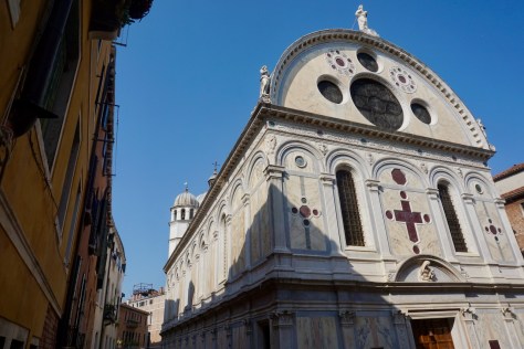
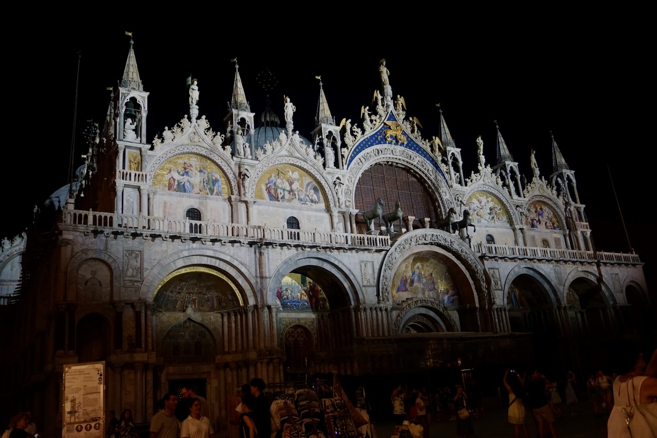
After a shower and changing into appropriate clothing, we walked the four minutes through twisting alleyways to reach Basilica San Marco, where we had timed tickets and could skip the line. I was pleased to see that everyone had followed the dress code, which isn’t always the case in places with posted dress codes. I hadn’t been inside on my first trip to Venice; according to a story my dad tells, the family voted in favour of gelato instead. I don’t remember that, but it sounds right.

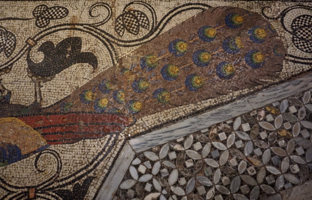
This time, my partner and I made multiple rounds of the Basilica interior, stunned by the plethora of gold, the intricate mosaic covering every surface of the floor, the saints celebrated on the walls. We tried to match the Latin names to what we knew in German and English, often coming up rather short. I have always been fascinated with the lengths to which people go to honour that which they wish to honour.

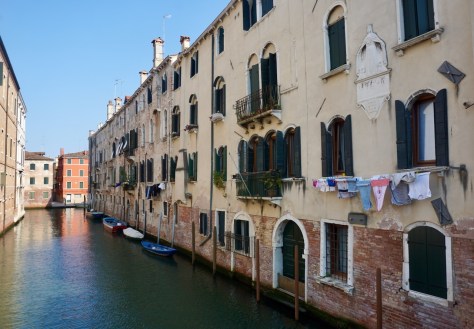
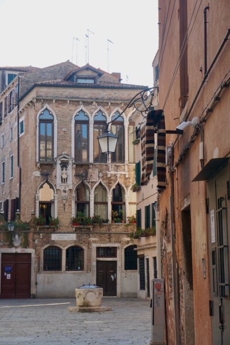
After changing clothes again (Venice, much like living in Singapore, required breaks in air conditioning and yet another shower before pursuing the next activity), we headed to the meeting point for our walking tour, always my favourite way to see a city. The tour took us through all six of Venice’s districts with a focus on the northern part where the locals live. As the tour guide explained, her job was to take us to places we wouldn’t find on our own. She told us about the history of Venice and about Venetian culture today, which we really enjoyed. I had taken a course on the history of Venice in university and I was surprised at both what I remembered and what I had forgotten.

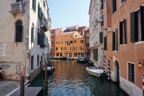
We walked over to the Rialto Bridge that evening and took in the view of the Grand Canal . . .

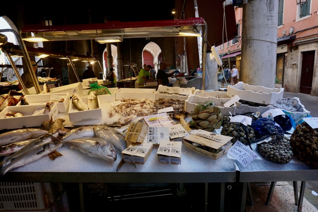
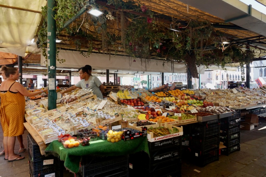
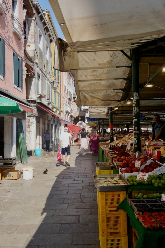
. . . and returned in the morning to visit the Rialto Market, a favourite activity whenever possible. Tourist kitsch aside, the primary ware was seafood, which should come as no surprise.

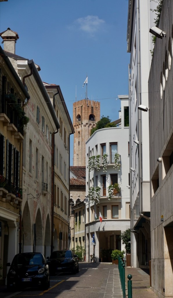
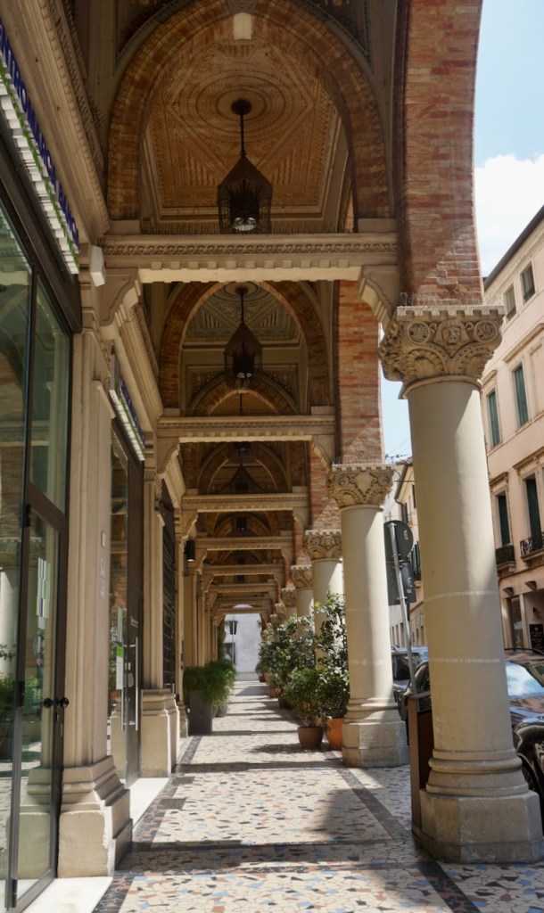
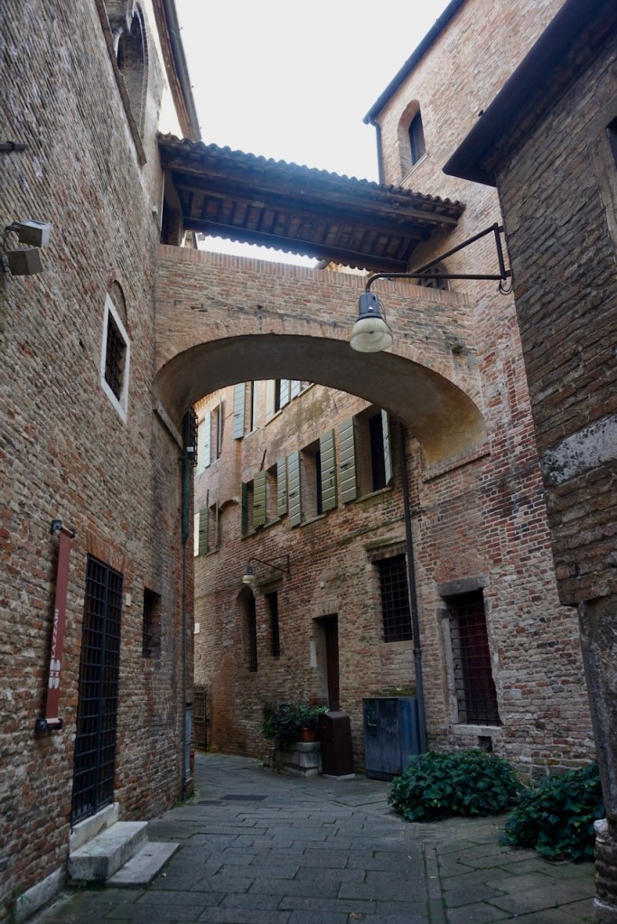
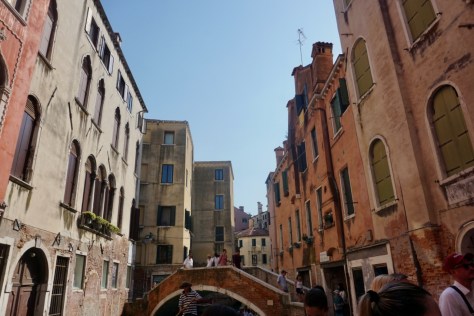
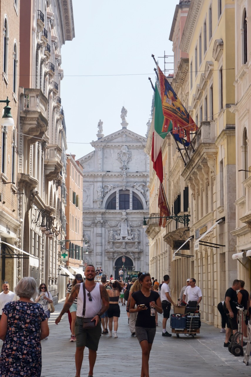
From there, we made our way leisurely through little alleys and side streets until we reached Piazza San Marco.

We walked along the water to confirm vaporetto (water bus) times for the transport passes we had purchased in advance . . .

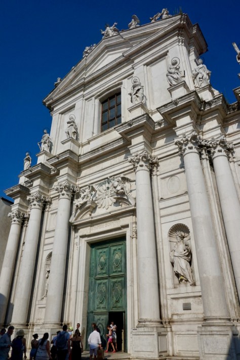
. . . before returning to Piazza San Marco for our timed entry to the Doge’s Palace, again avoiding the long line.

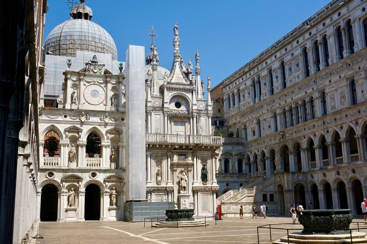
Much like Basilica San Marco, the Doge’s Palace is grand. The wealth that the former Republic of Venice had enjoyed, and the power that came with it, was awesome in the original sense of the word. The gold, the art, and the sheer size spoke volumes.

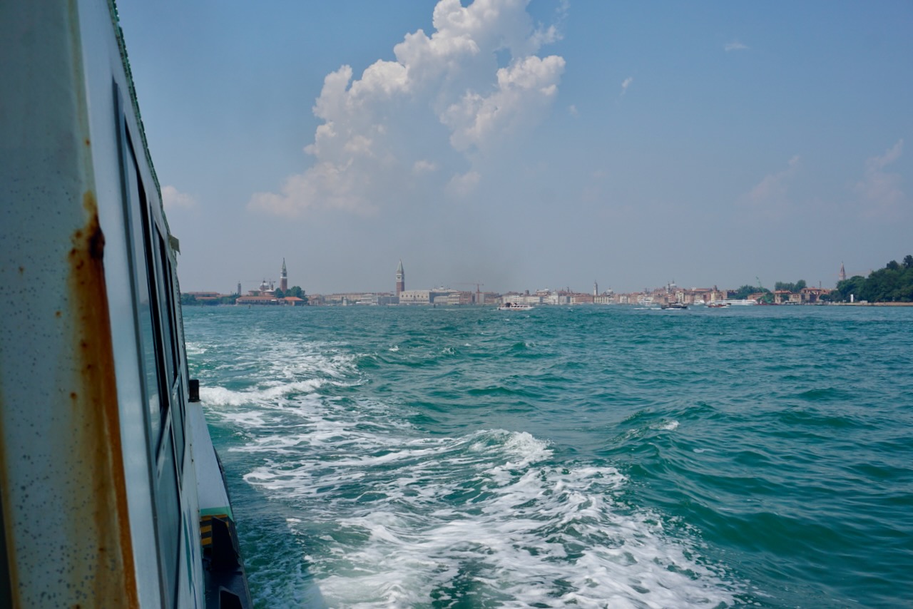
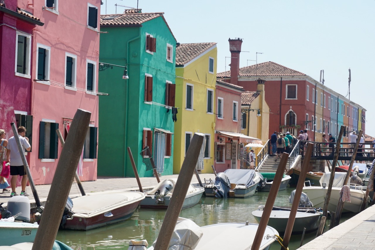
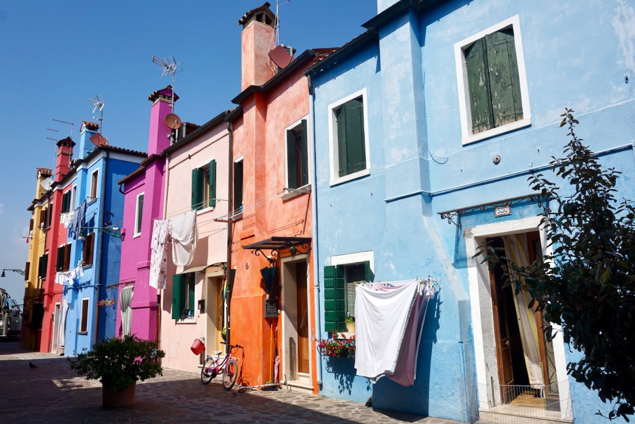
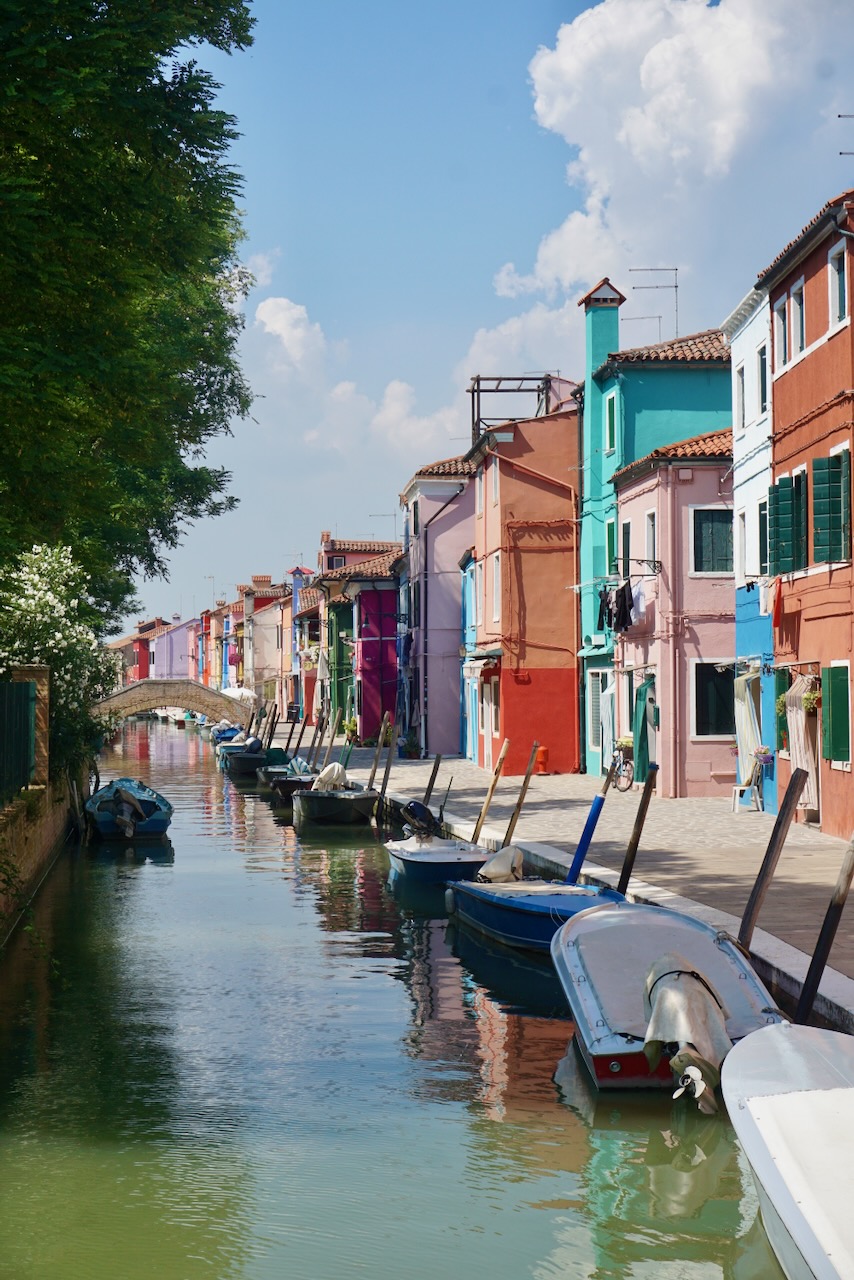
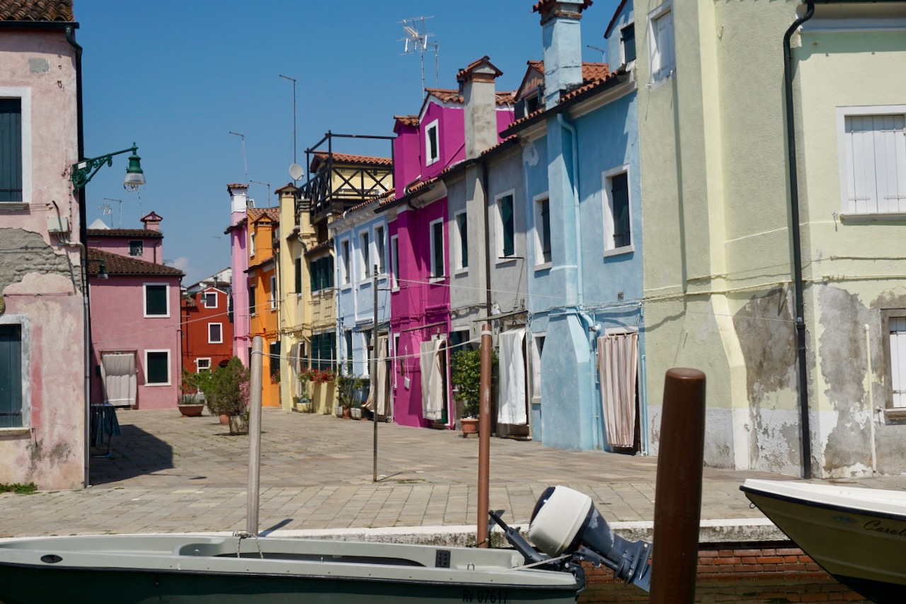
Afterwards, ready to escape the crowds for a while, we took a vaporetto for the 45-minute trip over to Burano, one of the neighbouring islands. Being on the water gave us some relief from the heat, but I would not recommend July as the time to visit Venice.

Burano is tiny, whimsical, and famous for lace-making, evidence of which could be seen in nearly all shops. What we were there to see, however, were the brightly-coloured houses that practically glowed against the blue of the sea and sky. We walked around, patronized a local café, and took photo after photo of this storybook come to life.

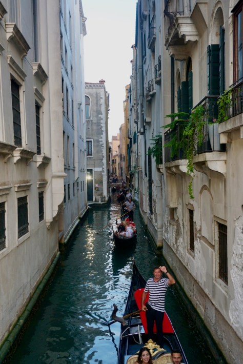
Upon returning to Venice and after some much-needed time to cool off, we braved the heat and humidity one last time to enjoy our final evening. Since Venice was designed to be seen from the water, our tour guide had said, many of the oldest building façades seen from the street side were actually the back. A gondola ride gave us a perspective of the city as it was meant to be seen. The sun was beginning to set and the city glowed.

As we rode, we asked the gondolier questions about how one gets into the business (sons are taught by fathers), how a route is chosen (the routes are what they are and do not change), and who owns the gondola (the family). The gondoliers called to each other in Venetian, the language of Venice that our Italian tour guide told us she had learned to understand since moving to Venice years ago but could not speak. Venice is Italy, but mostly, Venice is Venice.

A friend wrote to us that we were in the city of love, though we were pretty sure that designation belonged to Paris. At any rate, we held hands as we watched the sun set over the bridges.

Since we had day passes for the vaporetto, we hopped on board once again to ride nearly the whole length of the Grand Canal, a cruise for the price of a bus ride. It was dark when we disembarked this time.

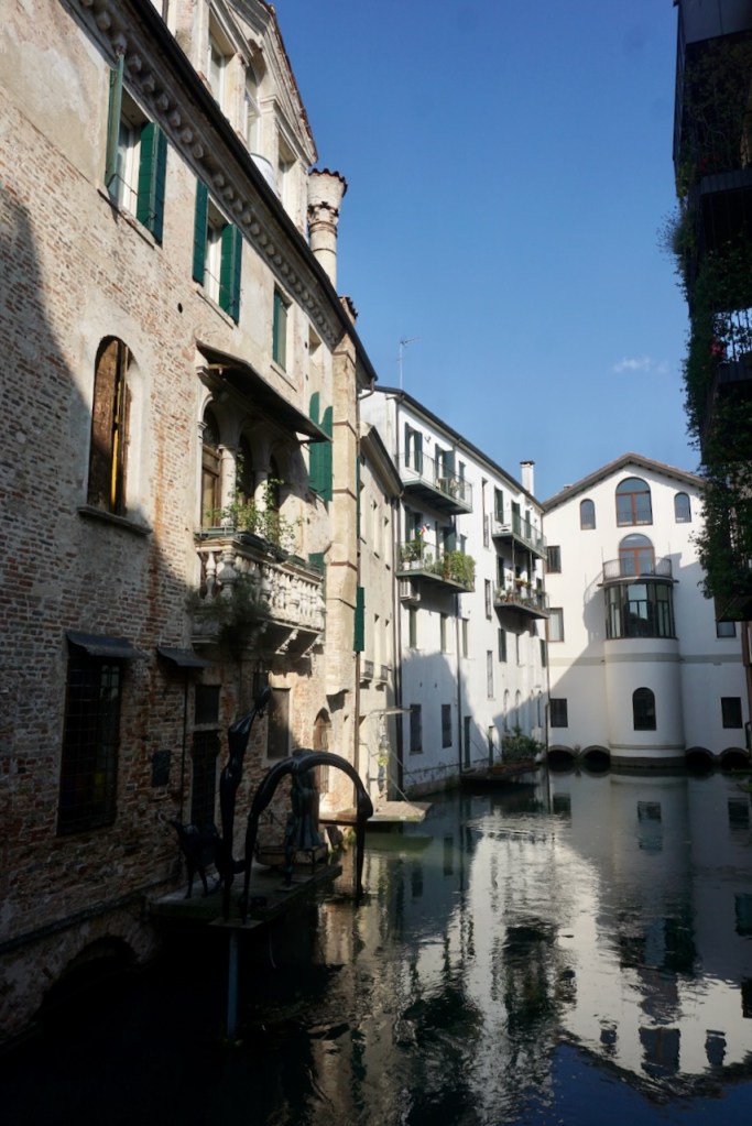
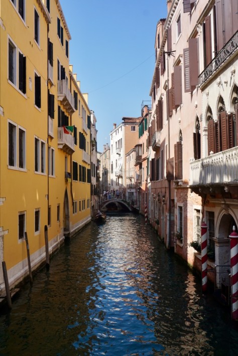
There is definitely something magical about Venice, something that lends itself well to the mysteries in novels and stories I loved as a kid. The cemetery is an island of its own; the city glows when it grows dark with the lights reflecting on the water; the language is half a secret; mailing addresses function differently here in order to function at all; there are so many twists and turns that we followed a map every time we tried to get anywhere, consistently unable to orient ourselves.

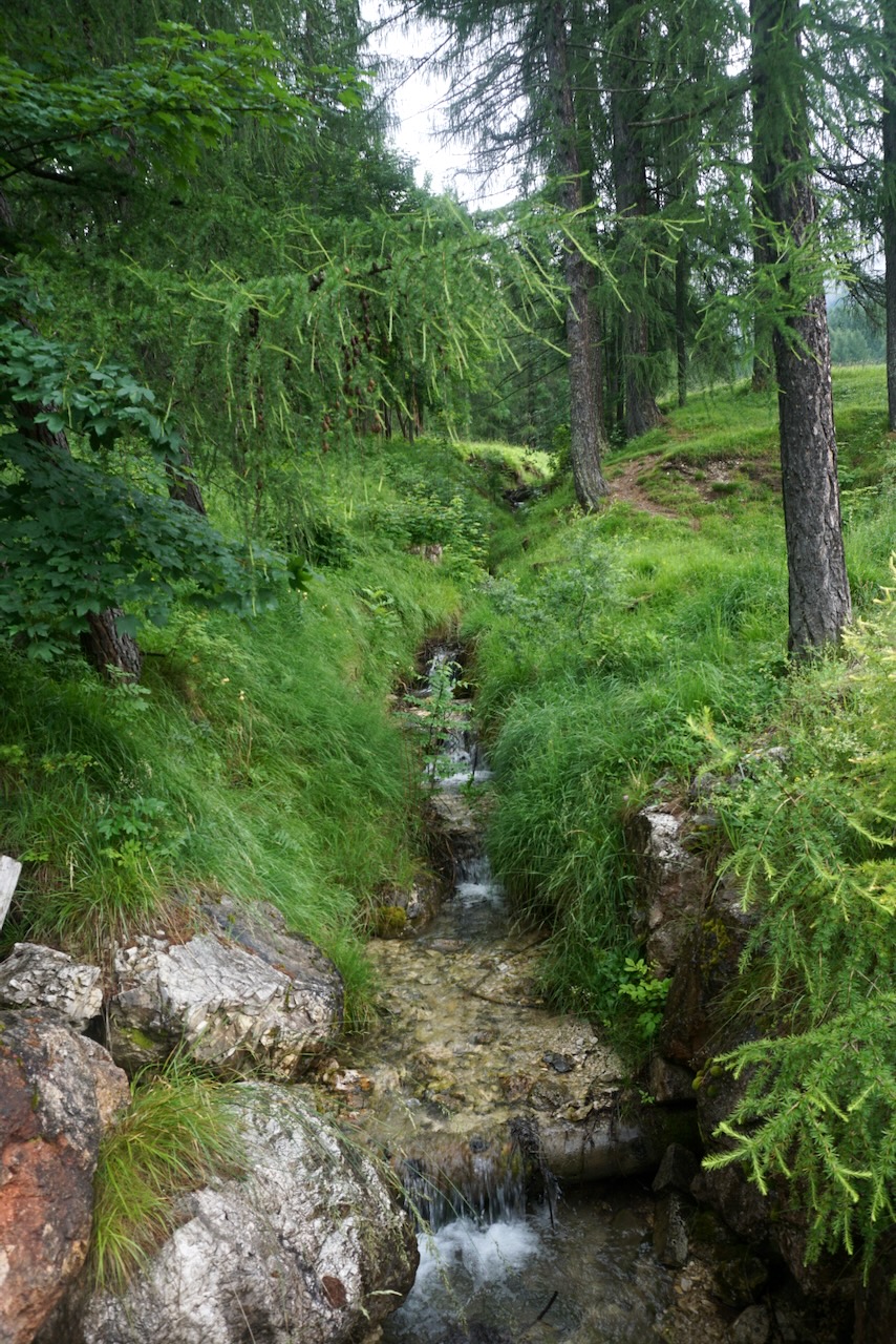
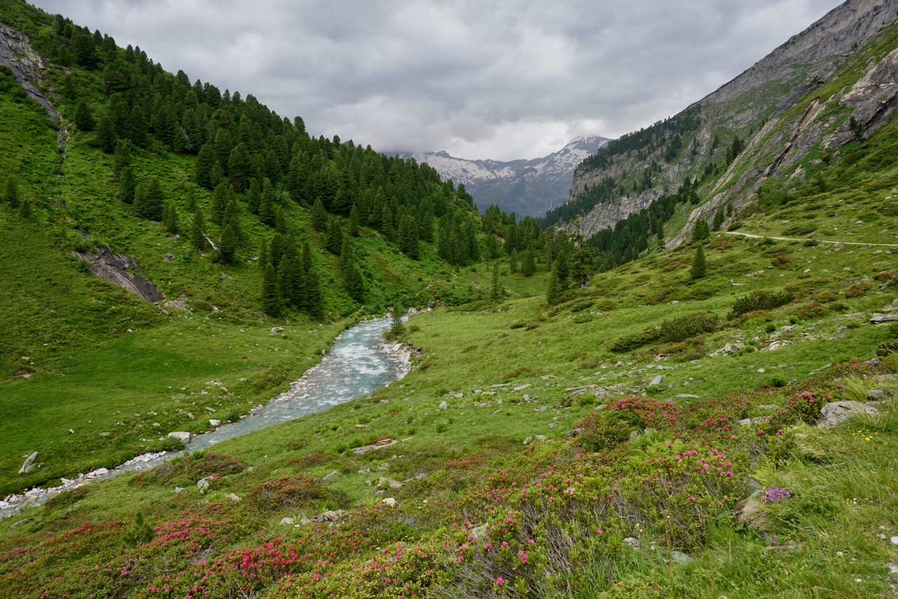
The following morning, we made our way slowly back to the car, managing to cross yet another piazza where we hadn’t been before. We loved our time in Venice but were ready to get away from throngs of people and back into nature. Next stop: Slovenia.

Travel Guide: Cortina d’Ampezzo and Treviso

My partner and I arrived in Cortina d’Ampezzo in Italy’s Veneto region ready for a break. We were in the heart of the Dolomites and though the mountains are part of the Alps, they felt completely different. The Dolomites tower. They impose. They are sharp and majestic and magnificent, vast in scale and scope. And they could be seen from everywhere.

We strolled through Cortina, enjoying the cool mountain air and admiring the architecture of the South Tyrol region. The historic and regional connection to where we had recently been in Austria was plain to see. Mountain regions are like that.

As climbers, Cortina was a draw for us because of its central location in the Dolomites and its proximity to Tre Cime di Lavaredo, or Drei Zinnen, or Three Peaks. We had planned to climb the smallest one and picked up the last remaining pieces of gear shortly after arrival, but the weather, our physical health after our multi-day trek, and the logistics proved more than we were ready for. But we are now prepared for next time!

Instead, we took a bus up to Rifugio Auronzo, the first of the guesthouses around Tre Cime. From there, we walked the easy route around the mountains, enjoying 10 kilometers of beautiful views and rock begging to be explored.

The temperature was much cooler than we had expected and we enjoyed walking with just a day pack. It was suddenly so easy.

We watched the clouds move as we rounded Tre Cime, waiting for the peaks to come into view. And they did.

As we walked, we looked for the route that we had researched and we watched climbers on other routes. This is not an adventure to be taken lightly and we were more than comfortable with our decision not to pursue a climb. It was enough to be among these stone giants.

The following day I walked alone through the woods near where we were staying. We were at the top of a hill, basically as far up as we could go, just outside of town. The usual feeling of quiet came over me as I followed the marked trail through trees. It’s a different perspective of nature than being in the mountains, and I welcomed the change.

Finally, the weather held up enough to allow us to get on some rocks. We’d brought multiple guidebooks with us and found a crag not too far away. It was typical Italian sport climbing, at least as far as my experience goes: Lots of protection, routes helpfully labelled, benches placed in convenient locations, lots of people, grading generally easier than what we have at home. But every crag has its quirks, and this was no exception. For instance, we warmed up on a climb with a grade that would have been much too hard elsewhere, and then we ended up abandoning a route with a much easier grade, leaving behind a green carabiner. Maybe you’ve seen it? Finally, a prominent sign expressly forbade individuals from pooping. All in a day’s climb, I guess.

After the fresh mountain air of Cortina d’Ampezzo, we were not fully prepared for the heat and humidity that greeted us the following day in Treviso, also in the Veneto. The landscape grew flatter as we drove and the mountains remained far in the distance. The air was thick, hazy, and dusty, and as we made our way into the old town, it made sense that everyone was home for siesta. We were nearly the only ones moving about in a city of closed shops and restaurants, precisely in the hottest hours of the afternoon, and the heat and humidity were punishing.

Unable to fathom anything else, we had our first gelato since arriving in Italy. Thus reinvigorated, we wandered through all of the city in just a few hours, taking in grand historic buildings . . .

. . . charming side streets and passageways . . .

. . . the rivers around which Treviso is built . . .

. . . and various stylistic elements (wrought iron, painted buildings, satellite dishes and antennae rising from tiled rooftops) that are, for me, typically Italian.

While seeing what there was to see in the old town, we stopped into multiple supermarkets, enjoying the opportunity to look at what was on offer and at what prices. A peek into another’s day-to-day, leading to reflection on my own, is an activity of which I never tire when I’m somewhere else. And importantly, supermarkets are air-conditioned.

As it would turn out, this heat was only a warm-up for our next stop: Venice.

In the Alps: Berliner Höhenweg

The German word “Hochtour” literally translates to “high tour” and the term is used to describe a trek through the Alps that passes through snow or over a glacier. As it’s been in Europe where I’ve become involved in mountaineering, I don’t know if there’s a single English word for this concept. I also don’t know how trekking through the Alps compares to multi-day trekking in North America, where I’m from. But I do know that my first Hochtour, accompanied by my partner and two girlfriends, left me hungry for more.

Based on available time and building in a buffer for the weather (summer is thunderstorm season in the Alps), we decided on a four-day trek along the Berliner Höhenweg, a famous nine-day route in the Zillertal Alps in Austria. Based on a weather report from friends who were in the area at the beginning of June, we changed some of our packing to include essentials for snow, which had come late and heavy. We added an ice axe, crampons, trekking poles, climbing harnesses, carabiners, and a rope; all of these items are needed to cross a glacier (stay tuned for a blog post!) and all could be helpful in snow. In the best case, we wouldn’t need anything but the crampons and trekking poles, but preparation is key.

Day 1: Breitlahner to Berliner Hütte

Our Hochtour began with a warm-up hike from the long-term parking lot at the Breitlahner restaurant and guesthouse to the Berliner Hütte, the first of the guesthouses (“Hütte” means “hut” but that has a different connotation in English) to be built in the Zillertal Alps. We ascended 780 meters in just over 9 kilometers, arriving shortly before the rain.

As we would quickly learn, we moved rather more slowly than the posted time estimates. This was likely due to inexperience within our group, but we also suspected that the estimated times described perfect conditions without backpacks. (Or so we told ourselves.)

The way led us past rivers and waterfalls . . .

. . . through fields of flowers, including our only wild edelweiss right at the Berliner Hütte . . .

. . . and alongside grazing cattle, whose gently tinkling bells accompanied us long before and after the cattle themselves were in view . . .

We were, of course, surrounded the whole time by mountains . . .

. . . and passed a World War I memorial on the way dedicated to the alpine club members who had died in the war.

This was the first of many memorials that we passed along our route, constant reminders that the mountains are not a playground.

Ready for a celebratory radler, a mixture of beer and lemonade known in the UK as a shandy, and a shot of Zirbe, a liquor made from a type of pine found in the Alps region, we reached the Berliner Hütte at 2,042 meters.

From here we could see where we’d be going next. We turned in early after a hearty dinner and a few rounds of cards; the following day would be a big one.

Day 2: Berliner Hütte – Furtschaglhaus

We woke to rain that came in waves over the course of the day, during which we would ascend 1,060 meters, descend 810 meters, and cover close to 9 kilometers.

For a variety of reasons, the way took us much too long. We were lucky that the original forecast calling for thunderstorms had changed, but the rain that blew in instead was nasty enough, and it was there that I realized I needed a new rain coat.

We began following the trail markers over sheets of rock that gave way to a trail that wound through scrubby trees and bushes marking the end of the tree line. The tiny alpine flowers provided pops of colour through the fog.

It wasn’t long before we needed to cross a river, one that is not always as high as it was when we were there. We looked for the most accessible points in the direction of the bridge that we very much needed.

Shortly thereafter, the rain cleared and we were greeted first by waterfalls, mystical as the clouds pulled away to reveal mountains . . .

. . . and then by goats sharing our path.

The mountains grew even more imposing . . .

. . . and we soon encountered the conditions that would be with us for the coming hours. We continued over rocks and boulders as the clouds came and went . . .

. . . and reached the first of the patches of snow that we would cross, all of which were larger and deeper than usual at this time of year. As we continued and the conditions became more technically challenging, crampons and trekking poles would prove their worth many times over. The winter child in me was delighted.

It started to rain again when we exited the largest of the snow fields so far and began the scramble in the direction of our planned summit. Unable to see or feel my fingers as I scrambled alone over jagged and unpredictable rock, voices of my friends somewhere below me, I had a moment of panic unlike anything I’d experienced before. It was neither graceful nor collected, but I continued to move until I reached a point where I didn’t know how to go further. A friend reached me and, feeling immediately better for not being alone, we pressed on together. This experience stayed with me for the rest of our trip and I handled myself much better on a different mountain later on (stay tuned!). There is a first time for everything and I know why I got scared. I also know why, in retrospect, I didn’t need to be. The key, at least for me, is working with the mountain rather than fighting against it. And this is something I had to learn.

The rain was kind enough to stop for a while as we reached the summit of Schönbichler Horn at 3,133 meters. Exhausted from the efforts of the previous hours, which had us well behind schedule but clearly past the threat of thunderstorms, we did not linger long, aware of how much farther we had to go.

We would find ourselves in snow multiple times over the next several hours, using crampons only when absolutely required in an effort to save time. We were cold and tired, the rain became relentless, and the difficulties within the group became more apparent.

Descending to Furtschaglhaus at 2,295 meters took much longer than it should have and I have never been more grateful for a hot shower. Those three glorious minutes were our longest shower of the trip and worth every cent.

Day 3: Furtschaglhaus to Olpererhütte

In comparison to the previous day, our path to the Olpererhütte was far less physically demanding. At over 10.5 kilometers, this was our longest day yet, but with only a 510 meter descent and 610 meter ascent. The five flat kilometers in the middle of the route followed the Schlegeis Reservoir, and we were looking forward to a little break.

Although we hadn’t had the energy to notice, the landscape had changed during our descent the day before. We were out of fields of snow and jagged stone and back to grass, gentle rocks, flowers, and waterfalls.

As when we first began, we passed grazing cattle as we made our way down to the Schlegeis Reservoir.

The route is beloved for day hikes as well as being part of the Berliner Höhenweg, and I can understand why. The bright flowers and the reservoir in bright blue with the mountains all around are rather photogenic.

However, the change of landscape came in stark contrast to the challenging solitude of being deep in the mountains. After some time on a gravel path with a heavy backpack, passing day hikers in sneakers and sandals, I was looking forward to being back “up there” with people who understood what we were doing and why we were doing it.

The ascent to the Olpererhütte, while full of pretty views . . .

. . . comprised of a clear path that zig-zagged along the side of the mountain. There was no way-finding using markers, no need to stop and think before putting one foot in front of the other. And because of its straightforwardness, it was busy and crowded. While not a path that I’d recommend doing in sandals, there were plenty of hikers doing just that. Choosing strategic points to get by them was about as challenging as it got, and we reached the Olpererhütte rather uninspired.

But being greeted by the resident animals was charming and it was comfortable to sit outside bundled up after the steep walk up to 2,389 meters.

The atmosphere of the hut changed after the day hikers left and the rest of us settled down to dinner, drinks, and cards. Feeling refreshed after our easy day, we spent our last night in the mountains in laughter.

Day 4: Olpererhütte to Breitlahner

We had planned our route so that we could walk back down to where we’d parked without the need for buses or trains. At slightly over 10.5 kilometers, this meant a 270 meter ascent and then a huge descent of 1,390 meters. Once again, we were very grateful for the trekking poles. We would pass another hut, Friesenberghaus, on the way.

The day started scrambling over boulders and small snow fields, aspects of a Hochtour to which we had become accustomed and that I really enjoyed. There’s an element of playfulness amidst the need to be sure-footed and deliberate.

As usual, we were greeted by cows. This time, though, they seemed to enjoy the sweeping vistas as much as we did. Perhaps it is not only humans who feel tiny and inconsequential when finding themselves in so much mighty, majestic nature.

After a round of steep snow fields, the landscape began to change yet again and alpine flowers appeared.

We saw Friesenberghaus before we reached it, picking our way down through particularly steep sections of snow, several of which had us first ascending, which was rather easier.

We stopped for a bowl of soup to get out of the rain that had picked up. It was interesting to note the bit of history on the wall, thanking the members of the Berlin section of the alpine club for their resistance against the exclusion of Jewish members from the German and Austrian alpine clubs. There is little place for exclusion in the mountains.

I also appreciated the sense of humour at Frisenberghaus in which a stuffed animal was employed as a weather station.

When Joachim . . .
Dry – Sun
Cries – Rain
White – Snow
Dances – Wind
Invisible – Fog
Hops – Earthquake

Doubles – Alcohol
Speaks – LSD

Checking our watches, we left before the rain stopped. We weren’t the quickest and had a ways to go.

The way continued to grow grassier as it wandered over rocks and streams. Flowers continued to appear and then scrubby bushes and trees. The air grew more humid and the clouds floated upward.

The final descent was long and we knew we were nearly there when our way headed directly through the trees. The mountains were above us again and we were too far from where we’d started to see where we’d been. Our trekking poles showed good signs of wear by now.


We spent one more night together to recover. We cooked a carbohydrate-heavy meal, drank wine, showered for free without looking at the time. We laughed and shared photos and congratulated one another.

We had been in the mountains, had experienced the rhythms of weather, the physical and emotional cycles of a body under strain, the atmosphere of a guesthouse filled with people who love mountaineering. We had been in the mountains, swept away, taken in, and in awe. Mountains are truly the most beautiful place.

And as glad as I was for a real bed in a room shared with only one person, I missed it immediately.

“The mountains are calling and I must go.” -John Muir