Tag Archives: Clouds

In the Alps: Berliner Höhenweg

The German word “Hochtour” literally translates to “high tour” and the term is used to describe a trek through the Alps that passes through snow or over a glacier. As it’s been in Europe where I’ve become involved in mountaineering, I don’t know if there’s a single English word for this concept. I also don’t know how trekking through the Alps compares to multi-day trekking in North America, where I’m from. But I do know that my first Hochtour, accompanied by my partner and two girlfriends, left me hungry for more.

Based on available time and building in a buffer for the weather (summer is thunderstorm season in the Alps), we decided on a four-day trek along the Berliner Höhenweg, a famous nine-day route in the Zillertal Alps in Austria. Based on a weather report from friends who were in the area at the beginning of June, we changed some of our packing to include essentials for snow, which had come late and heavy. We added an ice axe, crampons, trekking poles, climbing harnesses, carabiners, and a rope; all of these items are needed to cross a glacier (stay tuned for a blog post!) and all could be helpful in snow. In the best case, we wouldn’t need anything but the crampons and trekking poles, but preparation is key.

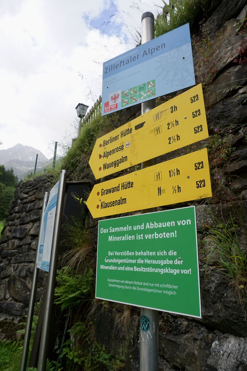
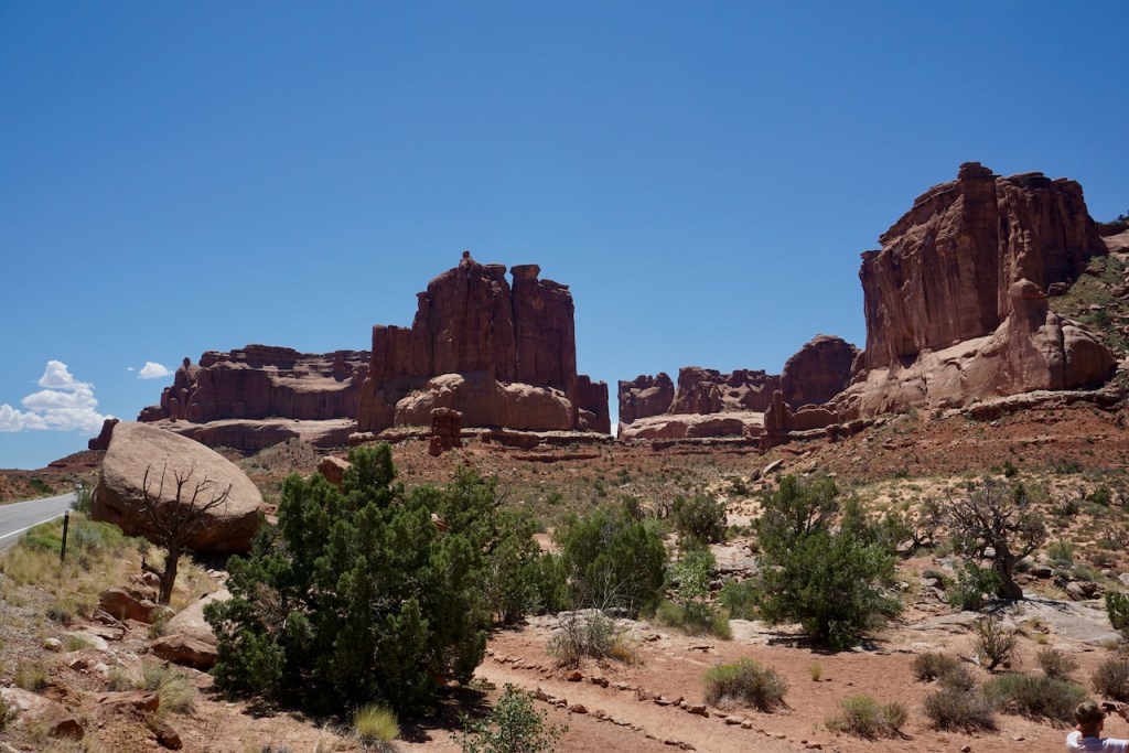
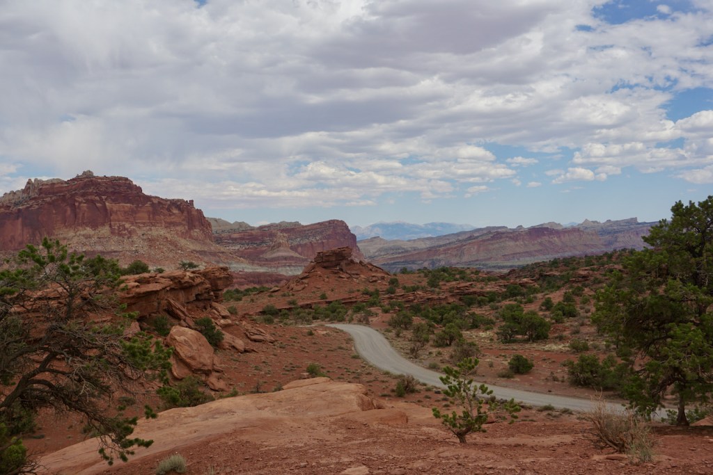
Day 1: Breitlahner to Berliner Hütte

Our Hochtour began with a warm-up hike from the long-term parking lot at the Breitlahner restaurant and guesthouse to the Berliner Hütte, the first of the guesthouses (“Hütte” means “hut” but that has a different connotation in English) to be built in the Zillertal Alps. We ascended 780 meters in just over 9 kilometers, arriving shortly before the rain.

As we would quickly learn, we moved rather more slowly than the posted time estimates. This was likely due to inexperience within our group, but we also suspected that the estimated times described perfect conditions without backpacks. (Or so we told ourselves.)

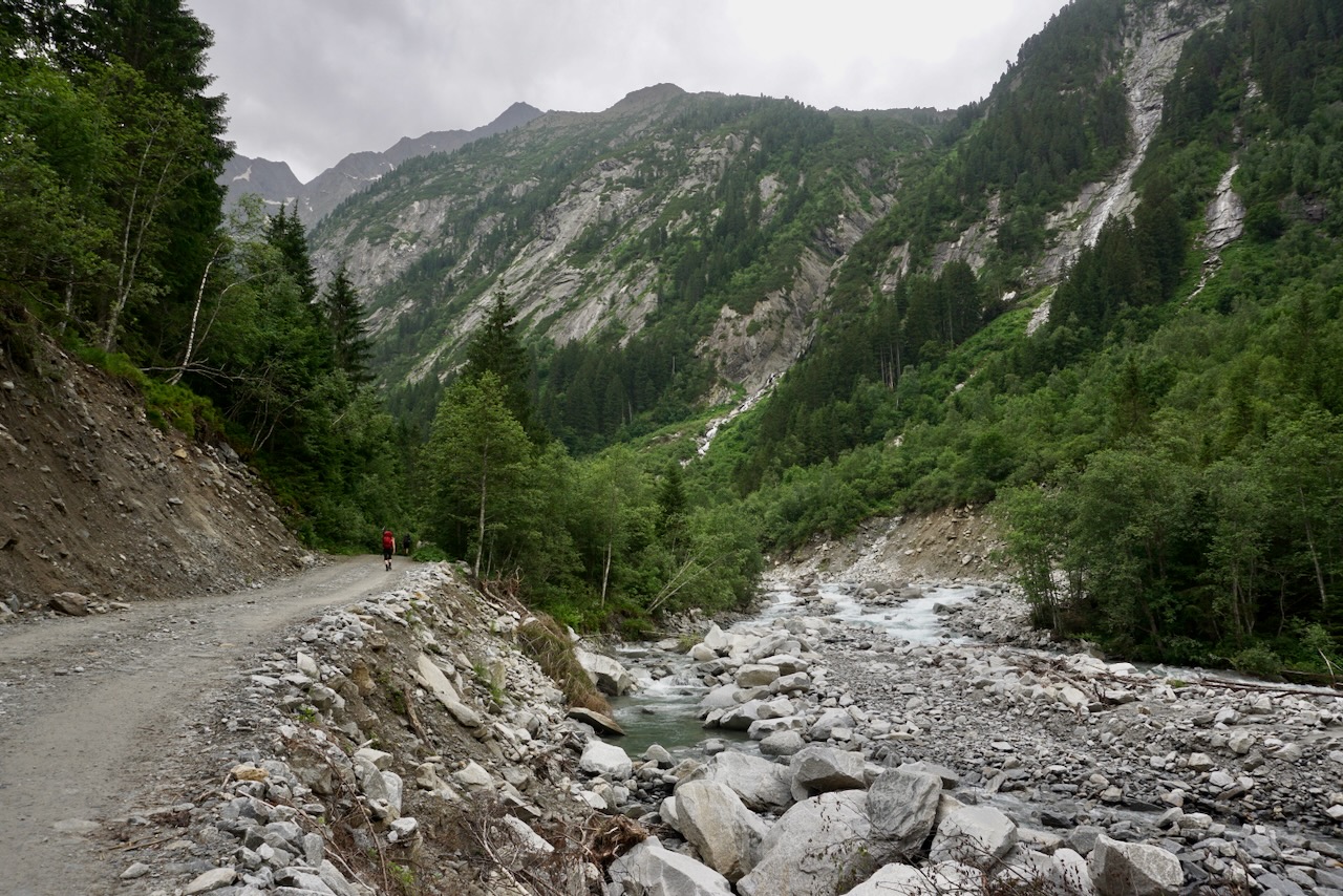
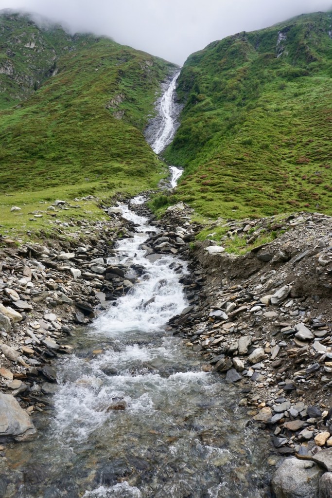
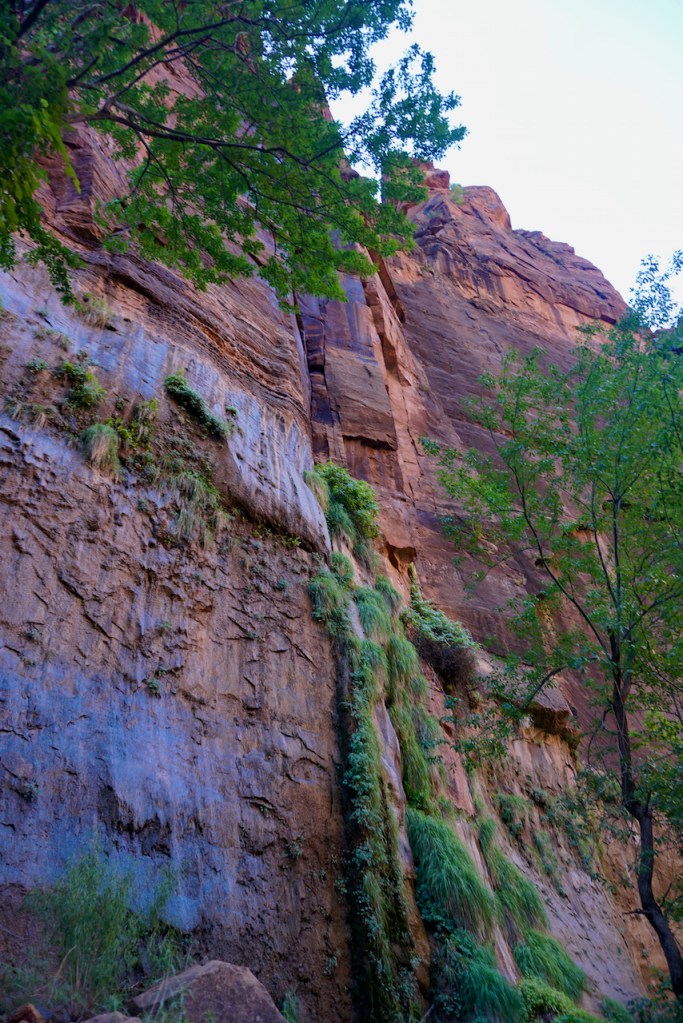
The way led us past rivers and waterfalls . . .

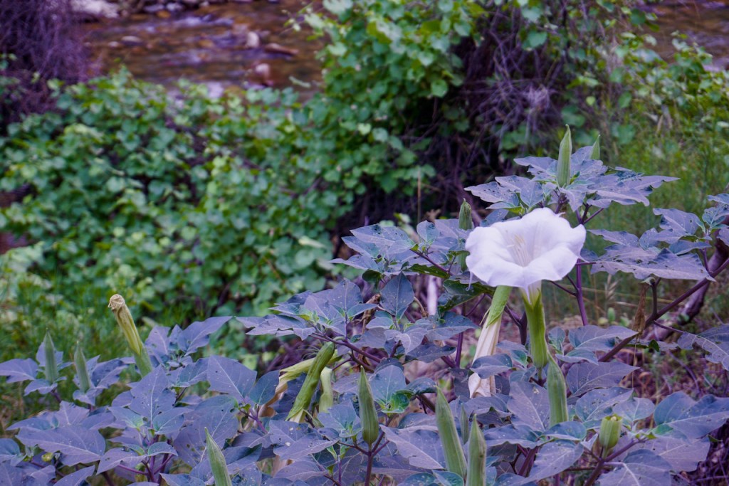
. . . through fields of flowers, including our only wild edelweiss right at the Berliner Hütte . . .

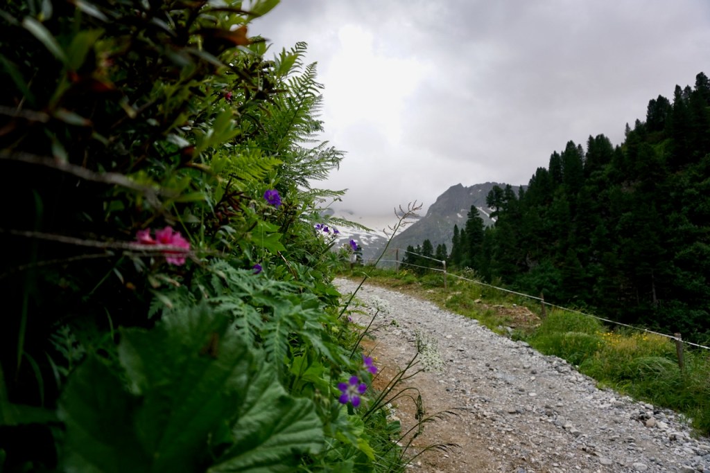
. . . and alongside grazing cattle, whose gently tinkling bells accompanied us long before and after the cattle themselves were in view . . .

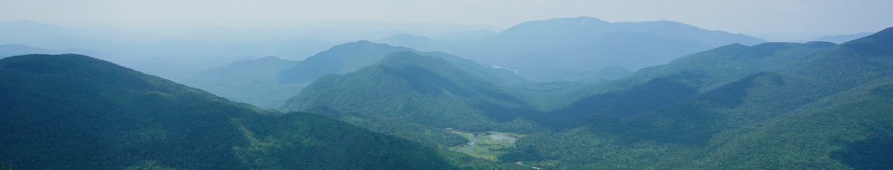
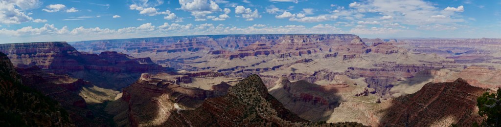
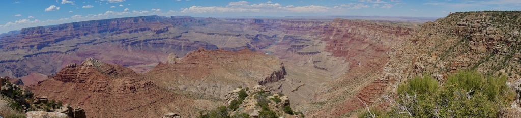
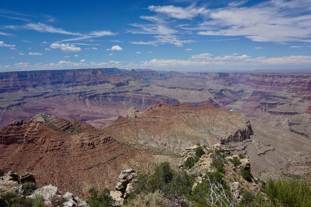
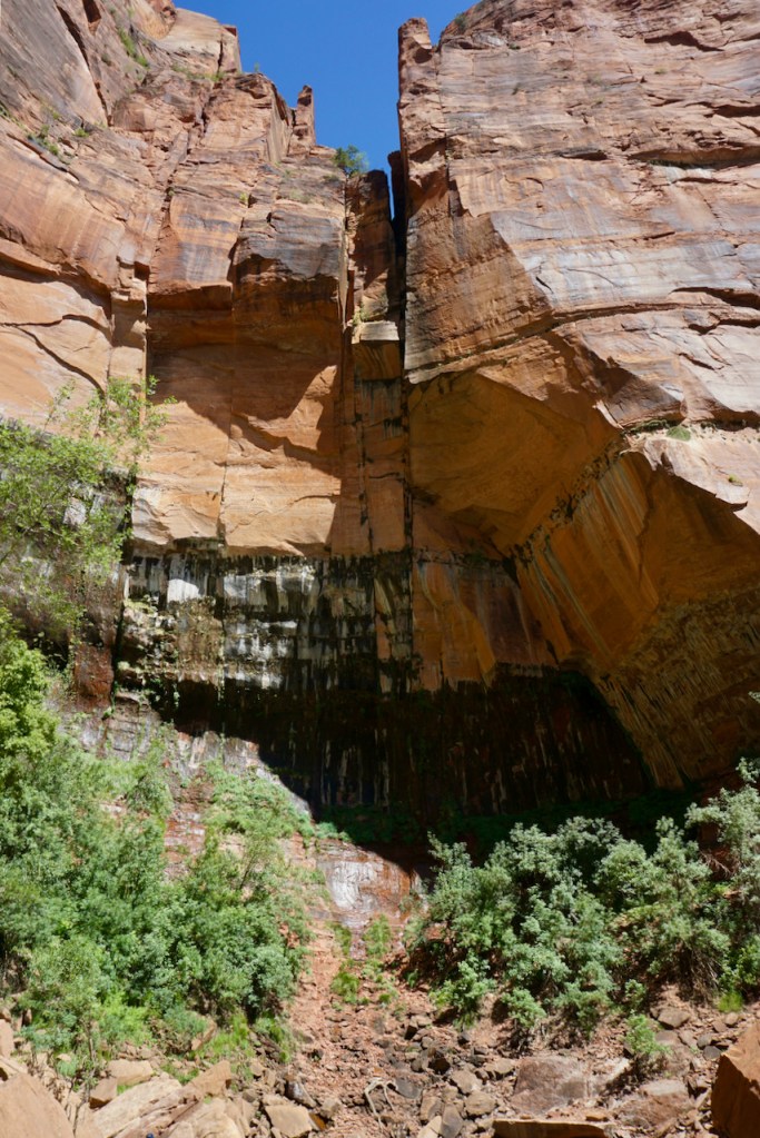
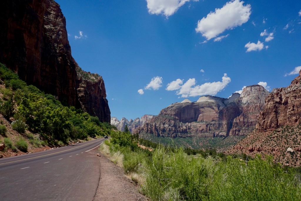
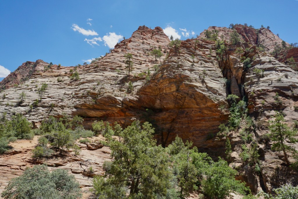
We were, of course, surrounded the whole time by mountains . . .

. . . and passed a World War I memorial on the way dedicated to the alpine club members who had died in the war.

This was the first of many memorials that we passed along our route, constant reminders that the mountains are not a playground.

Ready for a celebratory radler, a mixture of beer and lemonade known in the UK as a shandy, and a shot of Zirbe, a liquor made from a type of pine found in the Alps region, we reached the Berliner Hütte at 2,042 meters.

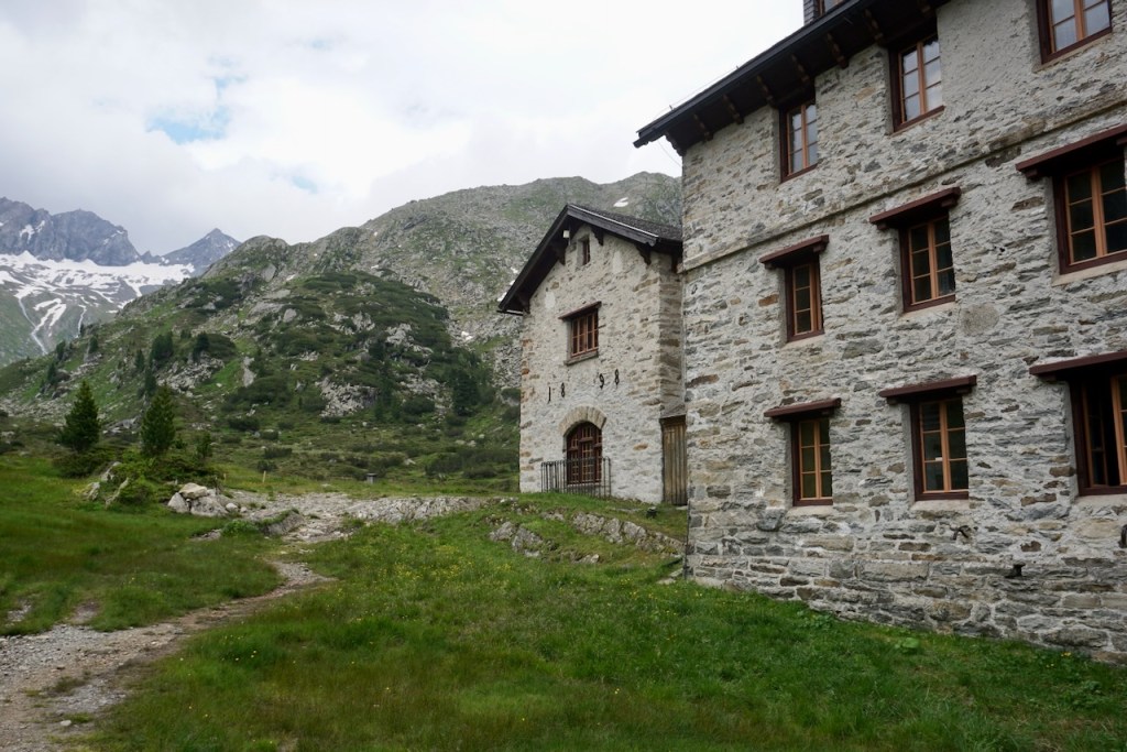
From here we could see where we’d be going next. We turned in early after a hearty dinner and a few rounds of cards; the following day would be a big one.

Day 2: Berliner Hütte – Furtschaglhaus

We woke to rain that came in waves over the course of the day, during which we would ascend 1,060 meters, descend 810 meters, and cover close to 9 kilometers.

For a variety of reasons, the way took us much too long. We were lucky that the original forecast calling for thunderstorms had changed, but the rain that blew in instead was nasty enough, and it was there that I realized I needed a new rain coat.

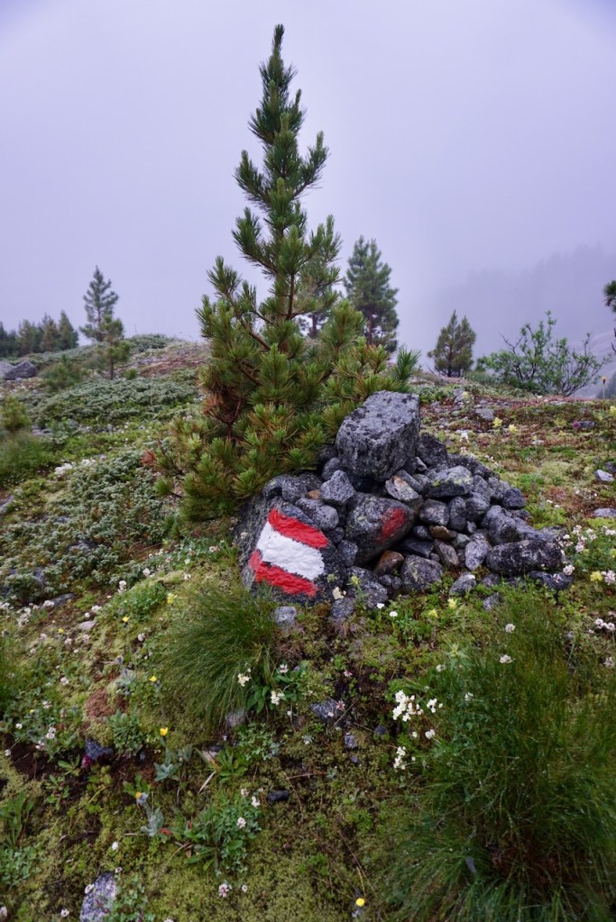
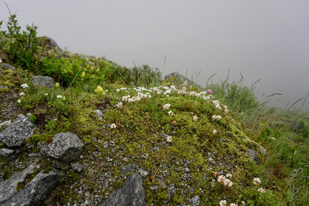
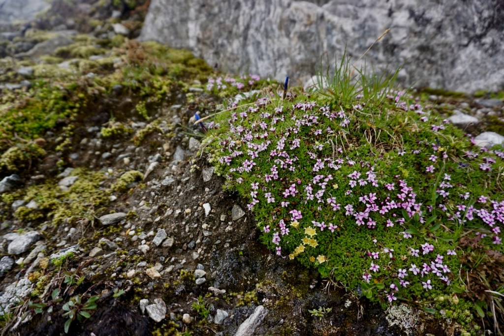
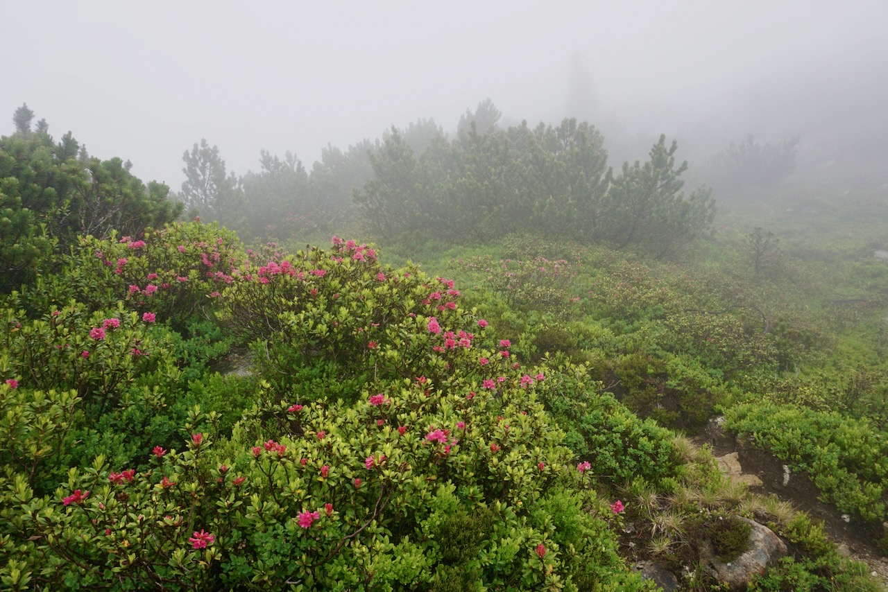
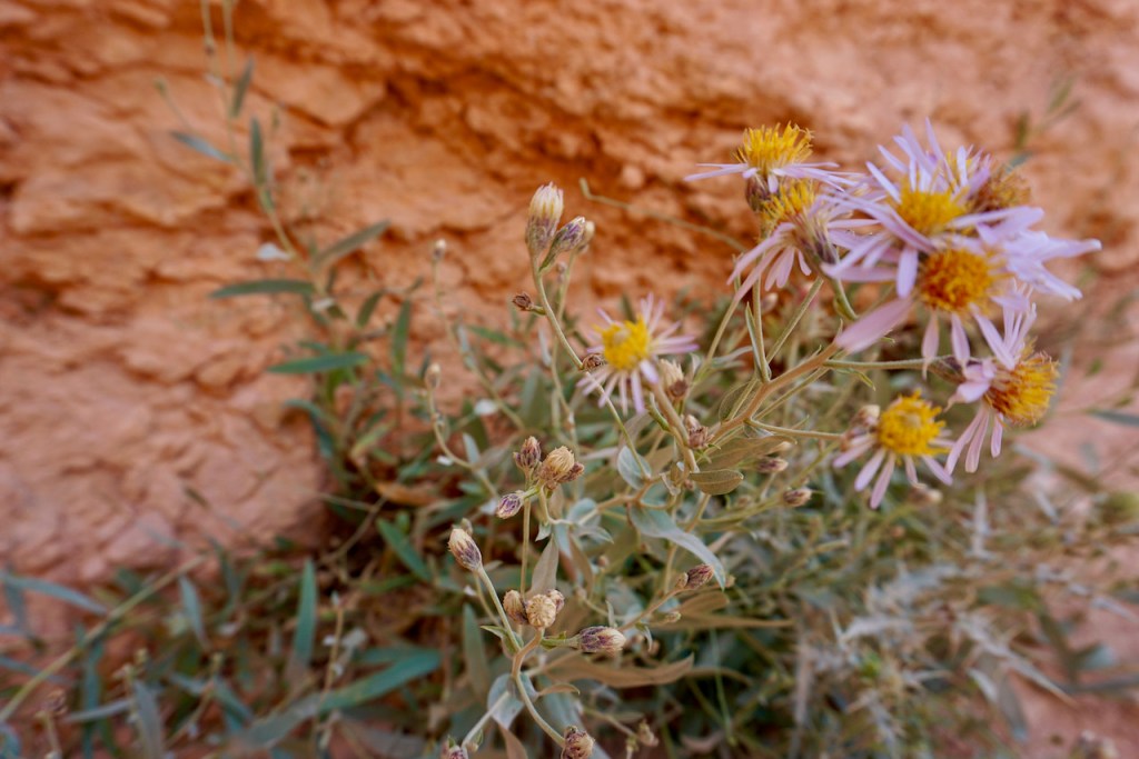
We began following the trail markers over sheets of rock that gave way to a trail that wound through scrubby trees and bushes marking the end of the tree line. The tiny alpine flowers provided pops of colour through the fog.

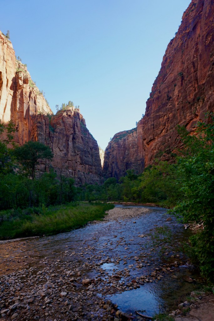
It wasn’t long before we needed to cross a river, one that is not always as high as it was when we were there. We looked for the most accessible points in the direction of the bridge that we very much needed.

Shortly thereafter, the rain cleared and we were greeted first by waterfalls, mystical as the clouds pulled away to reveal mountains . . .

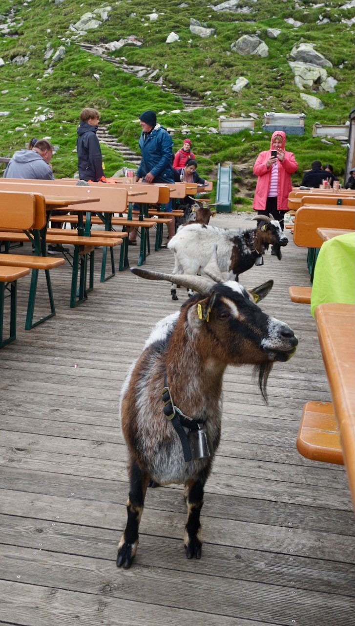
. . . and then by goats sharing our path.

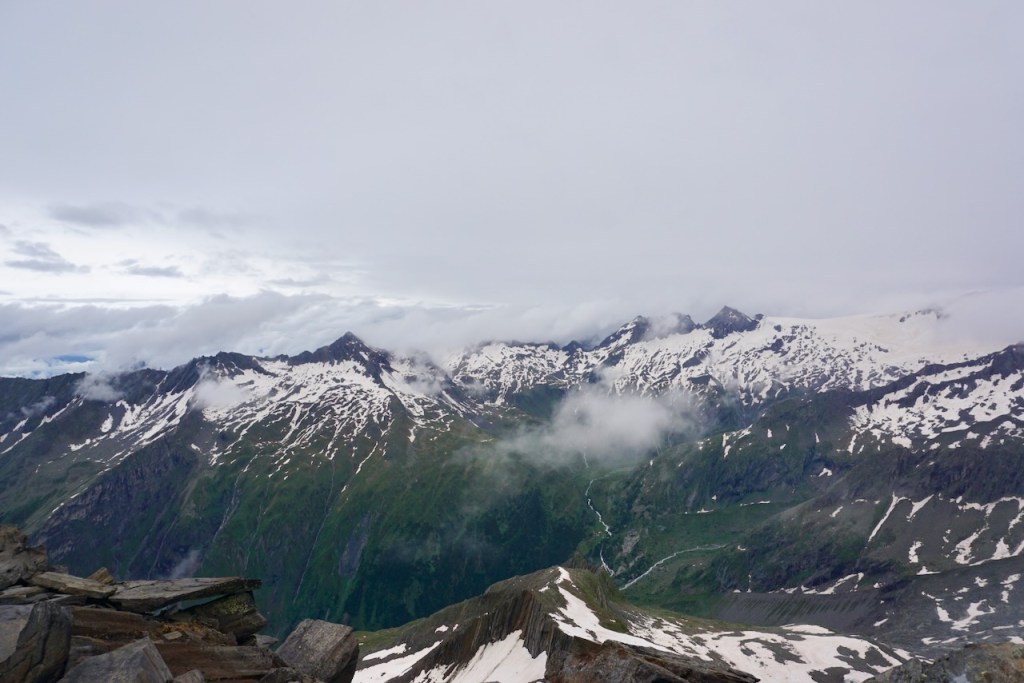
The mountains grew even more imposing . . .

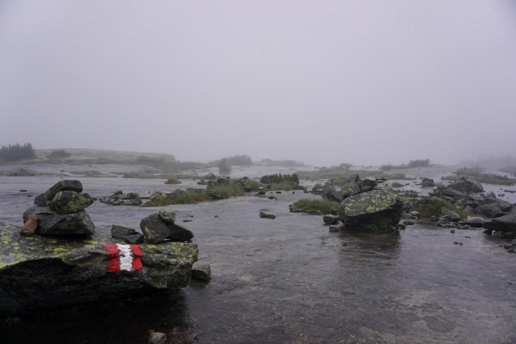
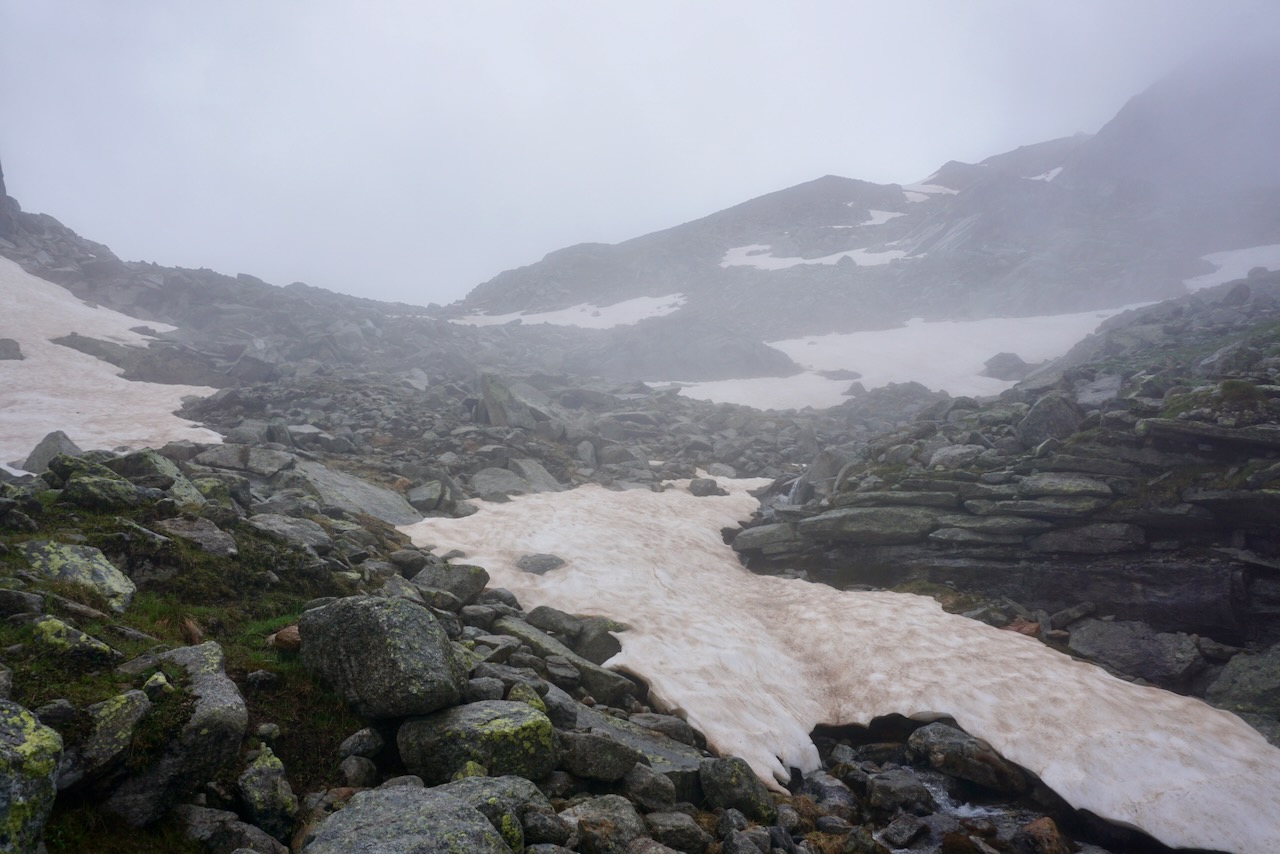
. . . and we soon encountered the conditions that would be with us for the coming hours. We continued over rocks and boulders as the clouds came and went . . .

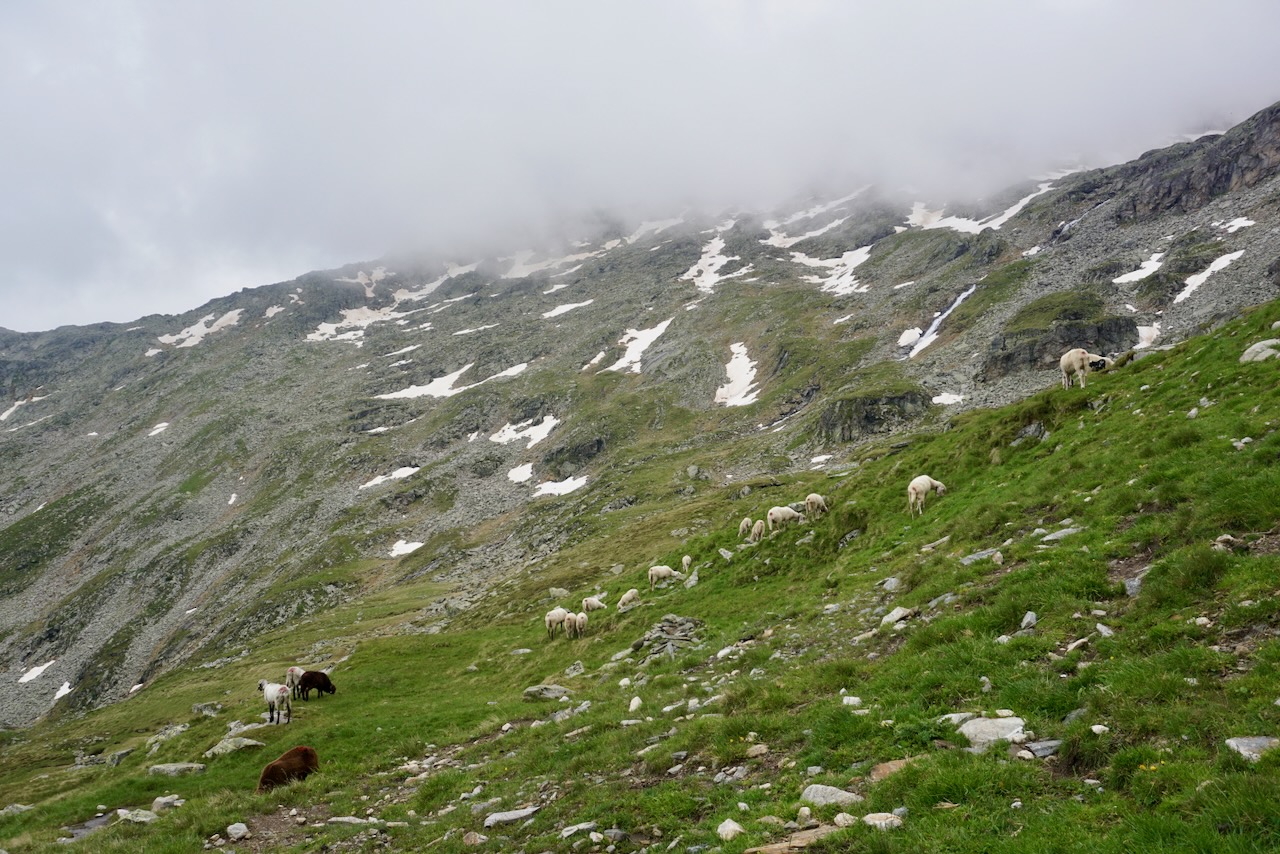
. . . and reached the first of the patches of snow that we would cross, all of which were larger and deeper than usual at this time of year. As we continued and the conditions became more technically challenging, crampons and trekking poles would prove their worth many times over. The winter child in me was delighted.

It started to rain again when we exited the largest of the snow fields so far and began the scramble in the direction of our planned summit. Unable to see or feel my fingers as I scrambled alone over jagged and unpredictable rock, voices of my friends somewhere below me, I had a moment of panic unlike anything I’d experienced before. It was neither graceful nor collected, but I continued to move until I reached a point where I didn’t know how to go further. A friend reached me and, feeling immediately better for not being alone, we pressed on together. This experience stayed with me for the rest of our trip and I handled myself much better on a different mountain later on (stay tuned!). There is a first time for everything and I know why I got scared. I also know why, in retrospect, I didn’t need to be. The key, at least for me, is working with the mountain rather than fighting against it. And this is something I had to learn.

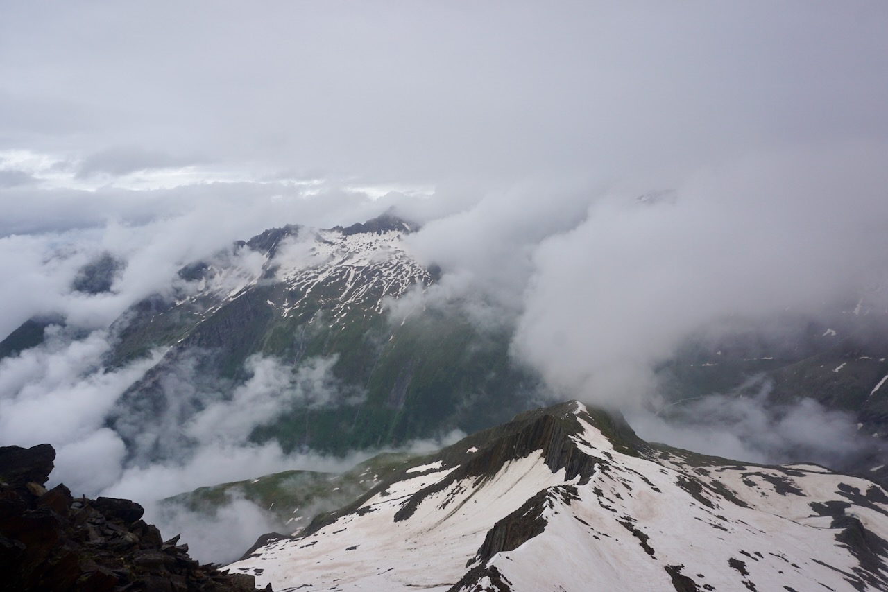
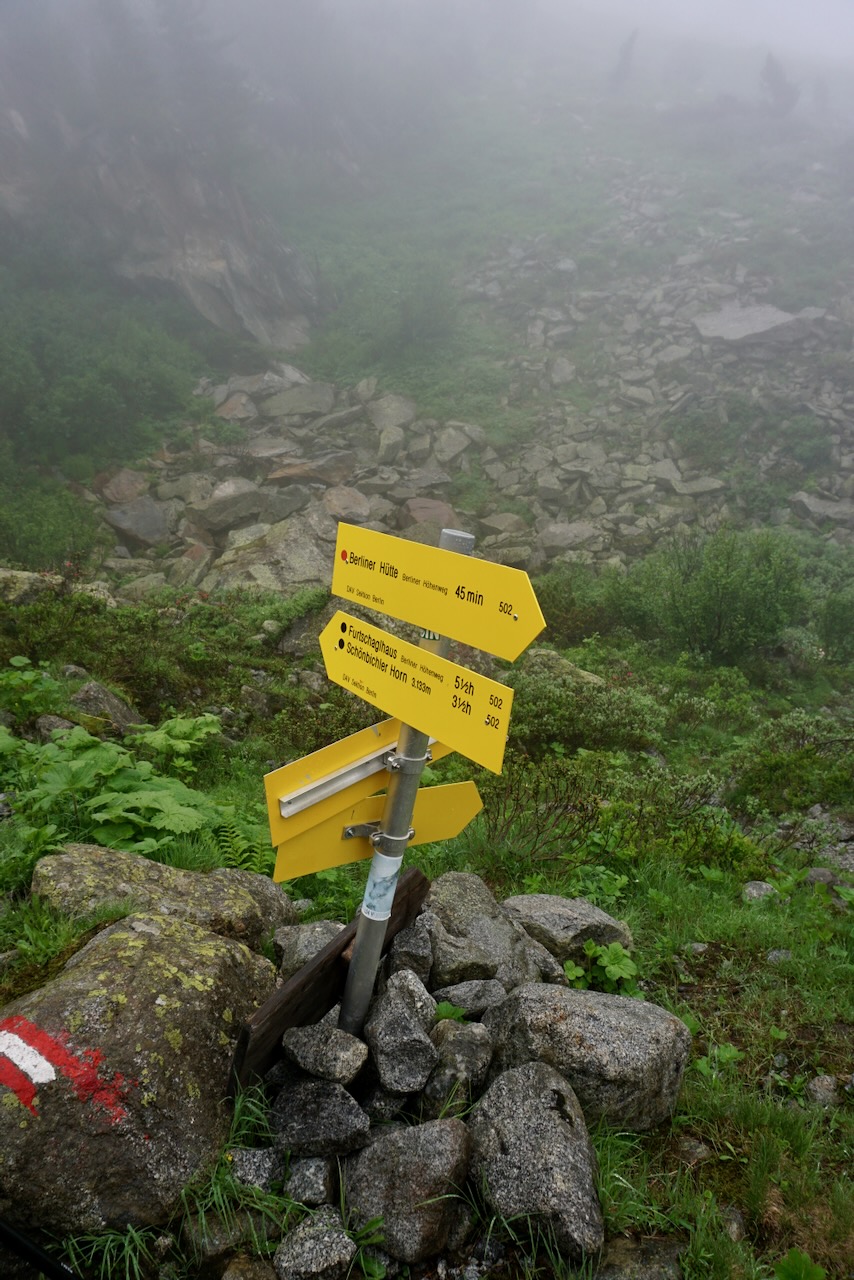
The rain was kind enough to stop for a while as we reached the summit of Schönbichler Horn at 3,133 meters. Exhausted from the efforts of the previous hours, which had us well behind schedule but clearly past the threat of thunderstorms, we did not linger long, aware of how much farther we had to go.

We would find ourselves in snow multiple times over the next several hours, using crampons only when absolutely required in an effort to save time. We were cold and tired, the rain became relentless, and the difficulties within the group became more apparent.

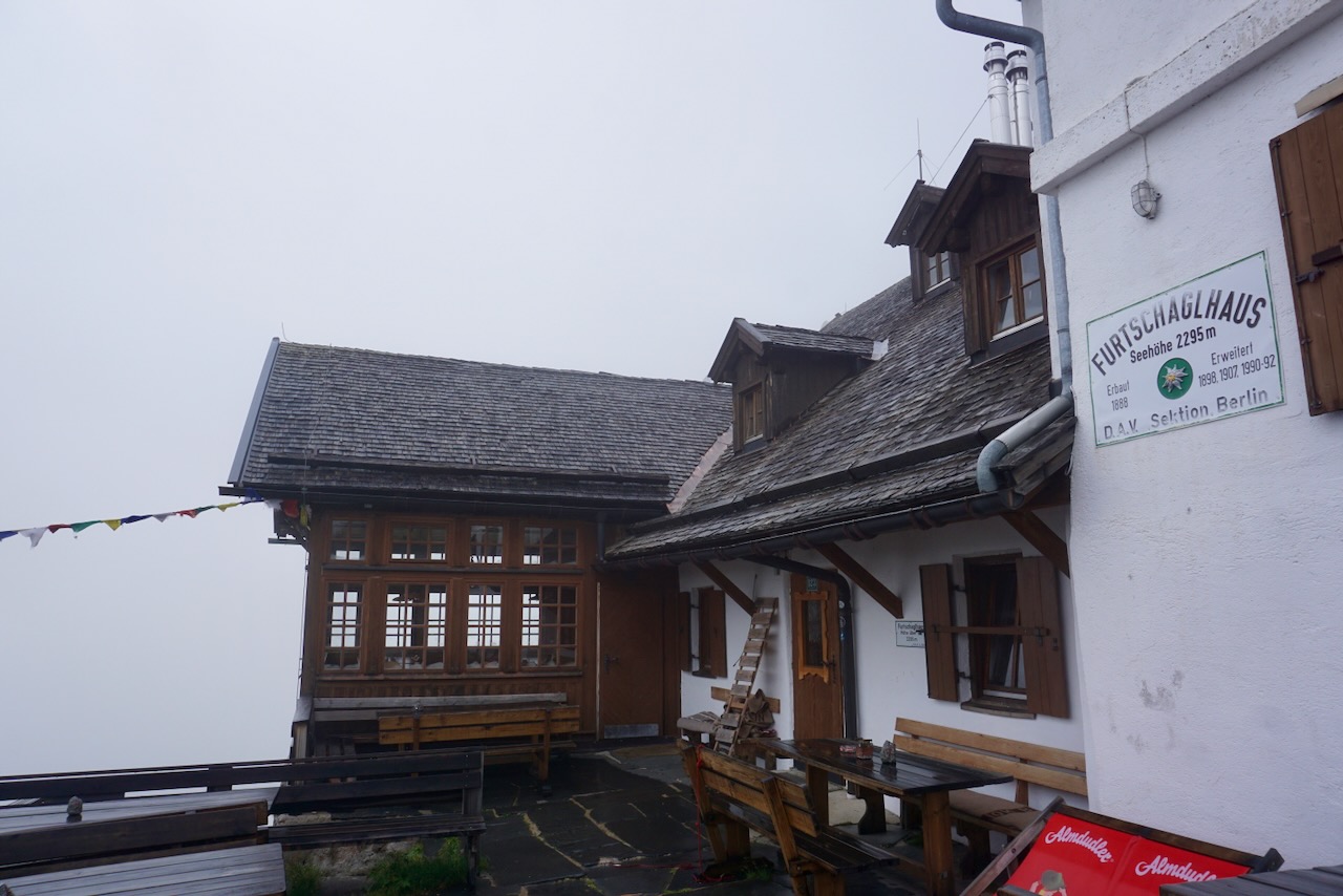
Descending to Furtschaglhaus at 2,295 meters took much longer than it should have and I have never been more grateful for a hot shower. Those three glorious minutes were our longest shower of the trip and worth every cent.

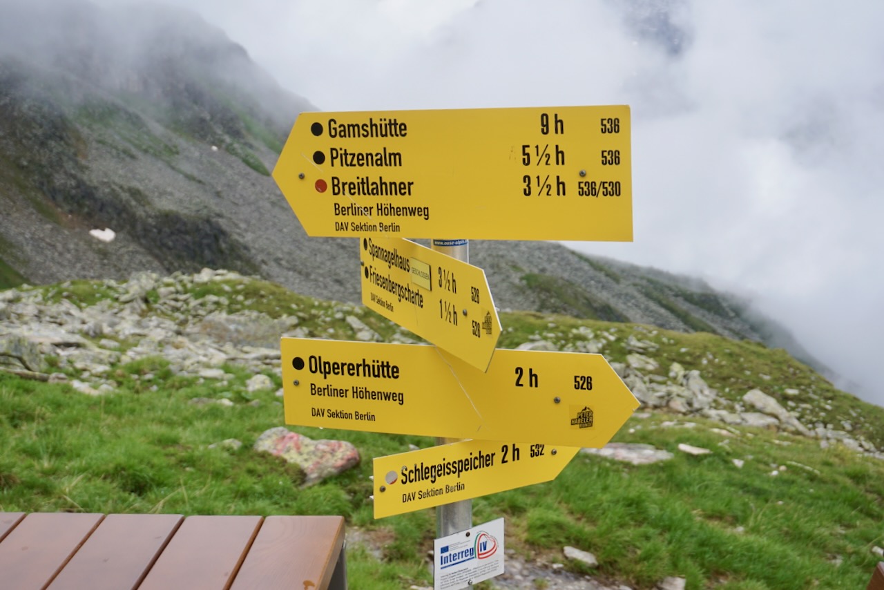
Day 3: Furtschaglhaus to Olpererhütte

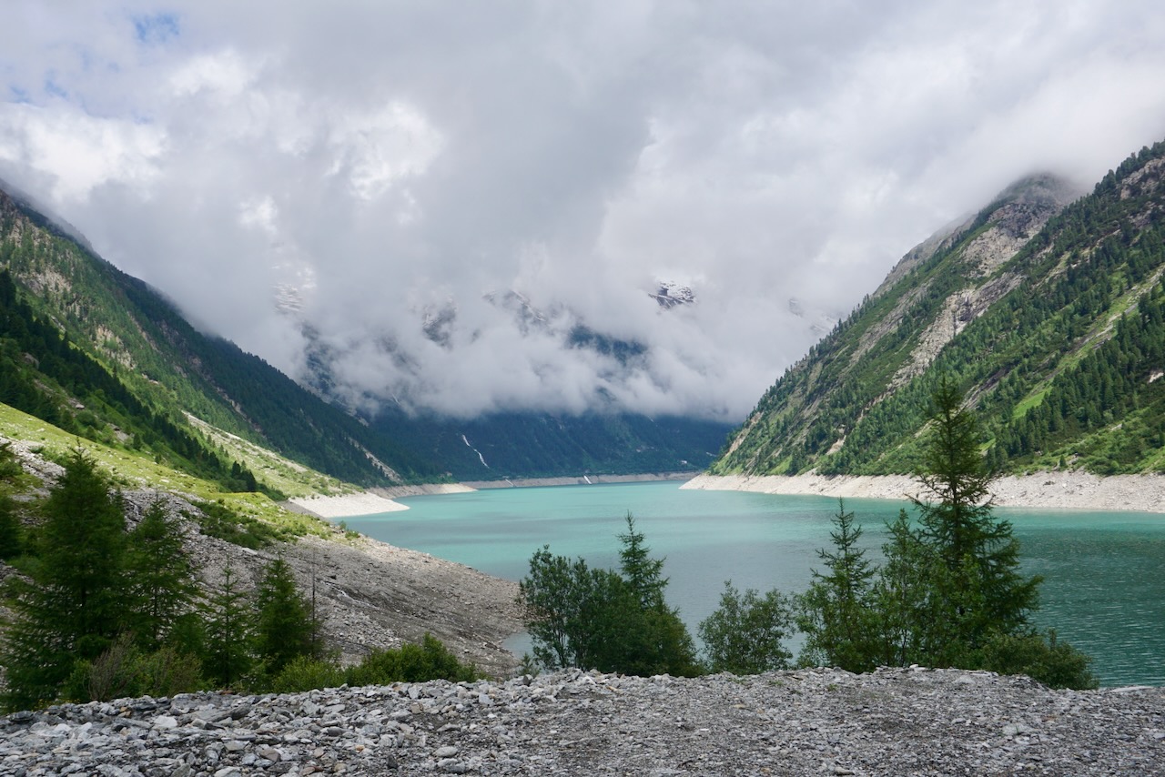
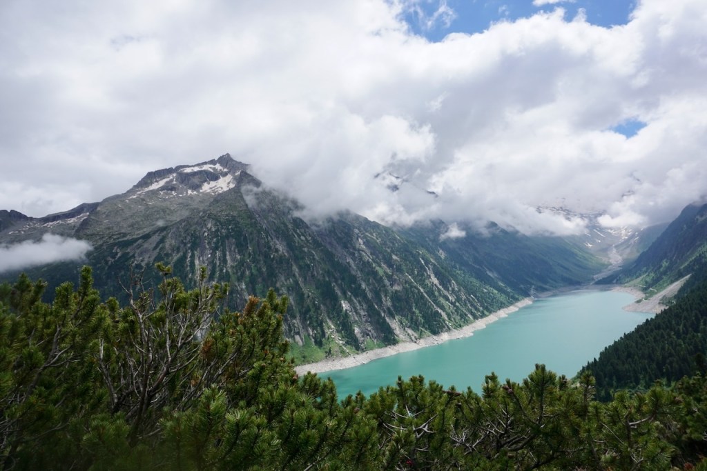
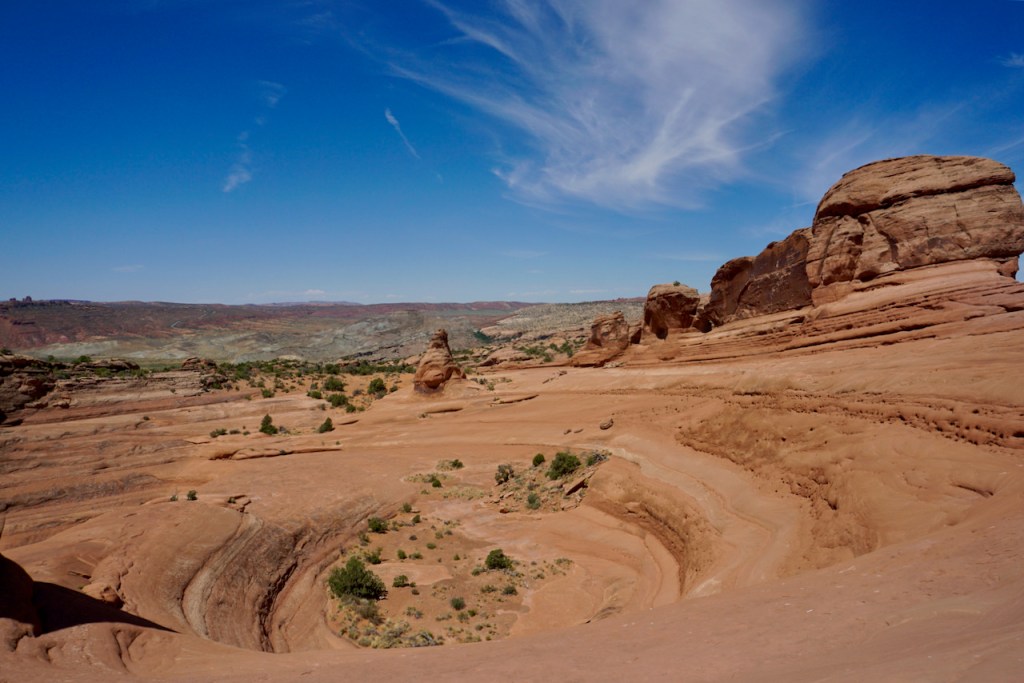
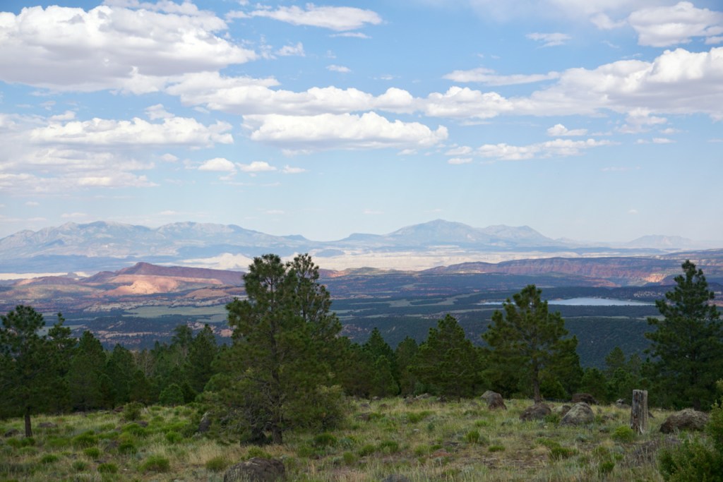
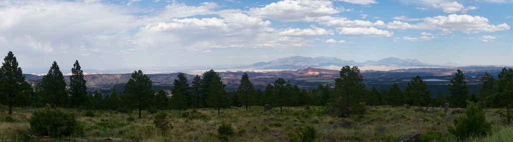
In comparison to the previous day, our path to the Olpererhütte was far less physically demanding. At over 10.5 kilometers, this was our longest day yet, but with only a 510 meter descent and 610 meter ascent. The five flat kilometers in the middle of the route followed the Schlegeis Reservoir, and we were looking forward to a little break.

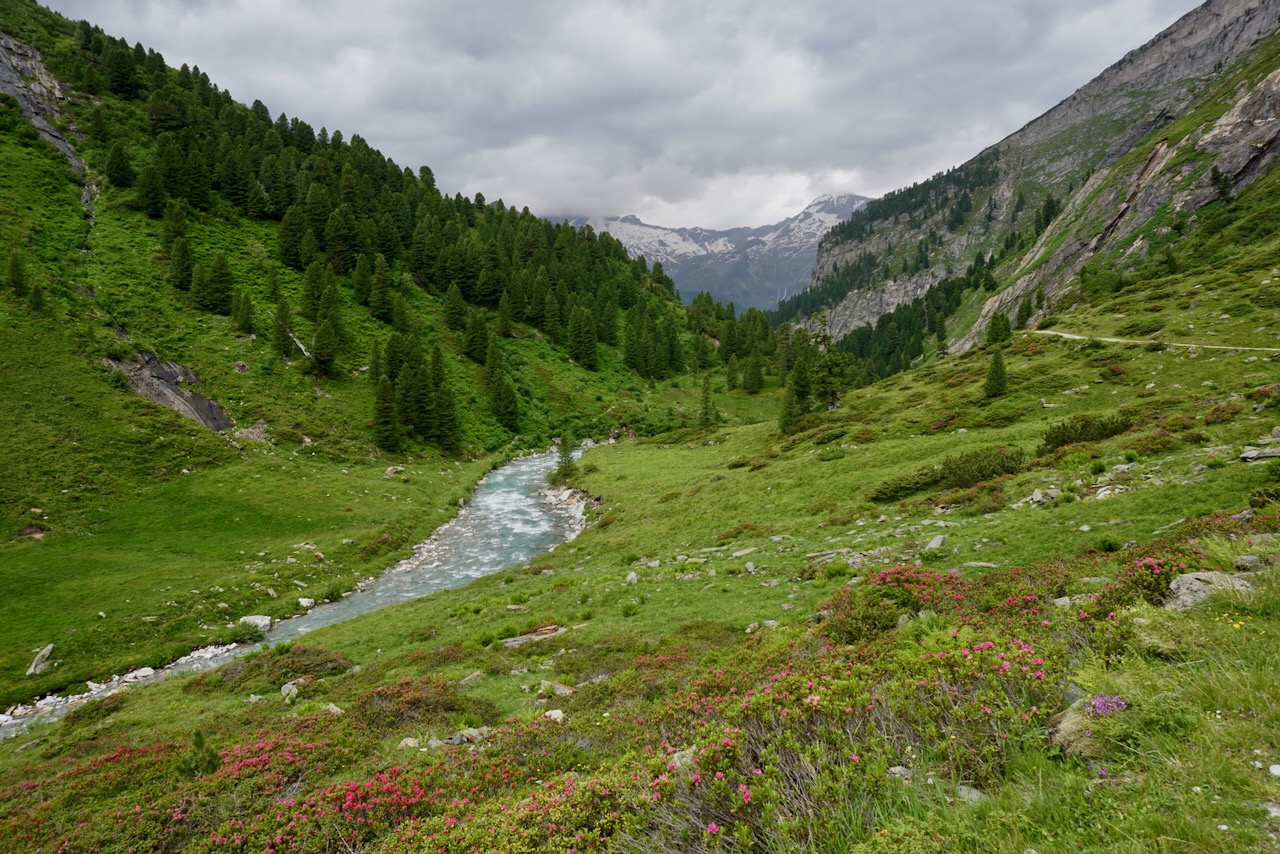
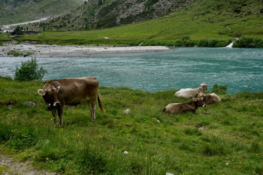
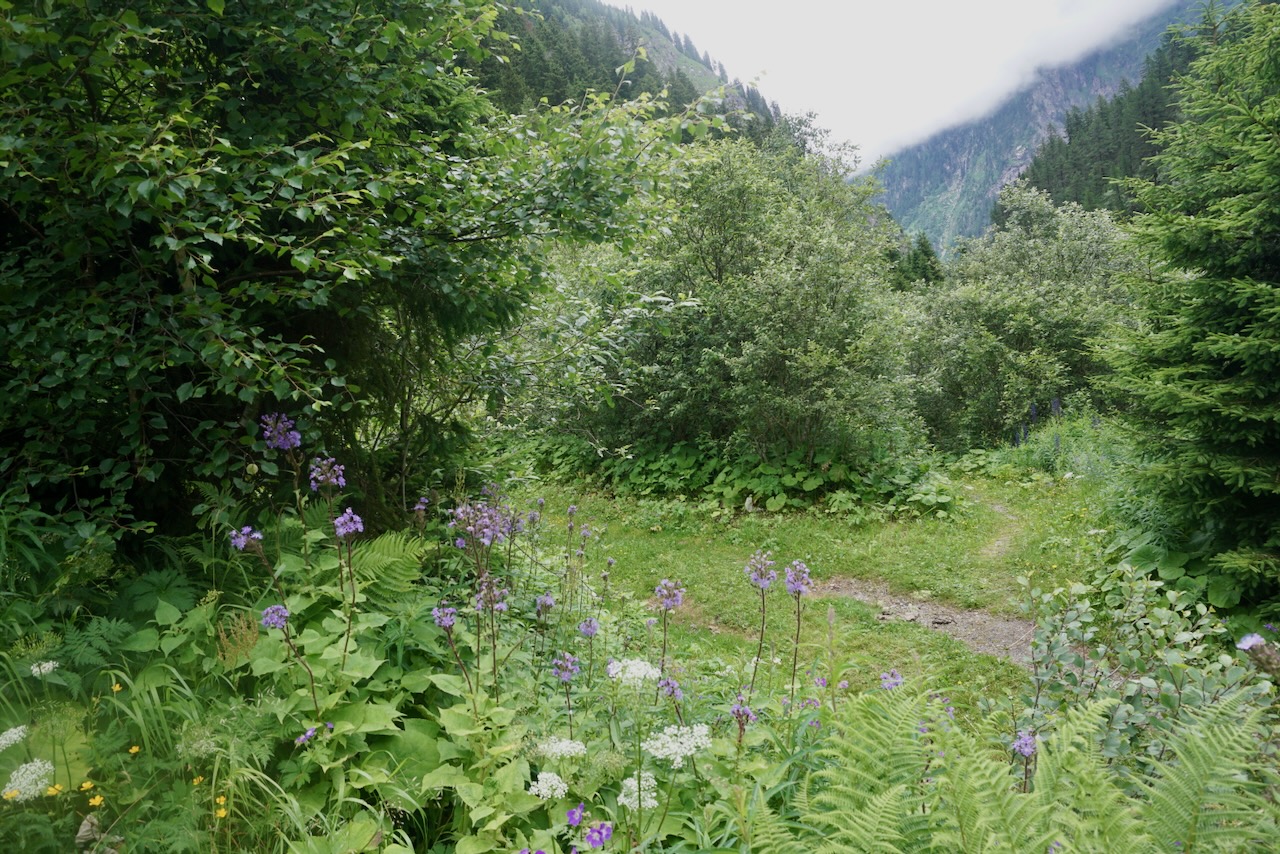
Although we hadn’t had the energy to notice, the landscape had changed during our descent the day before. We were out of fields of snow and jagged stone and back to grass, gentle rocks, flowers, and waterfalls.

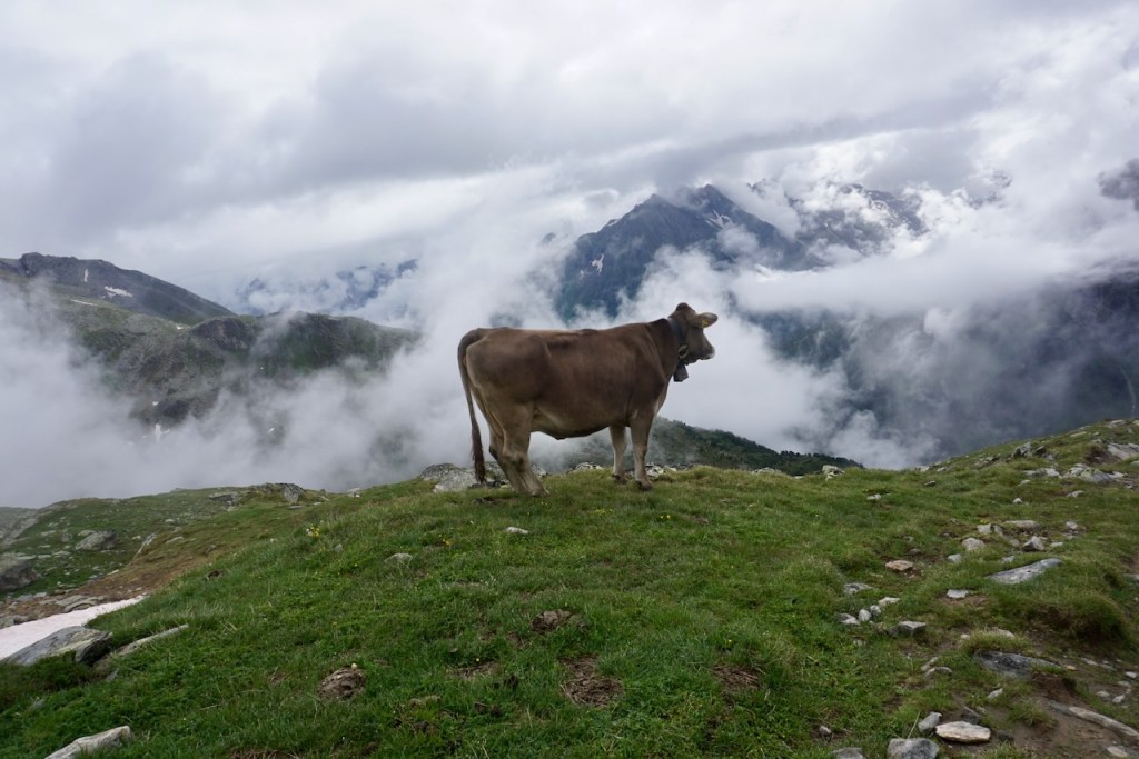
As when we first began, we passed grazing cattle as we made our way down to the Schlegeis Reservoir.

The route is beloved for day hikes as well as being part of the Berliner Höhenweg, and I can understand why. The bright flowers and the reservoir in bright blue with the mountains all around are rather photogenic.

However, the change of landscape came in stark contrast to the challenging solitude of being deep in the mountains. After some time on a gravel path with a heavy backpack, passing day hikers in sneakers and sandals, I was looking forward to being back “up there” with people who understood what we were doing and why we were doing it.

The ascent to the Olpererhütte, while full of pretty views . . .

. . . comprised of a clear path that zig-zagged along the side of the mountain. There was no way-finding using markers, no need to stop and think before putting one foot in front of the other. And because of its straightforwardness, it was busy and crowded. While not a path that I’d recommend doing in sandals, there were plenty of hikers doing just that. Choosing strategic points to get by them was about as challenging as it got, and we reached the Olpererhütte rather uninspired.

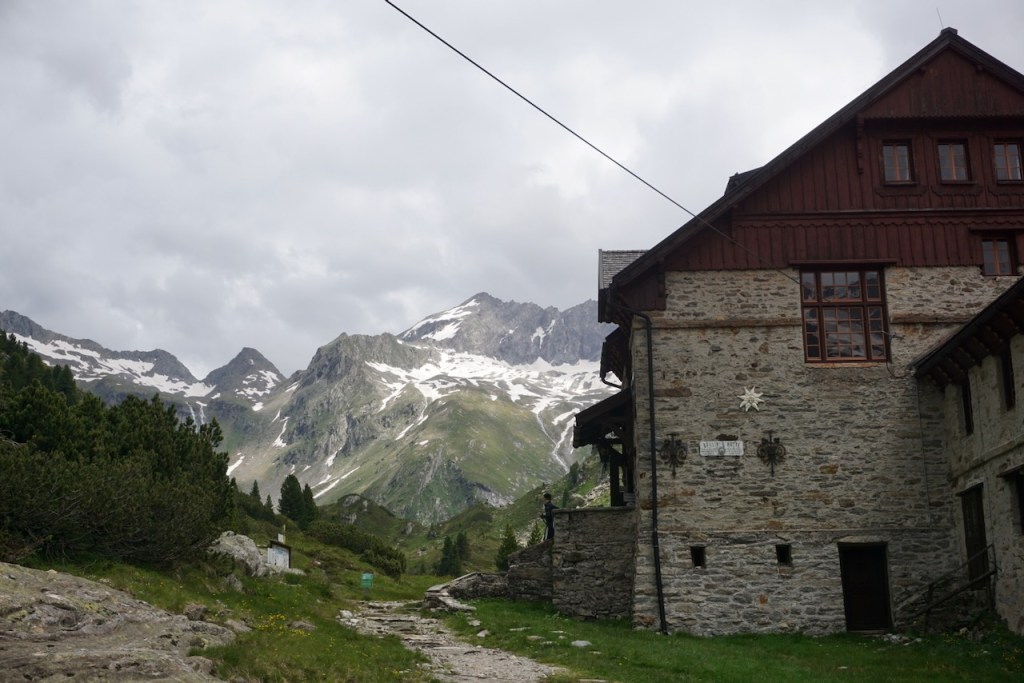
But being greeted by the resident animals was charming and it was comfortable to sit outside bundled up after the steep walk up to 2,389 meters.

The atmosphere of the hut changed after the day hikers left and the rest of us settled down to dinner, drinks, and cards. Feeling refreshed after our easy day, we spent our last night in the mountains in laughter.

Day 4: Olpererhütte to Breitlahner

We had planned our route so that we could walk back down to where we’d parked without the need for buses or trains. At slightly over 10.5 kilometers, this meant a 270 meter ascent and then a huge descent of 1,390 meters. Once again, we were very grateful for the trekking poles. We would pass another hut, Friesenberghaus, on the way.

The day started scrambling over boulders and small snow fields, aspects of a Hochtour to which we had become accustomed and that I really enjoyed. There’s an element of playfulness amidst the need to be sure-footed and deliberate.

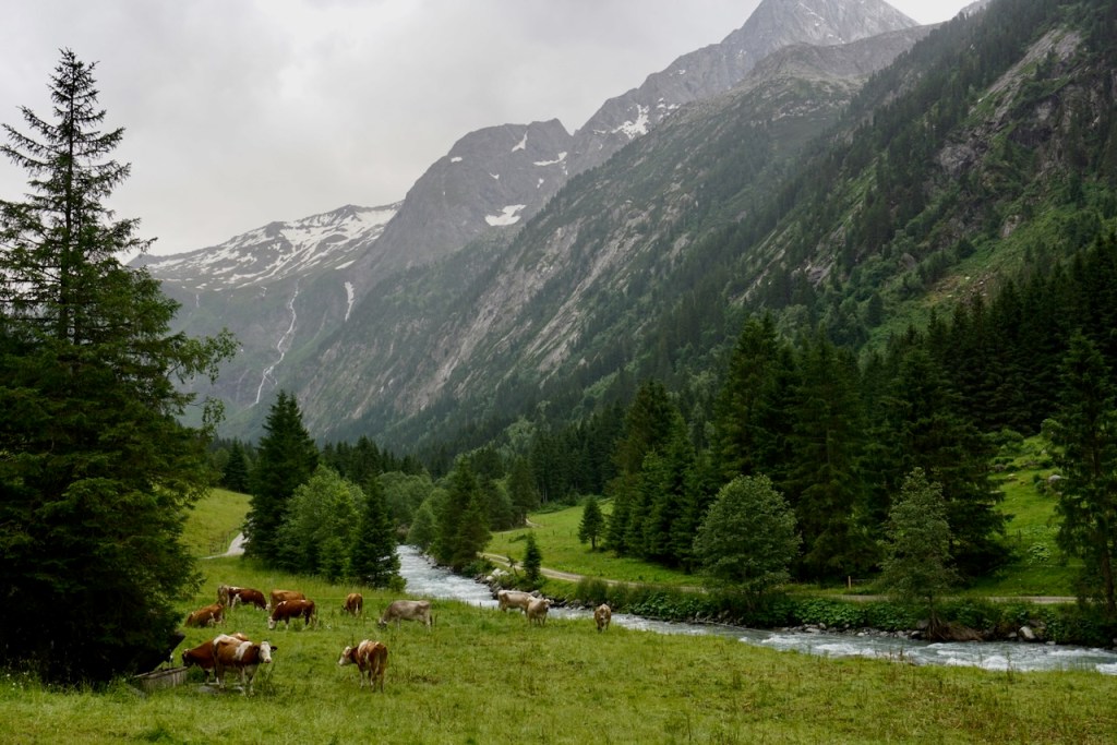
As usual, we were greeted by cows. This time, though, they seemed to enjoy the sweeping vistas as much as we did. Perhaps it is not only humans who feel tiny and inconsequential when finding themselves in so much mighty, majestic nature.

After a round of steep snow fields, the landscape began to change yet again and alpine flowers appeared.

We saw Friesenberghaus before we reached it, picking our way down through particularly steep sections of snow, several of which had us first ascending, which was rather easier.

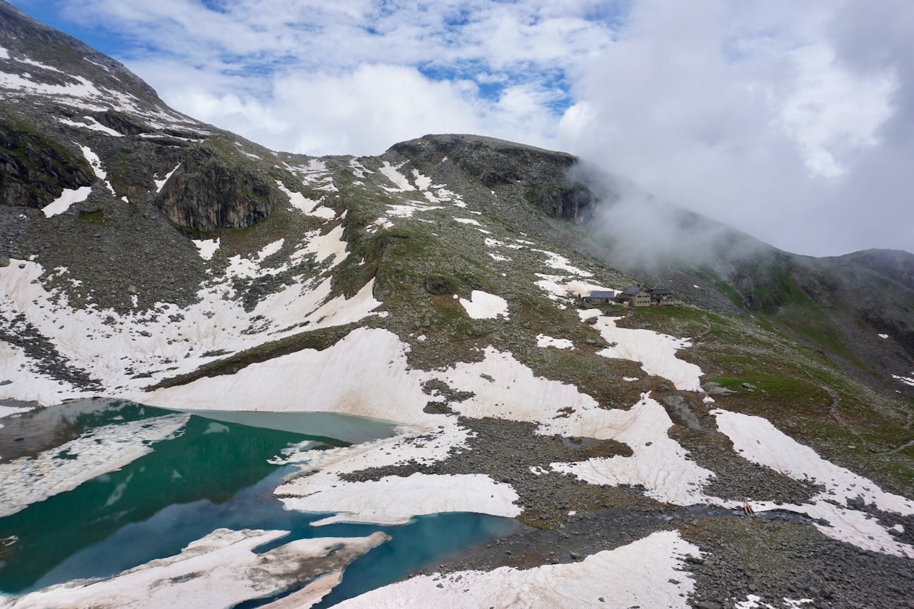
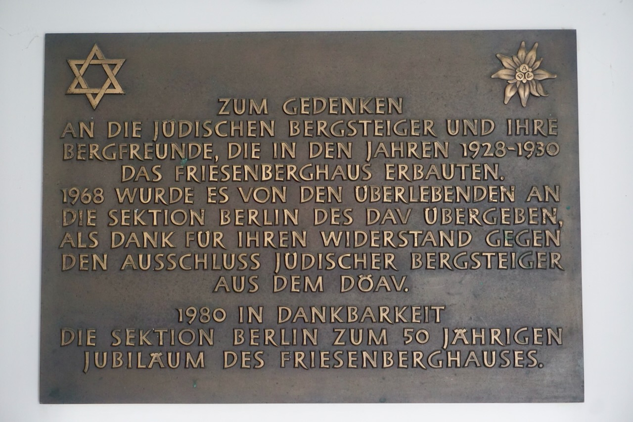
We stopped for a bowl of soup to get out of the rain that had picked up. It was interesting to note the bit of history on the wall, thanking the members of the Berlin section of the alpine club for their resistance against the exclusion of Jewish members from the German and Austrian alpine clubs. There is little place for exclusion in the mountains.

I also appreciated the sense of humour at Frisenberghaus in which a stuffed animal was employed as a weather station.

When Joachim . . .
Dry – Sun
Cries – Rain
White – Snow
Dances – Wind
Invisible – Fog
Hops – Earthquake

Doubles – Alcohol
Speaks – LSD

Checking our watches, we left before the rain stopped. We weren’t the quickest and had a ways to go.

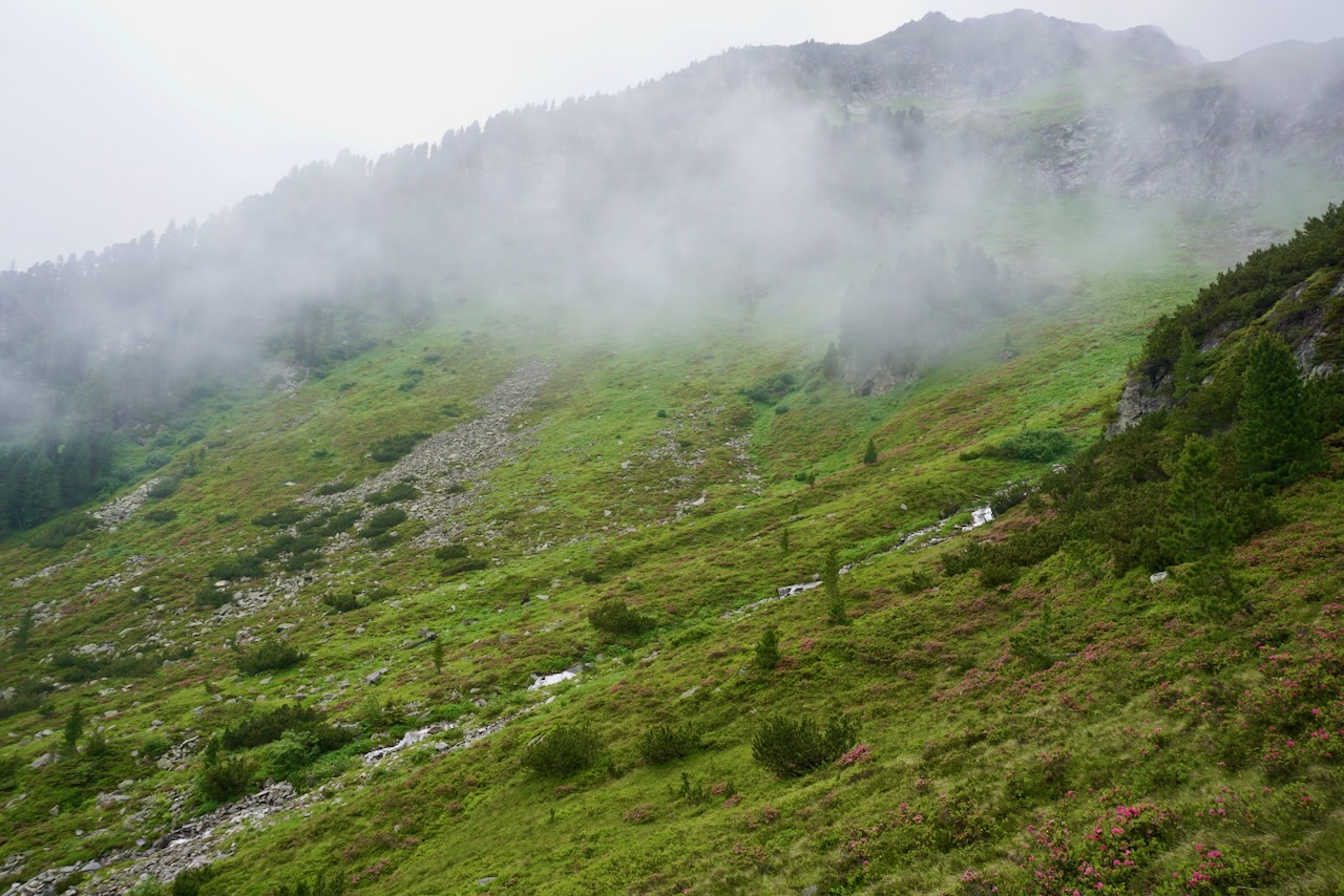
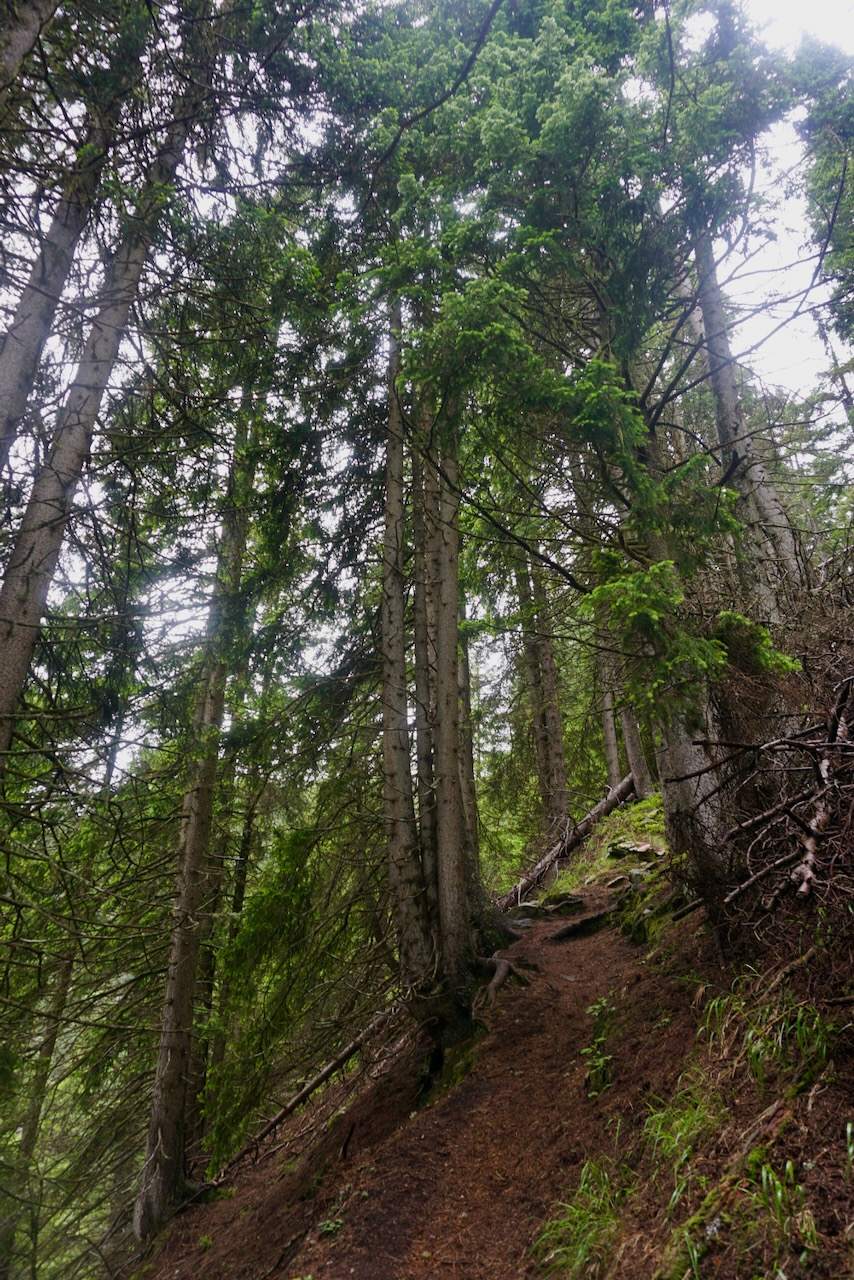
The way continued to grow grassier as it wandered over rocks and streams. Flowers continued to appear and then scrubby bushes and trees. The air grew more humid and the clouds floated upward.

The final descent was long and we knew we were nearly there when our way headed directly through the trees. The mountains were above us again and we were too far from where we’d started to see where we’d been. Our trekking poles showed good signs of wear by now.


We spent one more night together to recover. We cooked a carbohydrate-heavy meal, drank wine, showered for free without looking at the time. We laughed and shared photos and congratulated one another.

We had been in the mountains, had experienced the rhythms of weather, the physical and emotional cycles of a body under strain, the atmosphere of a guesthouse filled with people who love mountaineering. We had been in the mountains, swept away, taken in, and in awe. Mountains are truly the most beautiful place.

And as glad as I was for a real bed in a room shared with only one person, I missed it immediately.

“The mountains are calling and I must go.” -John Muir

Travel Guide: Arizona Road Trip (and a Moment in Nevada)

We’d been in Arizona since early afternoon, had seen sights, eaten at a diner where we heard a local band, and were getting ready to call it a day when we realized that we’d crossed, hours earlier, into a different time zone.

Source: https://en.wikipedia.org/wiki/File:US-Timezones.svg#/media/File:US-Timezones.svg

The shaded parts of Arizona and Nevada on the above map do not observe Daylight Saving Time, remaining instead on Mountain time. This means that Arizona follows Pacific time in the summer. The parts of Arizona that are not shaded are Navajo territory, where they do observe Daylight Saving Time. (Thanks to Wikipedia for helping us out once we noticed that our phones and my wristwatch were keeping different time. Figuring out how to change the time on the GPS took us another day.)

Our drive from southeastern Utah took us through Kaibab National Forest where we saw the effects of forest fire, sometimes stopped only by the road itself. We didn’t know when the fires were, or how many there had been. There were patches where tree trunks were fully blackened, leaves burned away, and patches where black tree trunks were topped with fresh green leaves. We had already seen warnings of fire risk in each of the national parks we visited, and this theme only became more prominent as we drove deeper into the desert.

What is desert? Desert is yellow sand, red and purple rock, vast blue sky, and the straightest roads I’ve ever seen. Roads that stretched beyond the horizon, already impossibly far away, and further than that. The lazy tumbleweeds of the movies actually exist, as do dust devils that you can see in the air long before you reach them, assuming a sudden shift in atmosphere doesn’t blown them away by then. We spent many hours driving through a desert of nowhere, of now here.

It was extraordinary to watch the flatness of this scrubby landscape, populated with yellow grasses and green shrubs, suddenly sprout canyon walls and huge red mesas that stayed with us along the road.

Several times a day, as we passed sign of human activity ranging from clusters of trailers to tiny towns built along the oases created by rivers, my partner commented, “You’re on a journey looking for a new place to live, and you stop here and you look around and you say, ‘Yep, looks great. We’ll stay.’ There’s nothing here. How do people live here?” My contributing comment in response: “And why do they still live here?”

Knowing what I know about the history of American treatment of Native people, it’s entirely plausible that living here was never a choice. And that means it’s also possible that the people who have stayed are here for reasons beyond eking out an income. The reasons the Navajo consider this land holy ground were all around us.

We stopped at Horseshoe Bend in the late afternoon, just outside of Page, Arizona, where we would spend the night. We looked down at the mighty Colorado River, which we had encountered multiple times on our journey, and we watched the clouds move and the sky change.

Although there is a great deal of beauty around Page, we didn’t linger. Instead, we drove in the direction of the Grand Canyon, which is indeed a sight to behold. It is so massive, so huge, and stretches to somewhere very far away. It is unfathomably deep, cavernous, and abutted by mountains in one direction and forest in the other. At lookout after lookout, we exclaimed over the scale, the vastness, and the majesty of sand, wind, water, and time, this wonder called nature.

After a while I stopped taking photos and just looked. There was really nothing to say, no words that could capture the privilege of being there.

Late in the afternoon, following our trip motto of, “Always take the scenic route,” we turned off the main highway to follow:

On Route 66 we found the town of Seligman, with preserved shades of former glory and local people used to welcoming tourists. My partner’s dream of being called “sweetheart” by a diner server was fulfilled, I finally had a veggie burger, and the man in the kitsch/second-hand/antique store gave us markers to sign the wall, like many hundreds of travellers before us. Liebe Grüße aus Weimar!

It took us fully by surprise that the diner where we ate was German-themed, the walls full of license plates, stickers, and other memorabilia. In addition to typical diner offerings (refillable coffee, breakfast all day, pie in a glass fridge by the door) bratwurst was on the menu at Westside Lilo’s Cafe. Based on the reactions of people who walked in the doors, we were the only ones who had just stumbled in, but not the only ones who could read the German and English newspaper clippings on the walls.

After a night in Kingman, Arizona, we drove to the other side of the Grand Canyon to experience the skywalk, which I really wanted to do despite having already paid once for access to nature. But, as with Horseshoe Bend, this was the way in. Here was our opportunity, picture-taking prohibition notwithstanding, to be high up on the rock and look down. Also enjoyable was the obligatory bus stop at another lookout where we scrambled up rocks to the highest point. The sheer size of the Grand Canyon was awesome, in the original sense of the word.

Our next overnight stop was Las Vegas, Nevada, and on the border between Arizona and Nevada, where our car registered 122°F (50°C), we pulled over to walk across the bridge at the Hoover Dam. Not interested in the engineering feat, I was mostly in shock at the heat against the backs of my legs and the fact that my greenstone necklace burned against my skin. No one needs to live in a place that is that hot.

And why people do so is the question we asked ourselves, and later the friend who hosted us in Vegas, as we continued our drive.

I never had any intention of visiting Vegas, but there we were, and having a local tour guide was a lovely experience. We visited the Strip in the afternoon to gawk at the buildings and the people, and returned at night to see the lights and a show, continue gawking at buildings and people, lose a gambling budget of $50 in under two minutes, and take a drive to the “old Vegas” of Freemont Street, glitzy yet cozy under even more lights.

There was so much to look at and it was impossible to stop looking. I’ve lived in big cities and have plenty of experience with glitz, glam, and mazes of shopping malls. After a week of the relative solitude of the desert and intense contact with nature, however, we found the scope and scale of it all a little stressful and overwhelming. I was glad to get back on the road and looking forward to the final part of our trip – California. Coming soon!

Travel Guide: Utah National Parks (and a Moment in Colorado)

In the end, we drove 2,716 miles (approximately 4,443 kilometres) in two weeks. While our trip earned negative points in the Environmental Friendliness category, we earned positive points in Support for Local Communities, often eating in the one diner or Mexican restaurant in the only town on endlessly straight roads that knifed through the desert.

The journey started in Denver, Colorado, where we visited old friends of mine. On our way out of town, they gave us directions to Rocky Mountain Arsenal Wildlife Refuge where, from the safety of our vehicle, we saw prairie dogs . . .

. . . and bison, first alone and then with the herd.

Knowing only of Colorado’s mountains, I was not expecting the endless prairie that was Denver, nor how big the sky felt when the land went on forever, with no groves of trees obstructing the view. The landscape changed as we drove, lush greenery and mountainous by the time we reached Vail, and then the rocks and red dirt, and tunnels that opened into canyons, that opened into more rock, until there was nothing. Just mountains and desert, which is to say everything.

We spent our first real night on the road in Silt, Colorado and then took our time getting to Moab, Utah. Our motto on the road became, “Always take the scenic route”, regardless of the amount of time added to the journey. After all, this trip was about the journey. And we were always, always glad for our choice.

Canyonlands National Park was our first real experience in the desert and it taught us very quickly that summer desert heat is to be respected and adhered to. And we recognized that while we were prepared for the rock, we could never be prepared for how hard it would be to not touch the rock.

My partner and I are climbers and we marvelled at the deep red, the layers of colours, the formations created by sand and wind and endless time.

The caverns, canyons, and shapes were otherworldly, and the fact that trees and plants grew there was a testament to the incomprehensible magic of nature.

We couldn’t help it, and we wanted to be part of that rock. We didn’t build the cairn, but we appreciated whoever did.

The following morning we had the earliest timed entry slot available for Arches National Park, allowing us to watch the sun move across an extraordinary landscape. My journal, sitting beside me as usual as I write this post, says, “Today is difficult to describe because it was overwhelming. Overwhelmingly beautiful, in the most diverse landscape I’ve ever seen.”

We hiked Devil’s Garden and found ourselves on what could have been another planet. We were in awe of the rock . . .

. . . of the landscape (Landscape Arch is indeed appropriately named). . .

. . . and of the greenery despite the harsh desert climate.

At my partner’s encouragement, we scrambled up the path under punishing sun to reach the famous Delicate Arch, which was every bit worth the discomfort.

It was on the way there that we saw our first petroglyphs, signs that real people had lived here, beginning thousands upon thousands of years ago.

Later in the day, again choosing the scenic route, we saw more of the same in Capitol Reef National Park.

The landscape had changed along the way, with stark rock formations gradually giving way to mesas and plateaus. Unlike Arches, which was so bright and so hot it was difficult to imagine the people who had sheltered in the occasional spots of shade, Capitol Reef was an oasis with fruit orchards, a welcome breeze, and rolling hills.

Later on, we drove through Dixie National Forest, in which we would find ourselves multiple times throughout the trip. From lookouts there, we could see Grand Staircase-Escalante National Monument, also part of our route, in the distance.

We spent the night in Cannonville, Utah, sleeping under the brightest, clearest stars that I’ve seen in North America. As is my habit, I first found the Big Dipper, and Polaris followed from there. The Milky Way winked hello and we lay on our backs pointing out constellations that we recognized and looking for others we thought we knew. It was a warm night that grew shockingly cool, and I was grateful for the heavy blanket in our cozy tent.

We left early the following morning to reach Bryce Canyon as the sun made its way across the rock formations that belonged, again, somewhere other than Earth.

And then we made our way down into the canyon, deliciously cool, and stared up at a storybook sky as we walked along pillars of red rock and shockingly green trees. The heat got to us again, but our attention was on the rocks made of chalky sand, with formations that could have been stalagmites had they been located elsewhere. And they towered over us.

Just based on what we saw in Bryce Canyon at the height of summer, I can almost imagine what it might be like to see a desert in bloom.

We spent the night in Springdale, Utah, at the foothills of Zion National Park. Zion is beloved among climbers, and it was no surprise as to why. This is real big wall climbing, and it is impressive in scope.

That being said, we found Zion underwhelming at first. Perhaps this is because of its similarity (cliffs and greenery) to what we’re familiar with from home, or perhaps because it came after the wonders of Canyonlands, Arches, and Bryce. We didn’t follow the crowds into the river to explore the famed Narrows, and we weren’t there at the right time of year to hike Angel’s Landing. But by choosing the scenic route on our drive out, we saw a part of Zion that raised its esteem in our eyes, and left us, as usual, glad for our choice.

Of the five states that comprised our road trip, Utah was by far the most impressive. The landscape was diverse in a way that I’ve never seen before, and each tiny settlement or small town was set in a beauty that we were privileged to merely pass through. I’ve previously been in Utah to ski, but this was the first time I’d actually seen it, the first time I’d eaten pie with ice cream at the only diner in the only town on the only road in the middle of wherever we were. We kept early hours and correspondingly early bedtimes. We were out exploring when it was comparatively cool enough and back in the air-conditioning of our car by early afternoon. Dusk brought not a respite from the heat, but a respite from burning the backs of our legs upon getting back inside the car after stopping at yet another lookout. (The newspapers provided by many national parks were put to great use.)

After two nights in Colorado and three in Utah, we had found a rhythm on the road, one helped along by a good supply of snacks, a discerning ear for religious radio, and a classic license plate game. With camera, hat, and waterbottle within reach and sunglasses always perched on the nose, we headed towards our next state – Arizona. Stay tuned!