There’s a river just south of our apartment – follow it east. When the option becomes available, turn south to walk above the train tracks, which takes you into the forest. I love this forest, and it is my place to go to breathe the air. It is my place to go to feel myself differently, and when I need to get away.
I was sitting on a bench in my favourite clearing with eyes closed, a result of not having slept well the night before. I heard the runner before he appeared (sound travels in forests), and opened my eyes right before he called out that I shouldn’t startle. I wished him well on his run and he paused several meters in front of me. He looked back over his shoulder to ask if I wasn’t cold. I was wearing a thick sweater under my coat, I assured him. “You have that youthful fire,” he stated matter-of-factly. He was an older gentleman and we had addressed each other with the formal “you”, so I knew to feel flattered, and I did. I laughed, we said goodbye, and he went on his way.
When the runner was out of earshot, I got up to continue my walk home, suddenly rejuvenated. I’d been in a funk all day as a result of the broken sleep, and I felt myself refreshed.
Sometimes, all you need is a walk in the forest, friendly strangers, and a new pair of eyes.
This post is dedicated to AL, CC, DF, KB, LC, MS, SB, SF, and TM.
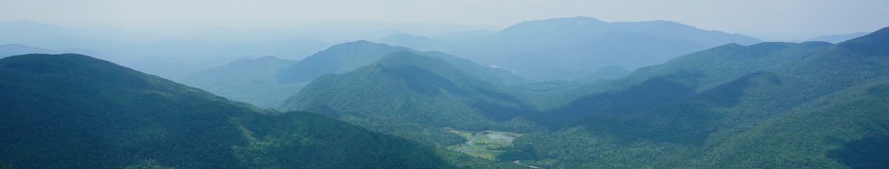
The 91-kilometer SaaleHorizontale Wanderweg was voted Germany’s prettiest hike of 2023. It is located in the hills surrounding the city of Jena, about 20 kilometers from where I live in Weimar, and conveniently divided into nine very manageable stages that are accessible by public transportation. I really enjoy the nature around Jena, a city situated in a valley cut by the Saale River among rolling hills, farms, and some wine country. From the hills, which are easily accessible on foot throughout the city, you can look into the distance and the appreciation of the landscape only grows. I miss that in Weimar sometimes.
I had heard about the SaaleHorizontale previously, but didn’t knowingly experience it myself until the beginning of 2024 with the aid of a helpful map. Immediately upon completing the first stage, I decided that my outdoor goal for 2024 was to complete all nine stages. I wanted be intimately familiar with the nature in my backyard.
As it worked out, I didn’t walk the stages in order and completed only three alone. I spent most of my time in good company; my partner and I were often together and I am happy to have friends who like hiking as much as I do. I ended up in the rain only twice, the first time a heavy shower for a few minutes and the second time a steady four hours on a day where no inclement weather was called for. It’s nice to remember that we are part of nature and not the other way around.
A story of changing seasons can be seen in the photos below. Nature never fails to calm and to comfort, and that was my experience the whole time.
Stage 1: Klinikum Jena to Kupferplatte (12.7km) – Early January
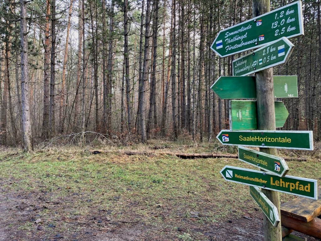
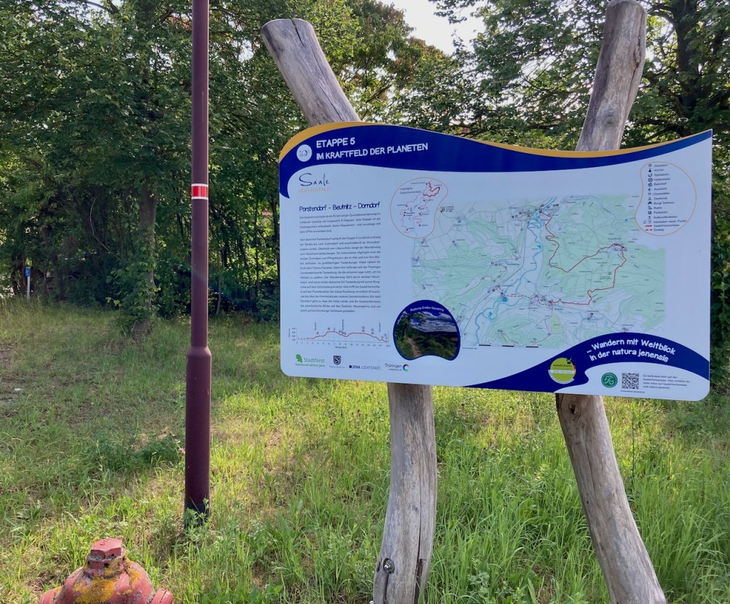
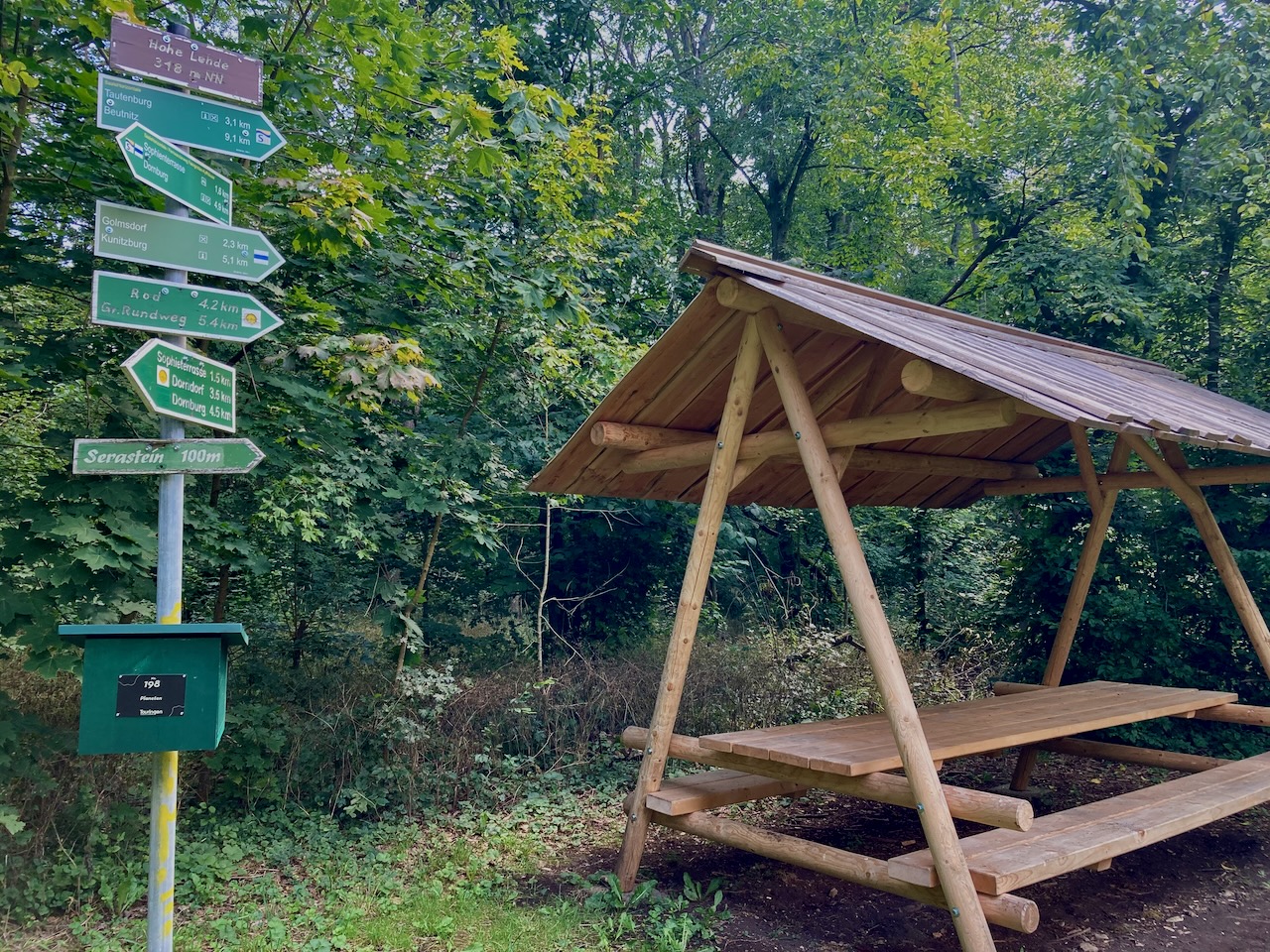
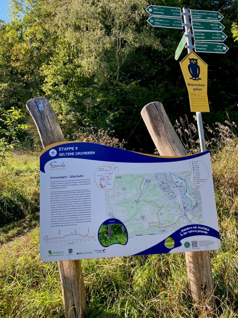
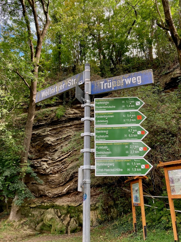
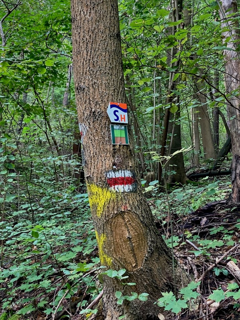
Germany is known for being nature-loving and hiker-friendly, which can be seen in the helpful signs at the start of each stage.
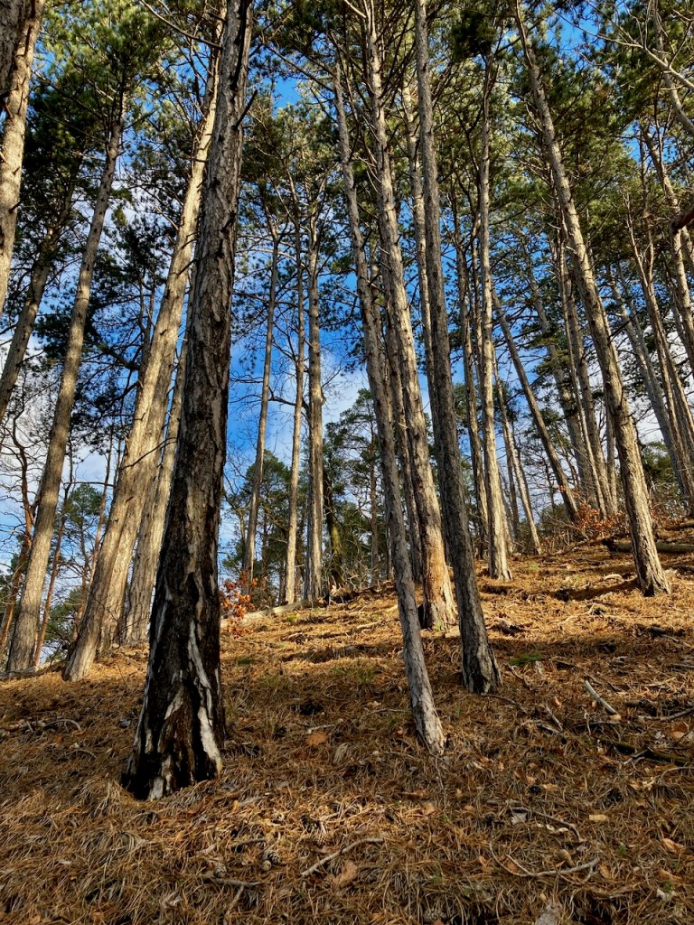
Although January and cold enough for my winter jacket, this was obviously not a point at which we had snow. We had had a lot of snow at the beginning of November and would get more later in the month. I love winter hiking and did as much of it as the weather allowed this year, but the SaaleHorizontale trails are narrow and on the edges of hills. I’m sure people walk it in the snow, but I don’t need to do that.
The view from all exposed parts of the trail is wide, and I saw the rain coming before it came. I enjoyed a snack in the last rays of sunshine and had almost made it out of the woods before the short, heavy shower. As often happens, the sun that came out immediately thereafter was beautiful and left me completely dry before I reached the tram stop.
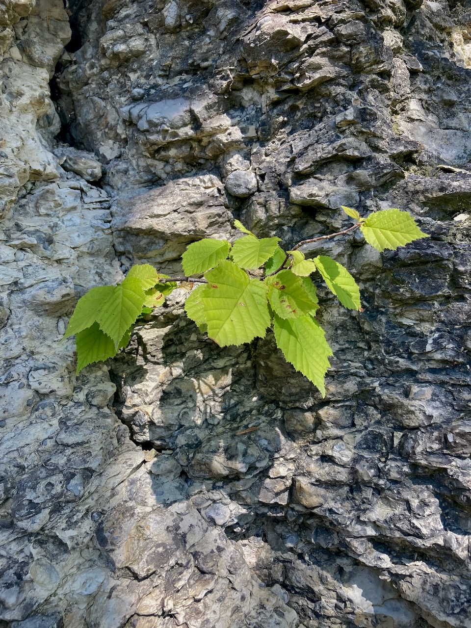
Rock tells the story of the history of our planet and there’s a good deal of beautiful rock along the SaaleHorizontale. Unfortunately, there’s no climbing immediately around here because this is Muschelkalk, or shell limestone, and very brittle. Shells? Indeed – this region was once under water.
Stage 6: Dornburg to Zwätzen (13.8km) – Late February
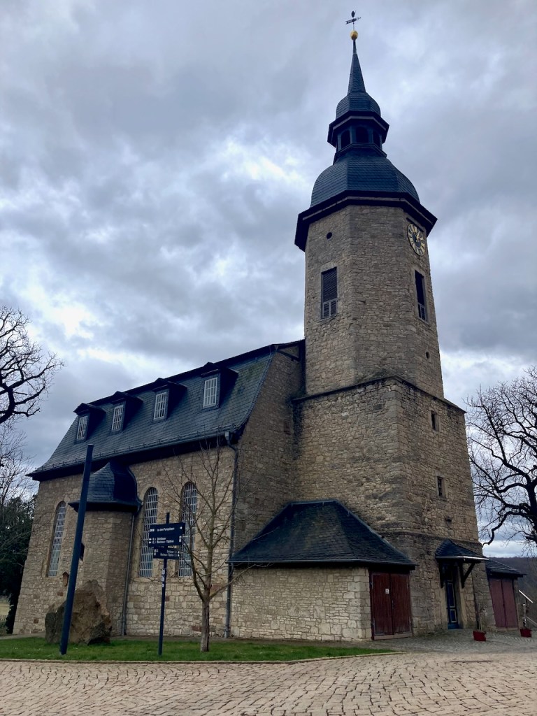
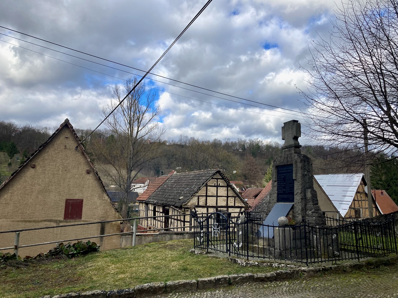
It was very early spring the next time I stepped foot on the SaaleHorizontale, this time with a large group of friends. Bundled into down jackets, we began in a small village . . .
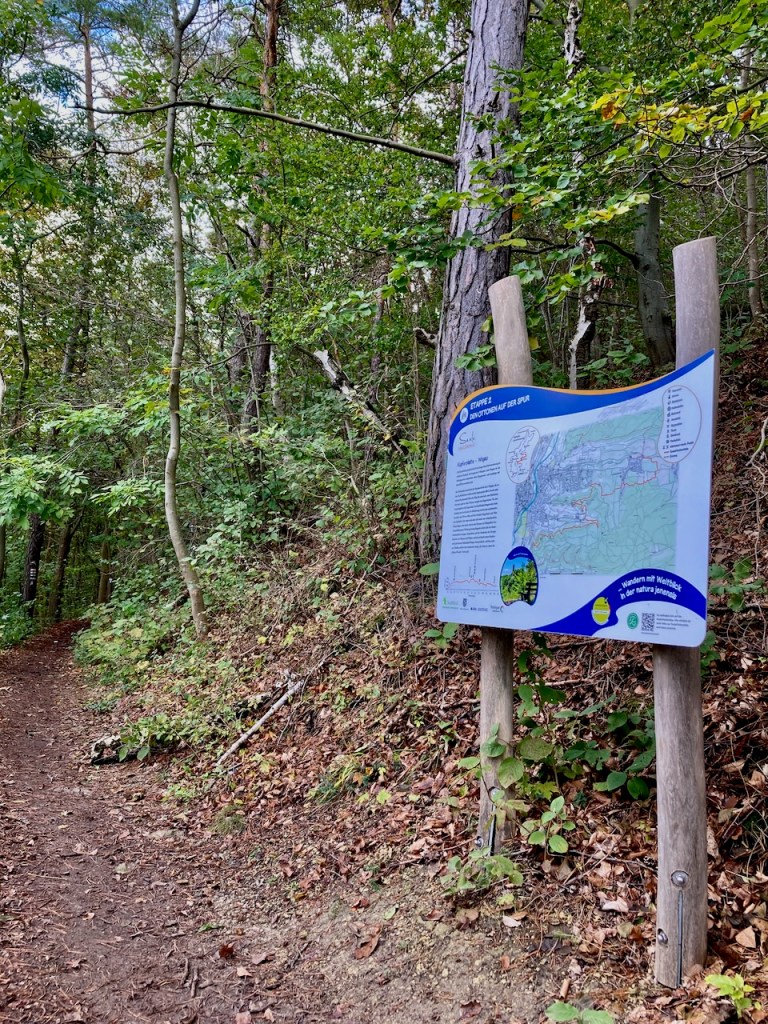
. . . and followed the signs to the trailhead.
A charming aspect of Germany is that even small villages have castles. Royals since time immemorial have loved the countryside.
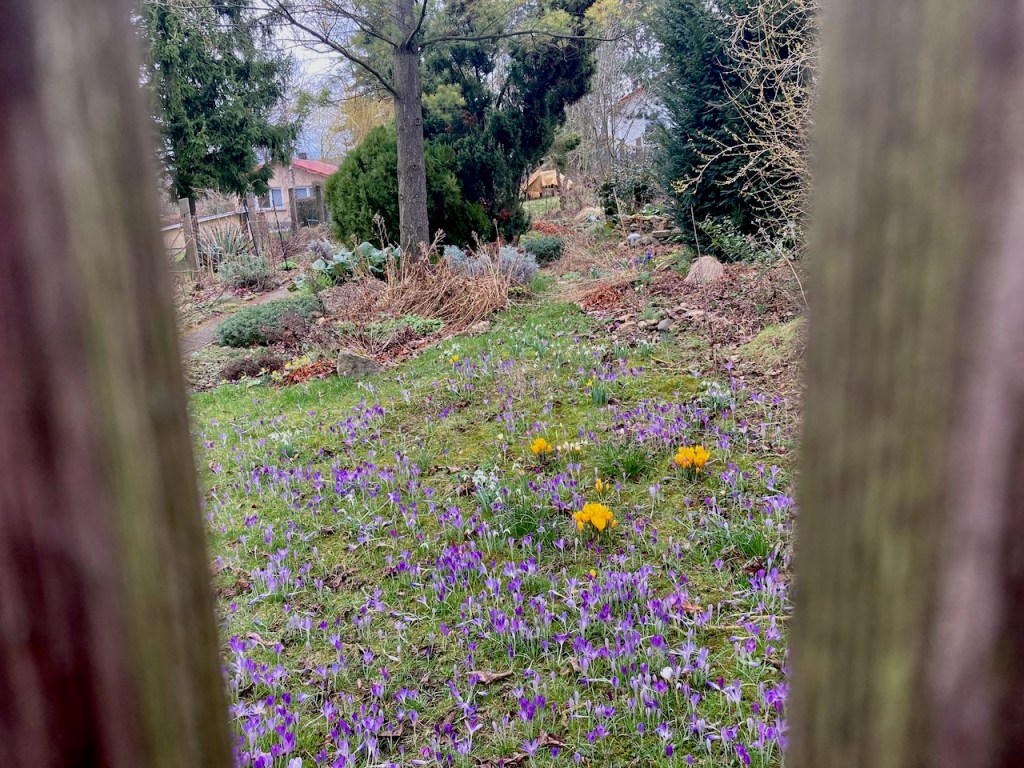
We walked past small farms . . .
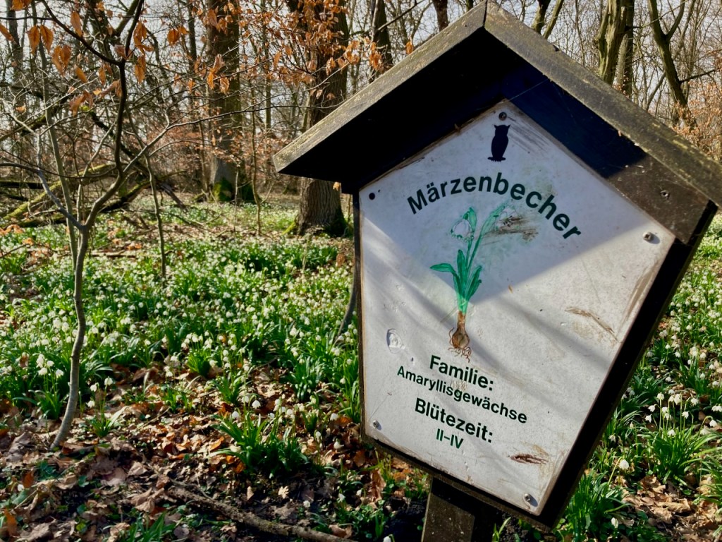
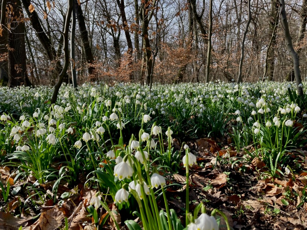
. . . and past fields of tiny spring flowers. The little yellow ones are Winterlinge, visible for just a few weeks as winter fades into spring, the white ones are called Märzenbecher, which roughly translates to “March goblets”, and the purple ones are, of course, crocuses.
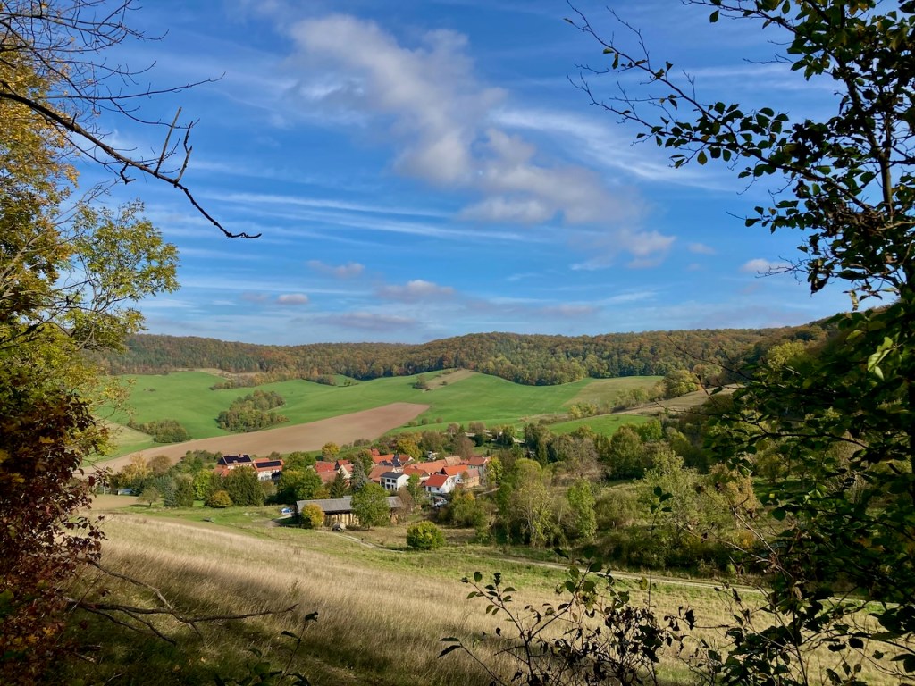
The SaaleHorizontale route passes through many little villages that look a lot more remote than they are. The hills make for the remoteness while their location in the valley mean that the university city of Jena is a short public bus ride away.
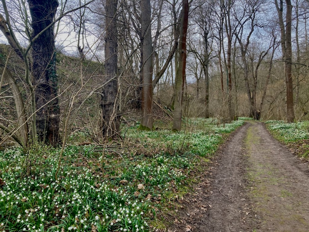
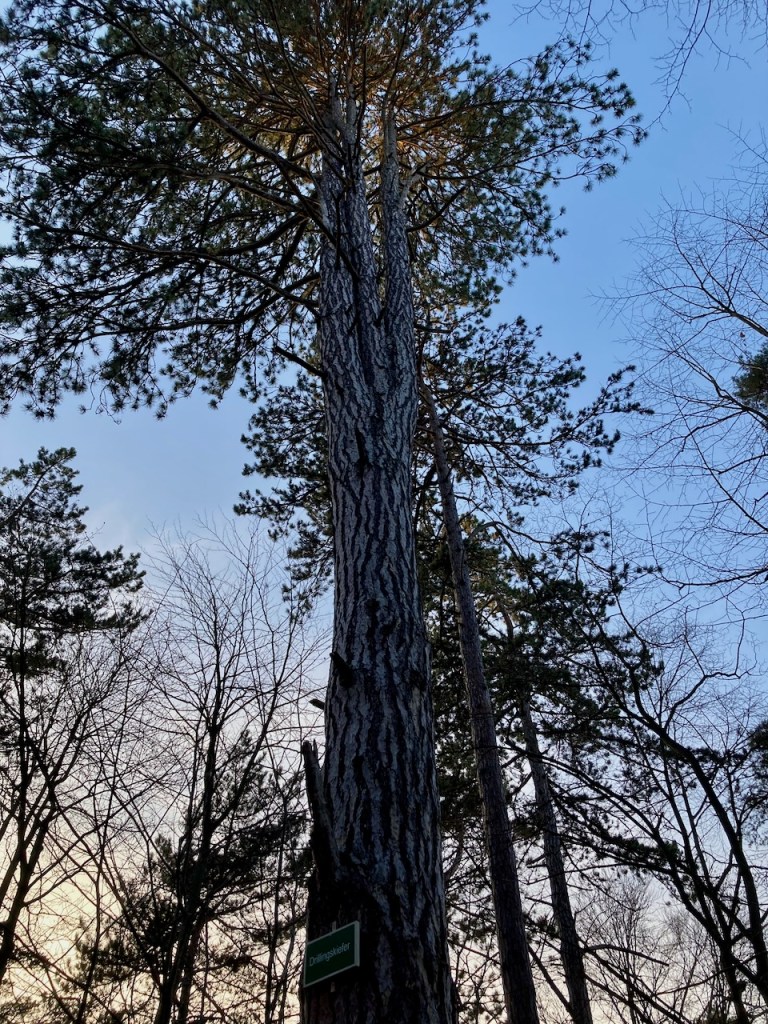
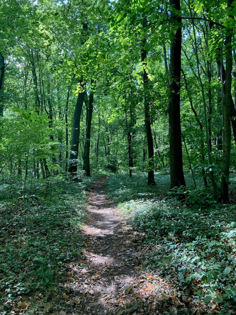
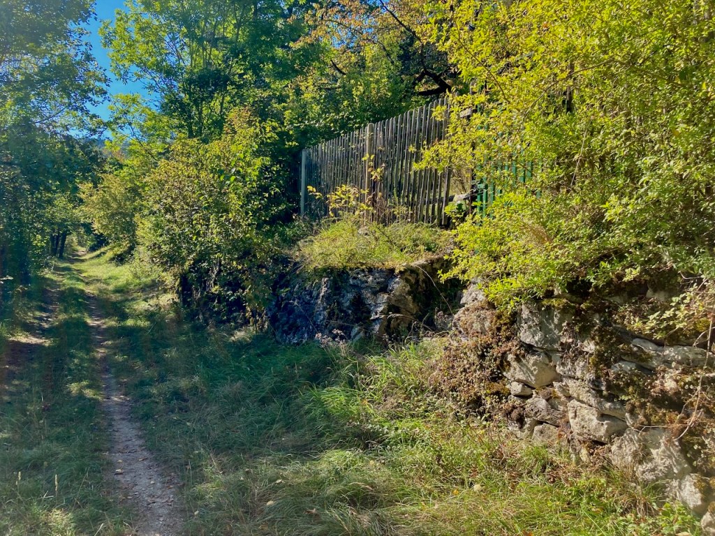
My favourite parts of the trail are in the woods . . .
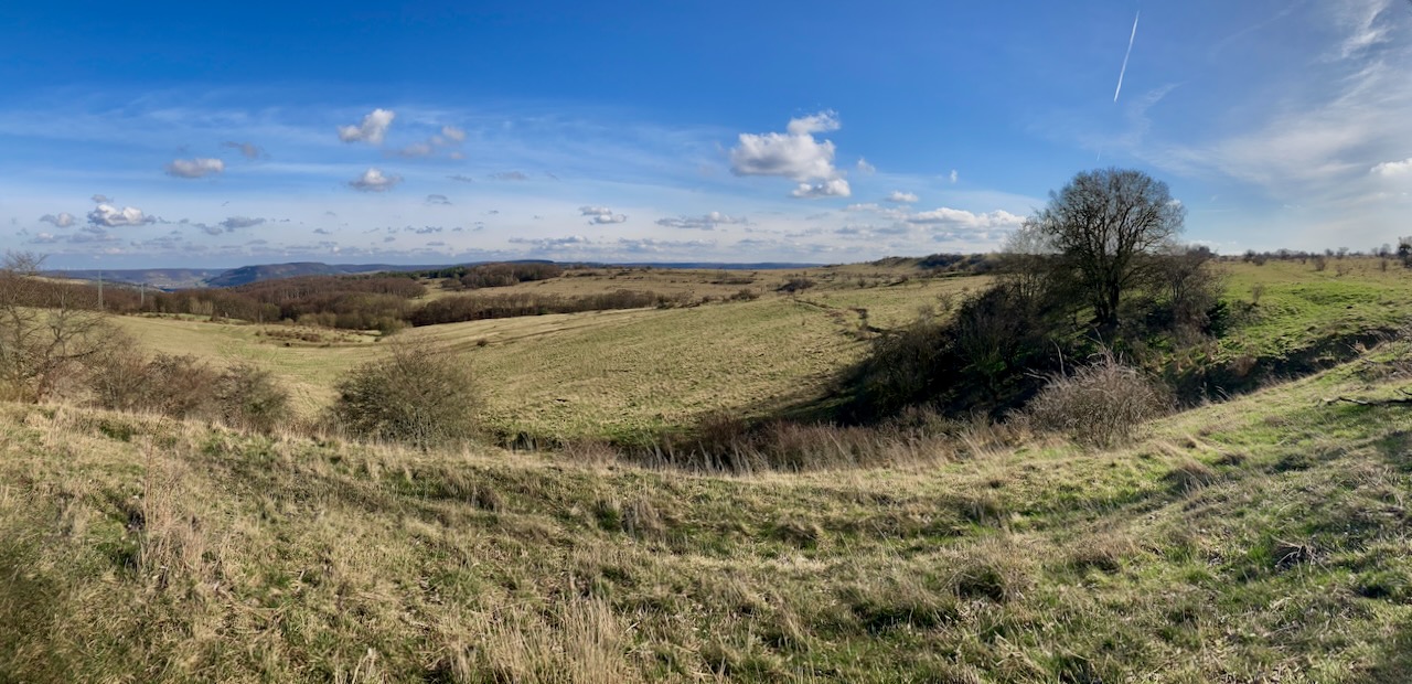
. . . and I love the moments where the sun shines through and leaves patterned shadows. My very old phone doesn’t take the smoothest panoramas, but the clouds really were storybook clouds and the grass really was turning green again.
Stage 7: Zwätzen to Papiermühle (9.3km) – Early March
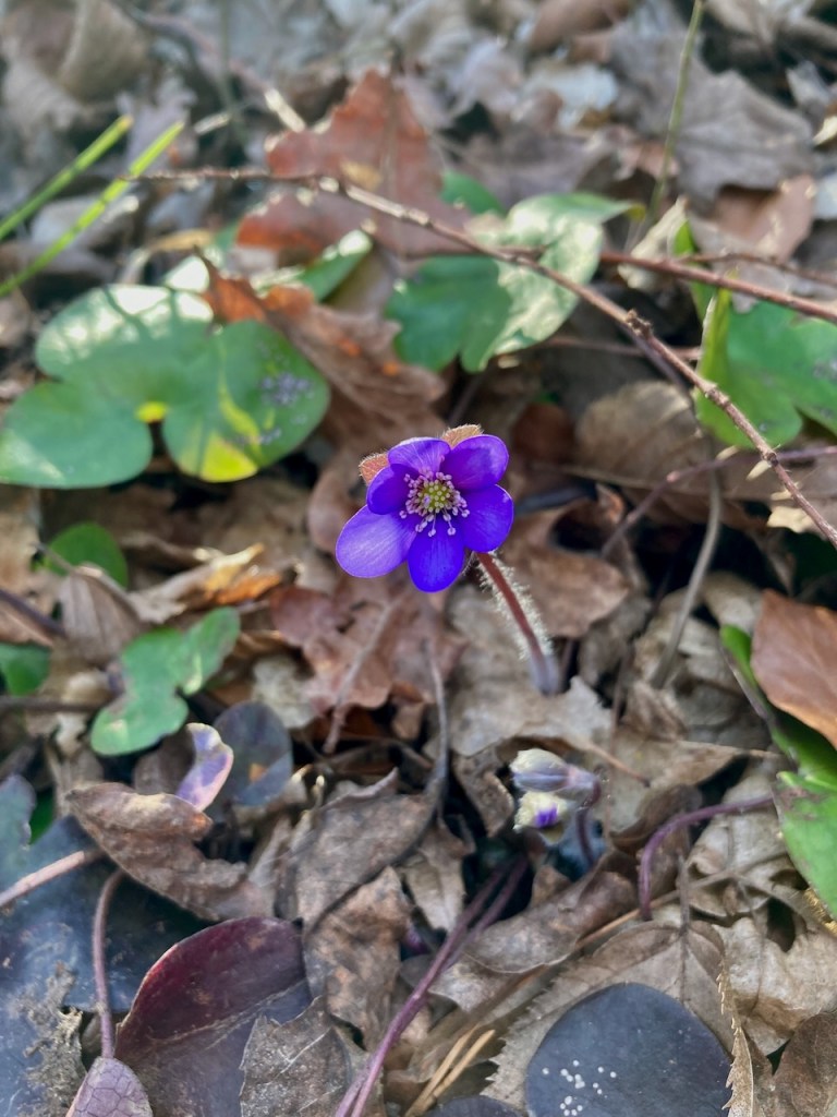
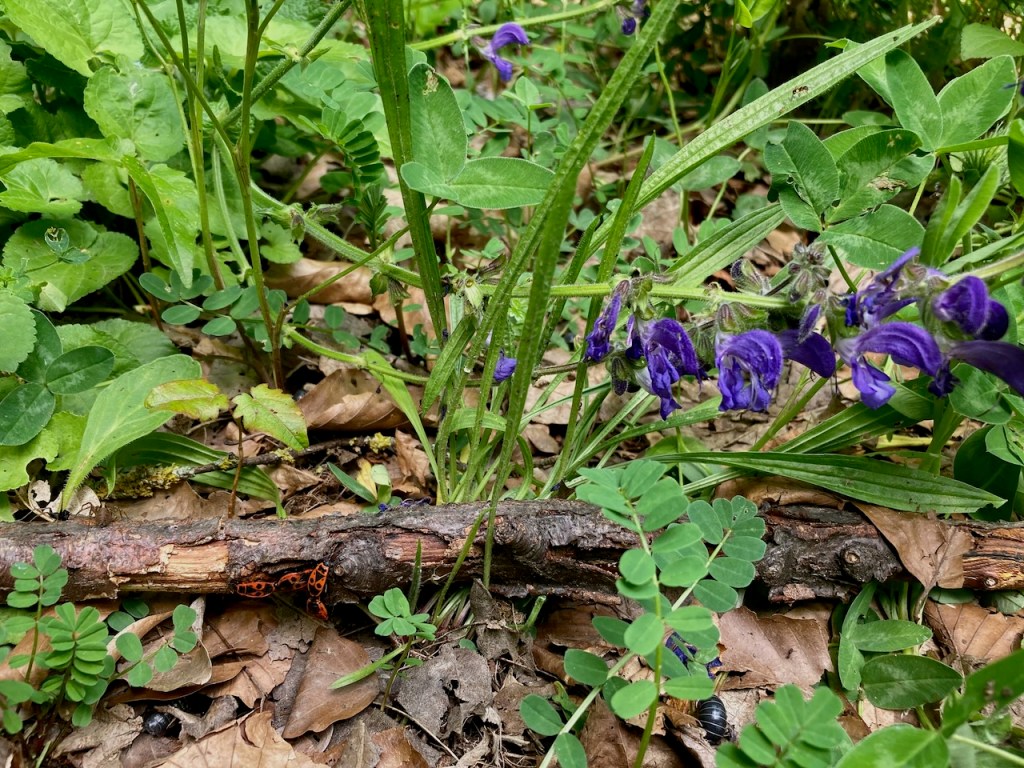
Shortly thereafter, in order to once again enjoy the tenderest flowers, my partner and a friend, both of whom had been along the previous weekend, went with me for another walk in the woods.
Rather than down jackets this time, we stripped off layers and headed up hills into the sunshine.
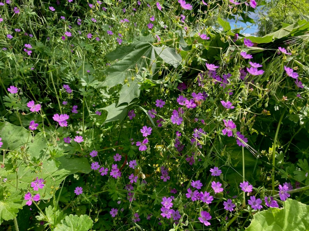
The first signs of spring, which grow with abandon and without scruple, had settled into a thick carpet on the forest floor.
Today’s stage took us over a plateau where it’s not hard to imagine Napoleon’s army standing in 1806. There’s also a monument that we’d visited before, as well as a museum in a nearby village dedicated to the area’s battle. Every so often in this area, one comes across markers designating that Napoleon and his army had been there.
Clearly, the battles of Napoleon were not the only confrontations that had taken place there.
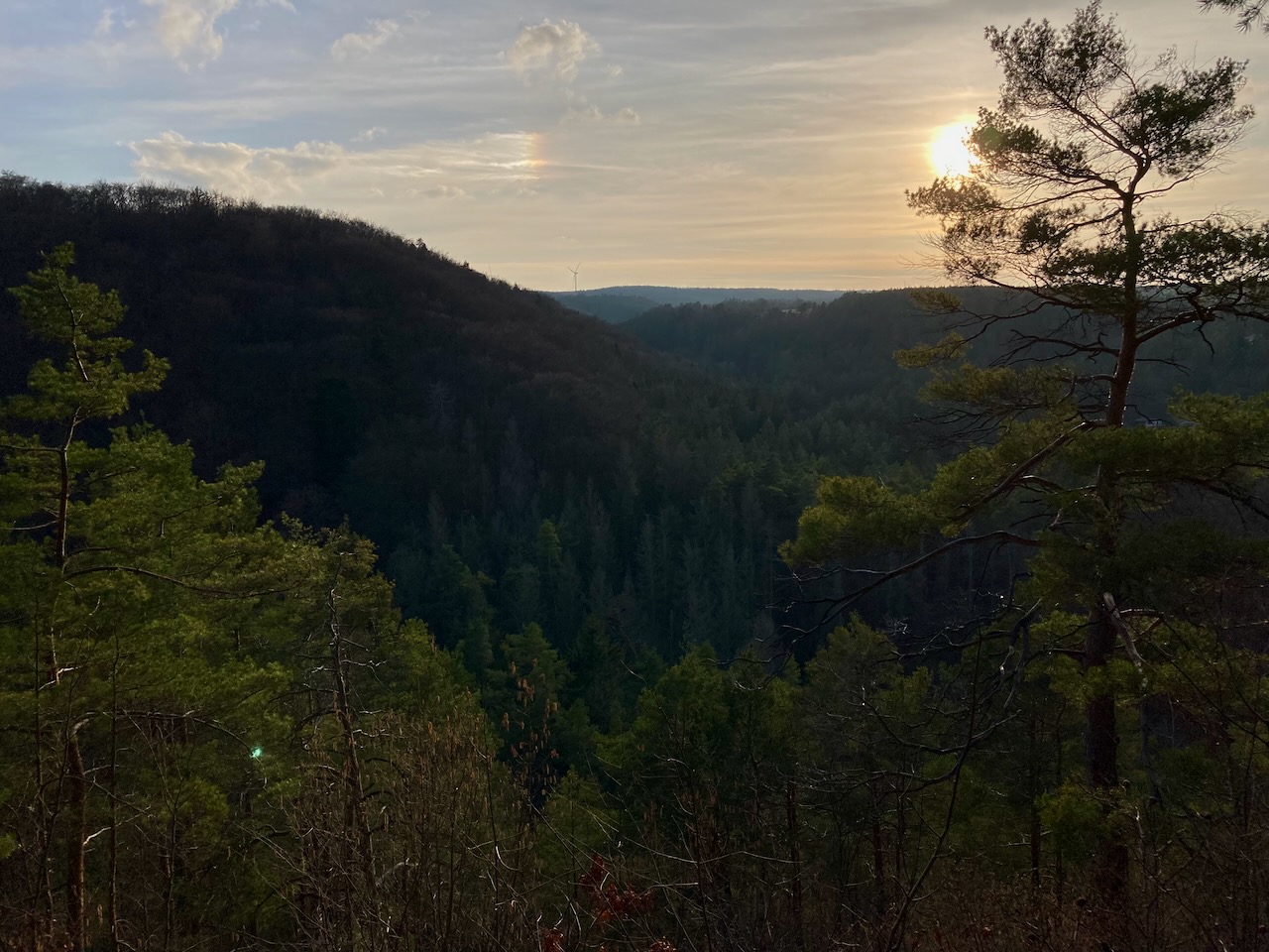
We watched the sun beginning to set as we made our way to the end of the trail and back to the train station.
Stage 8: Papiermühle to Ammerbach (10.9km) – Late May
More than two months passed before I made it to the SaaleHorizontale again, this time accompanied by yet another friend. The day was hot and humid, the leaves lush and green, and the air had the smell of the coming summer. It was the kind of warm day that quickly cools off when the sun goes down, which is how you know it’s very much still spring.
We passed a number of sights of interest along the way including Bismarckturm, celebrating the great general and unifier himself . . .
. . . a marker denoting the different layers in the earth and the sadly unclimbable rock . . .
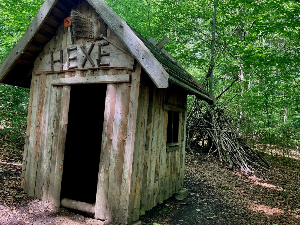
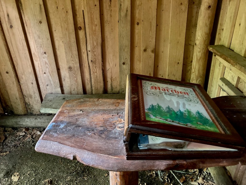
. . . and a section that was part of a children’s discovery trail of fairytales and witch houses.
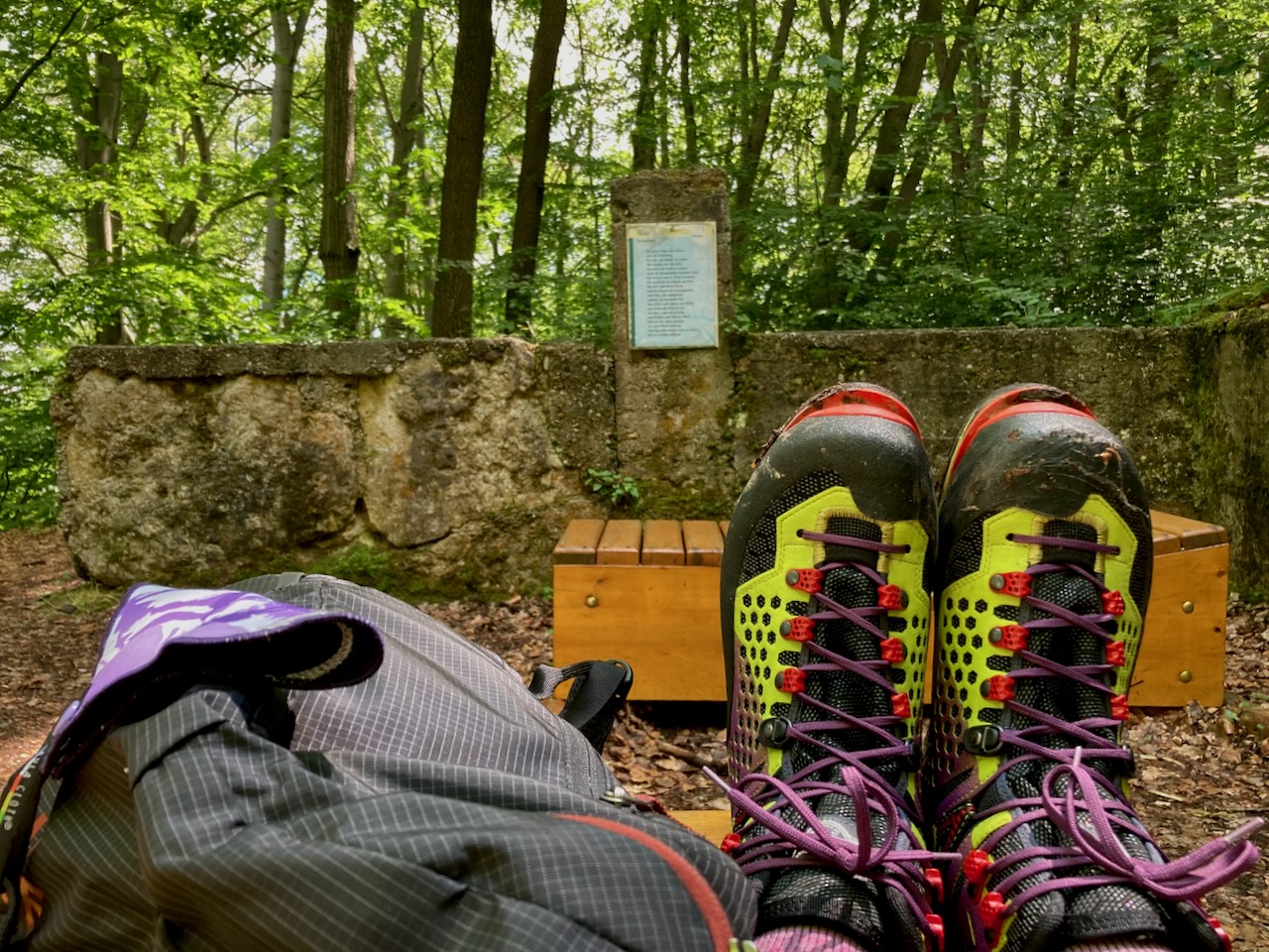
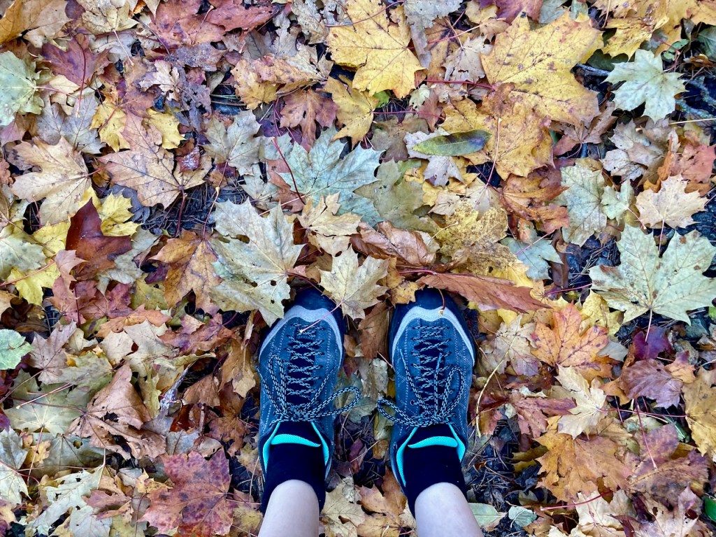
As I had for months by this point, I was using every hiking opportunity to break in my increasingly-less-new mountaineering boots in preparation for our Alps tour over the summer. They are far too intense for a casual walk in the woods, but they have seen many kilometers of this trail.
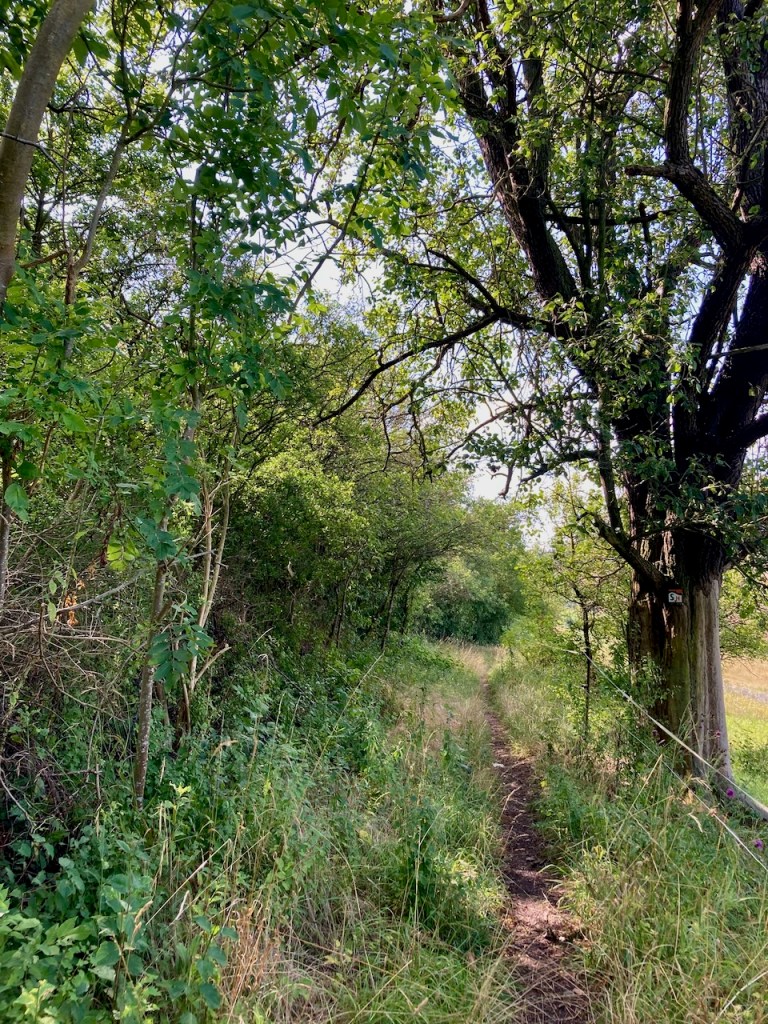
Stage 5: Porstendorf to Dorndorf (18.2km) – Late July
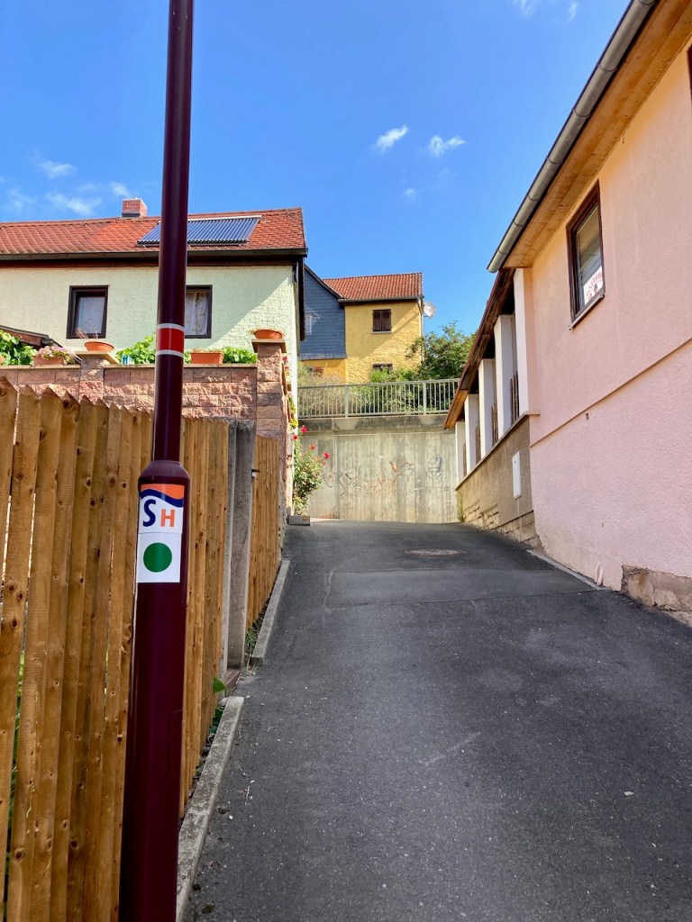
My next stage on the SaaleHorizontaale was the longest, but it was a comfortable way to spend the day in comparison to the outdoor adventure that was climbing the Zugspitze, which my partner and I had done just a week earlier. While I very much appreciate that all stages are organized with accessibility to public transportation, I did not love the approach along a road for this one . . .
. . . and was very happy to see the trail markers that pointed, as the SaaleHorizontale often does, along a small alley through a village.
I walked past farmers’ fields . . .
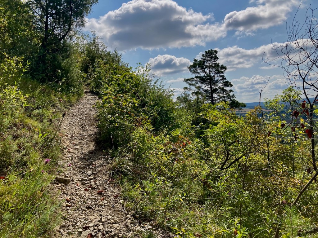
. . . and then remained largely on narrow paths . . .
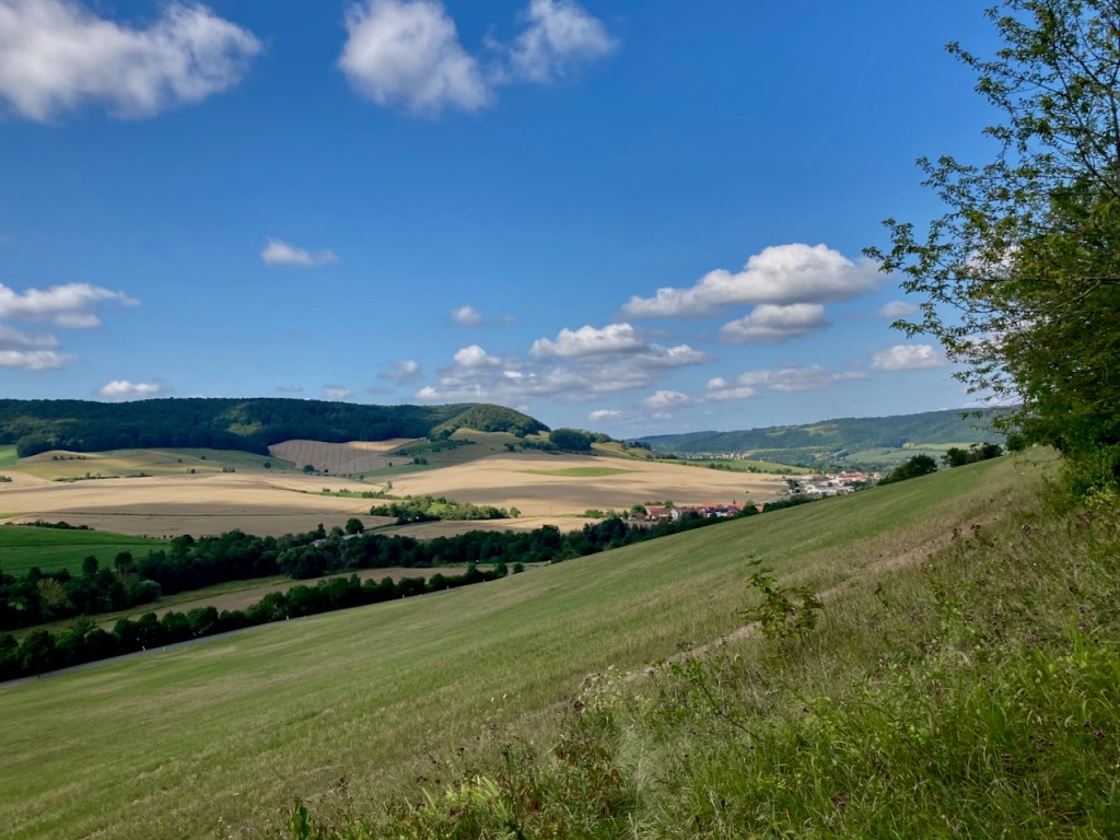
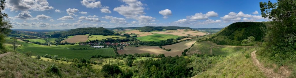
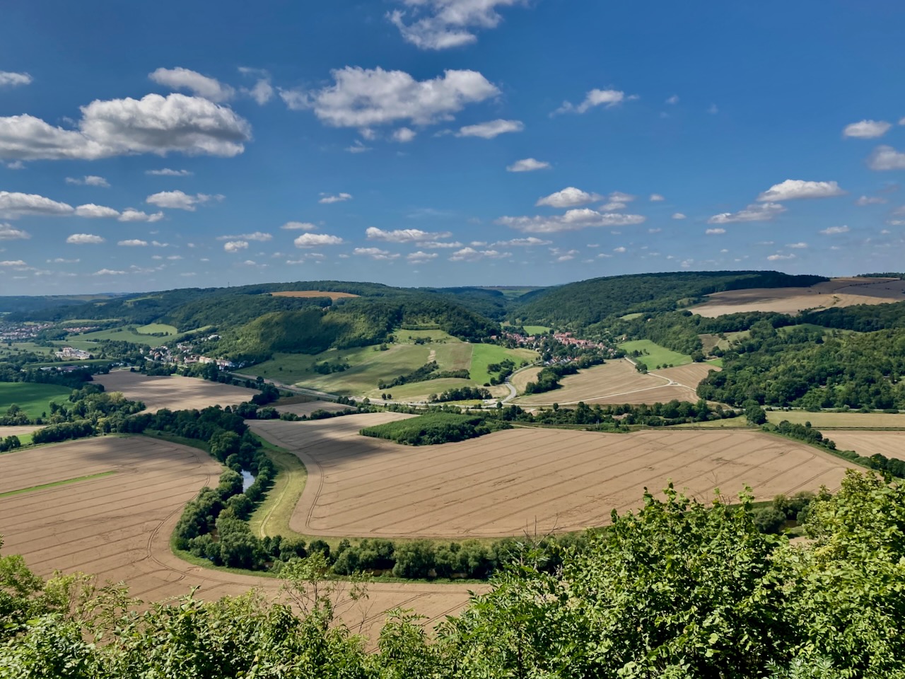
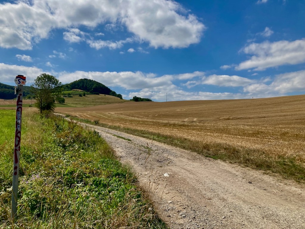
. . . steadily working my way upwards towards a view of rolling hills and harvested and harvest-awaiting fields interspersed with forests. This is so typical of the landscape here and I love it anew every time.
It was a hot day and I was glad to make it into the cover of the forest.
The butterflies were busy enough that I could inch closer, and I wondered at the old road in what was now woods.
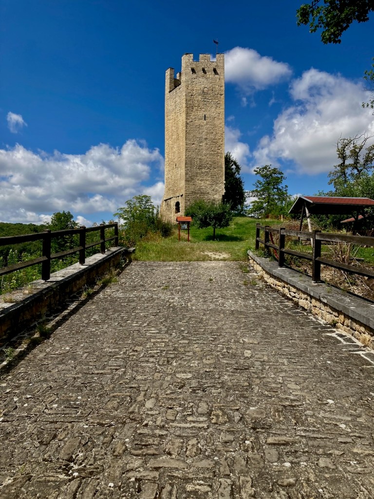
I passed a village with the remains of a castle . . .
. . . took a break at one of the many picnic tables that one finds on hiking trails around here . . .
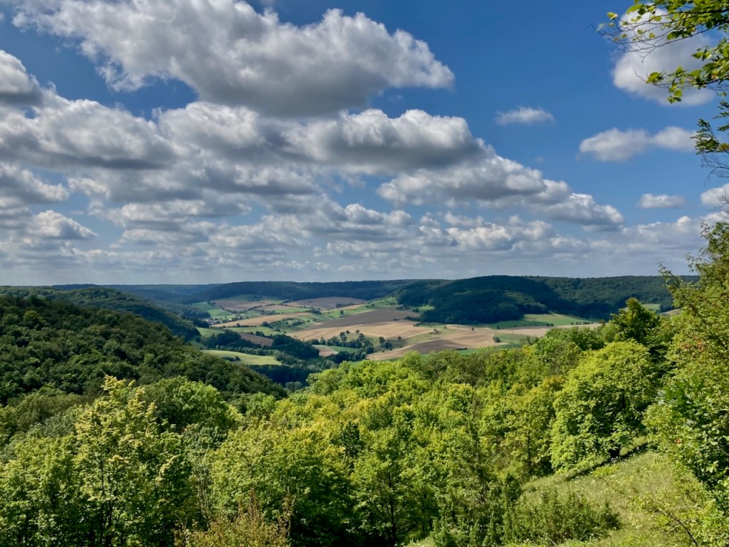
. . . and once again took in the view from above.
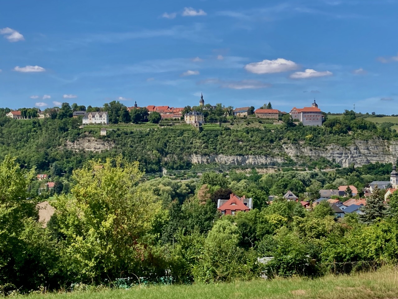
I crossed a small lookout point named for a duchess and princess who had lived in the area . . .
. . . and found myself looking up at the palace where my friends and I had started for stage 6.
Rather than dip my tired feet in the springs that seem to be there just for this reason, I practically ran to the train station. The following train would be in an hour and I was too hungry to wait.
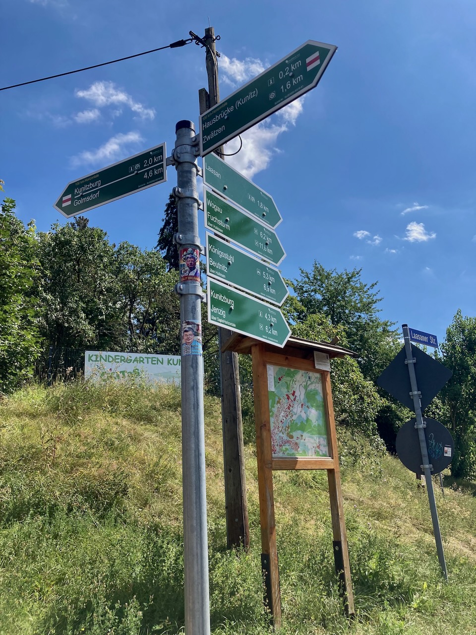
Stage 4: Kunitz Loop (9.7km) – Mid-August
There is only one stage on the SaaleHorizontale that starts and ends from the same point, and the majority of this stage is the approach. As a result, my partner and I relied on other trail markers to get us where we wanted to go.
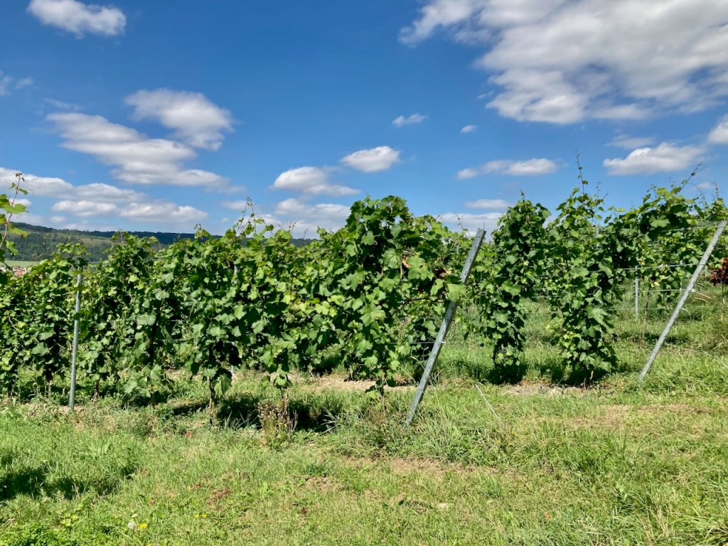
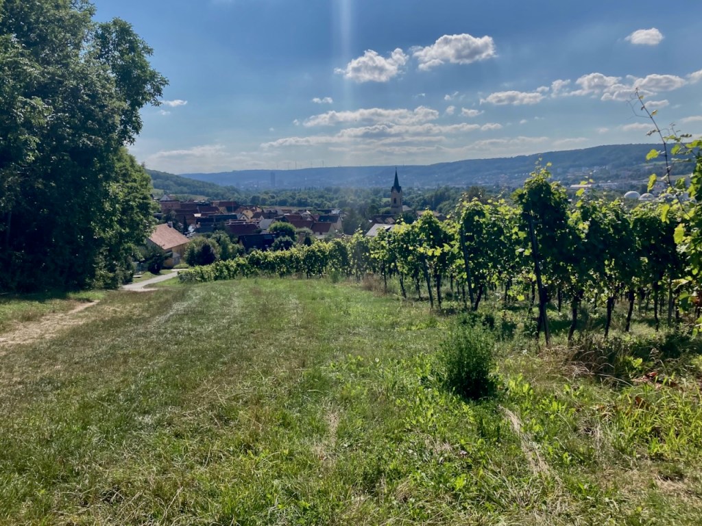
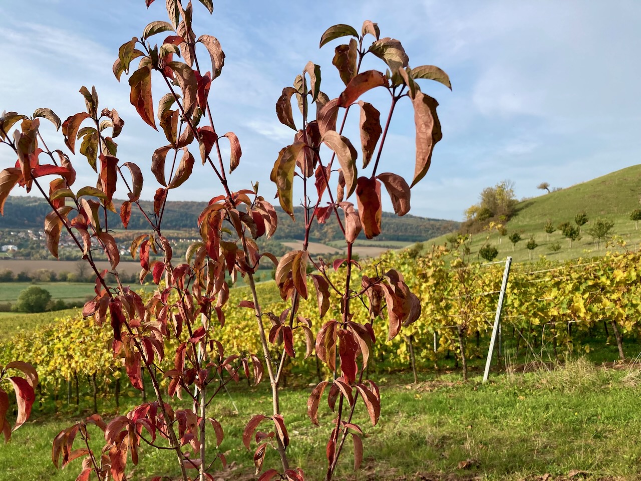
We passed vineyards along the way and I can attest that the wine grown on the hillsides of this region is lovely.
We were glad for the portions of this stage that led us through the forest because the mid-day August sun was hot indeed.
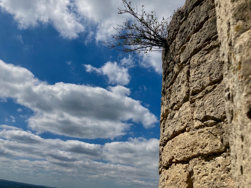
We lingered for a few moments in the cool of castle ruins and asked ourselves what the valley had looked like back when there was a castle here.
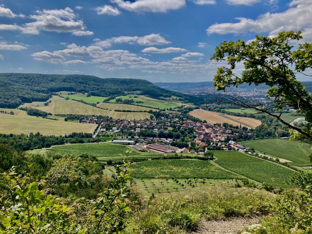
The fields were in varying stages of harvest time and the air smelled like hay.
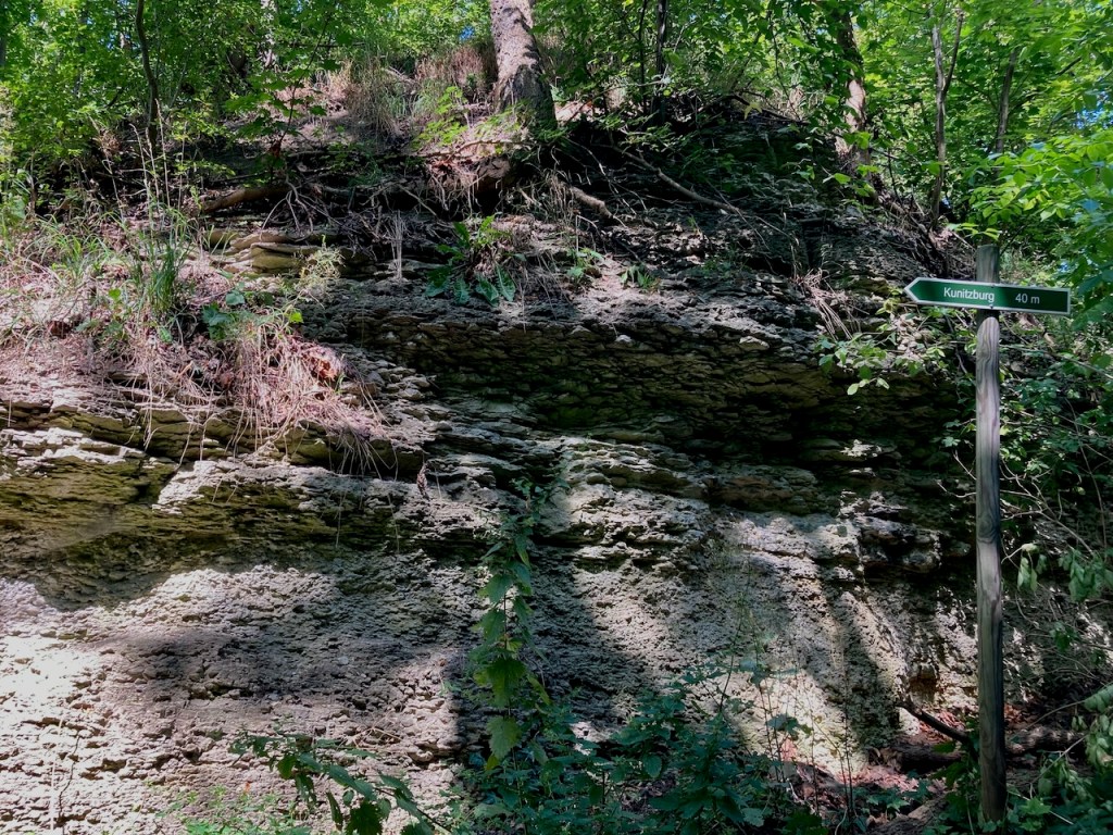
We walked for a couple hours before reaching the sign for our stage of the SaaleHorizontale . . .
. . . and the rest of the walk left us with the feeling of this stage being somewhat forgotten, its purpose to connect two other stages rather than having an identity of its own. There’s a run each year that follows the entirety of the SaaleHorizontale, which would therefore skip the approach and descent to public transportation locations; perhaps this stage makes more sense when done like that, but I am not about to find out.
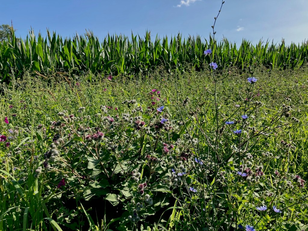
Stage 9: Ammerbach to Göschwitz (12.3km) – Mid-September
The calendar had just flipped over to fall the next time my partner and I took a walk along the SaaleHorizontale, but a fall feeling had been in the air for somewhat longer. The light had changed, and this is always a sign.
The beginning and end of the trail was located in the woods, woods with which we had become familiar in the months walking the hills around Jena.
Hay bales were drying in the fields and grass had regrown. These are signs of fall, of summer having just gone.
But only just, as the corn was still waiting. Where I grew up, corn is grown to be eaten, and a great joy of my childhood was being sent outside to shuck the yellow ears. My middle sibling and I played “old fashioned times”, corn opening the portal to another world. The corn that grows in this area is meant as animal feed or to be processed into fuel, but the sound of dry stalks as the wind rushes is one I know and it takes me back.
We ended this stage in the woods again, and I liked the feeling of coming full circle over the course of the afternoon.
Stage 2: Kupferplatte to Wogau (13.6km) – Early October
The last stage that I completed alone was probably my favourite, and this despite nearly four hours of steady rain. A good jacket and study shoes go a very long way.
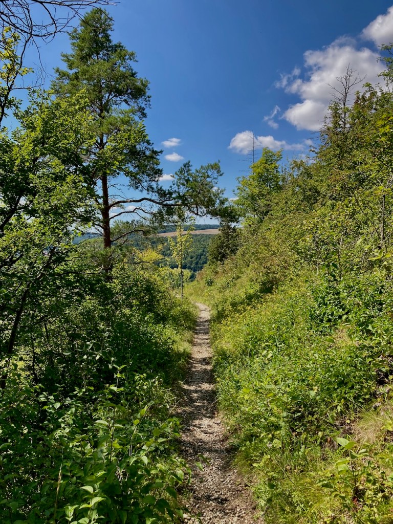
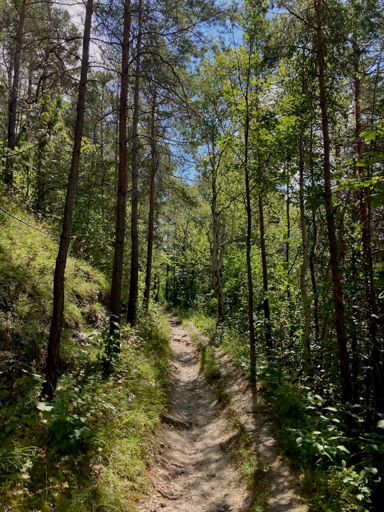
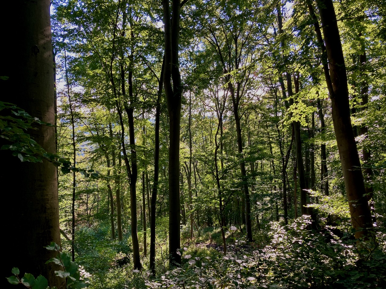
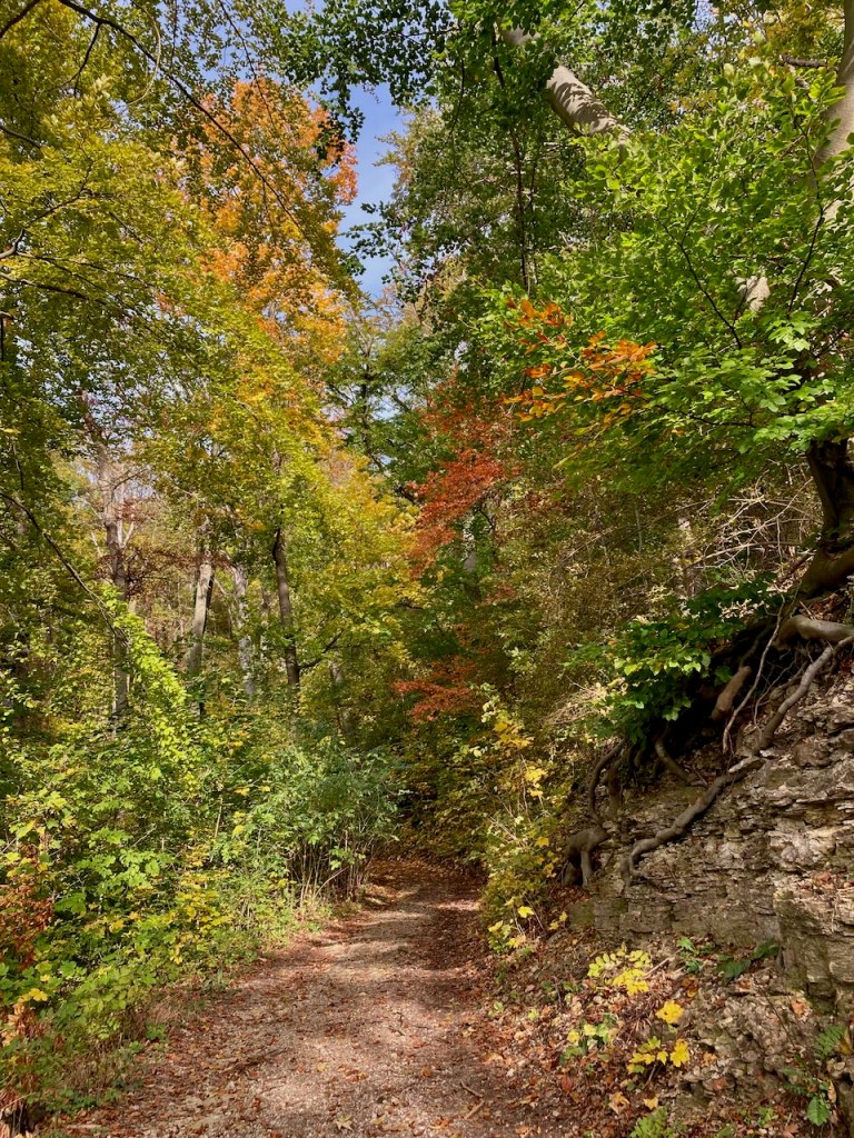
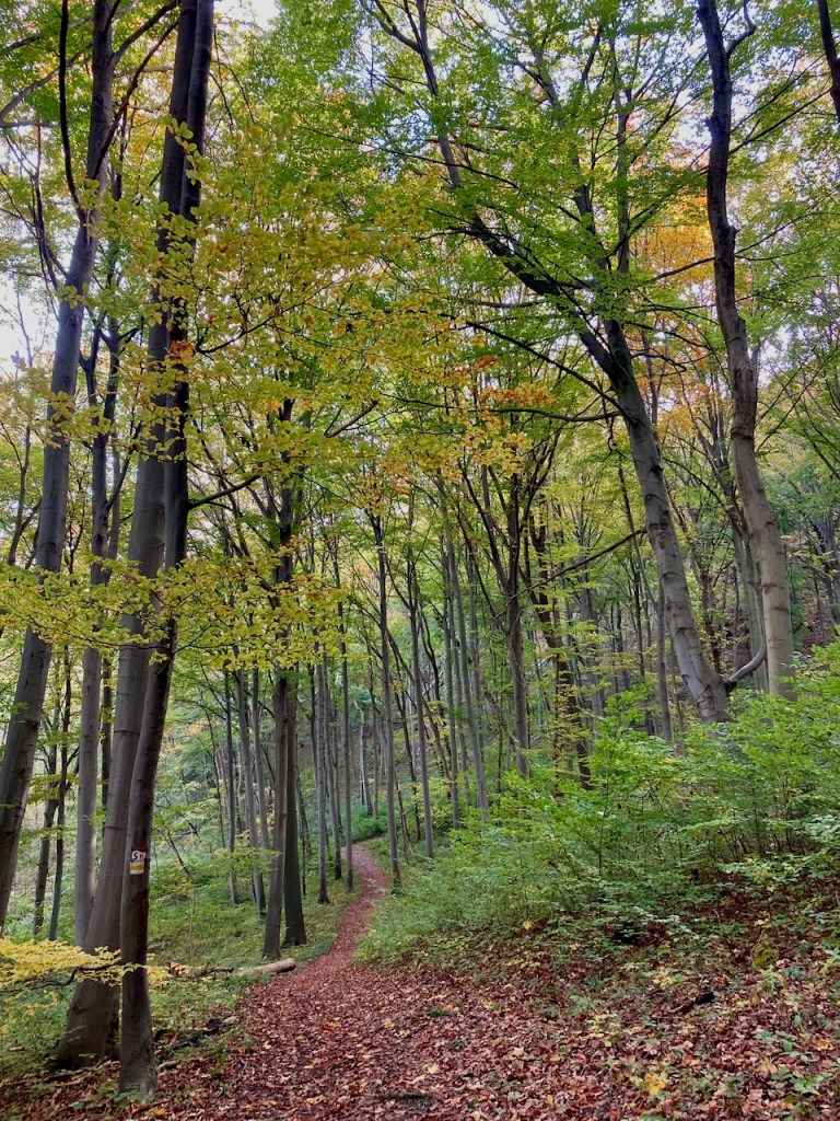
The approach to this stage went immediately through forest, blue skies above, and I was reminded of the descent from the first stage along the same path back in January, the first time I had experienced rain on the trail.
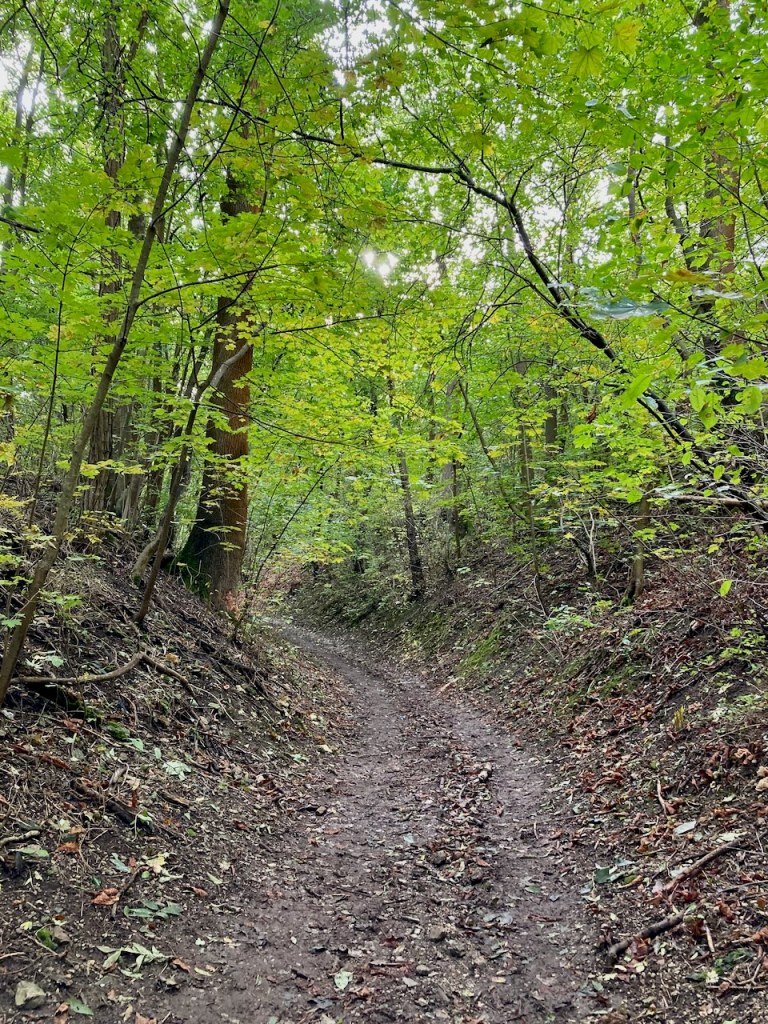
It didn’t take long to reach the first set of trail markers, by which time the steepest part of the route was already behind me.
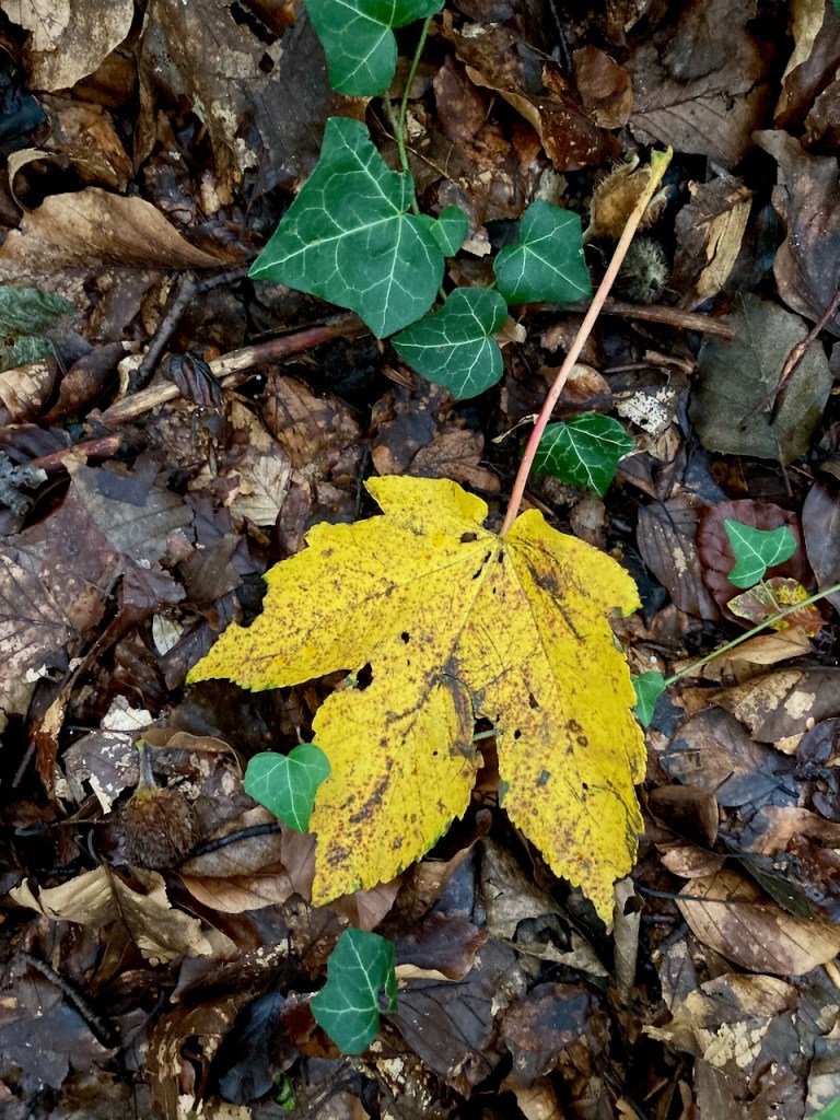
The leaves in the forest were slowly starting to change colour and the clouds began to roll in.
Good views were the reward for much of this stage . . .
. . . and even the increasingly muddy crossings over fields failed to bother me.
I walked by an old cemetery . . .
. . . a monument to someone I’d never heard of but who is important to the history of Jena (according to brief research while writing this post) . . .
. . . and a tree with a stunning root system that clearly ignored the expectation that it remain in the ground.
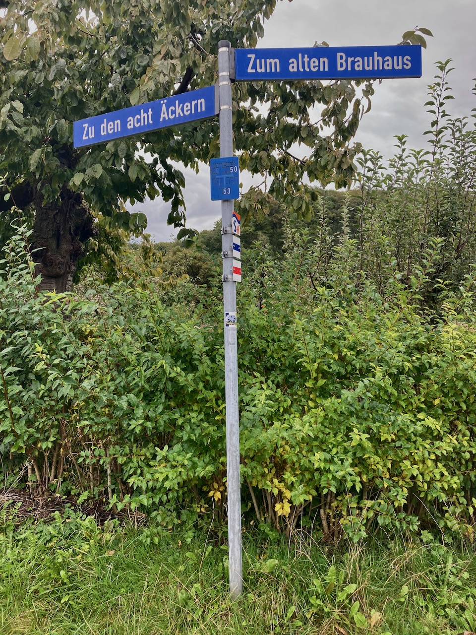
I crossed through a village in which the street signs nodded to times past . . .
Left to the eight acres and right to the old brewery
. . . and then came upon a field at the edge of the forest populated with hungry cows and their curious calves.
The stage concluded as I skirted the edge of the field and though I had thoroughly enjoyed it, I really was looking forward to getting out of the rain.
Stage 3: Wogau to Kunitz (12.6km) – Mid-October
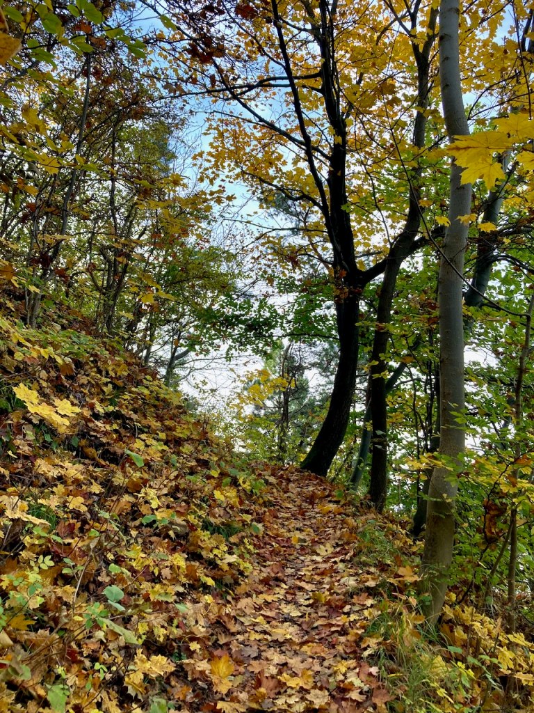
When I finished the previous stage, fall was slowly beginning. Mere weeks later, it had arrived. My partner and I took the blue skies as a sign and headed out to have a look.
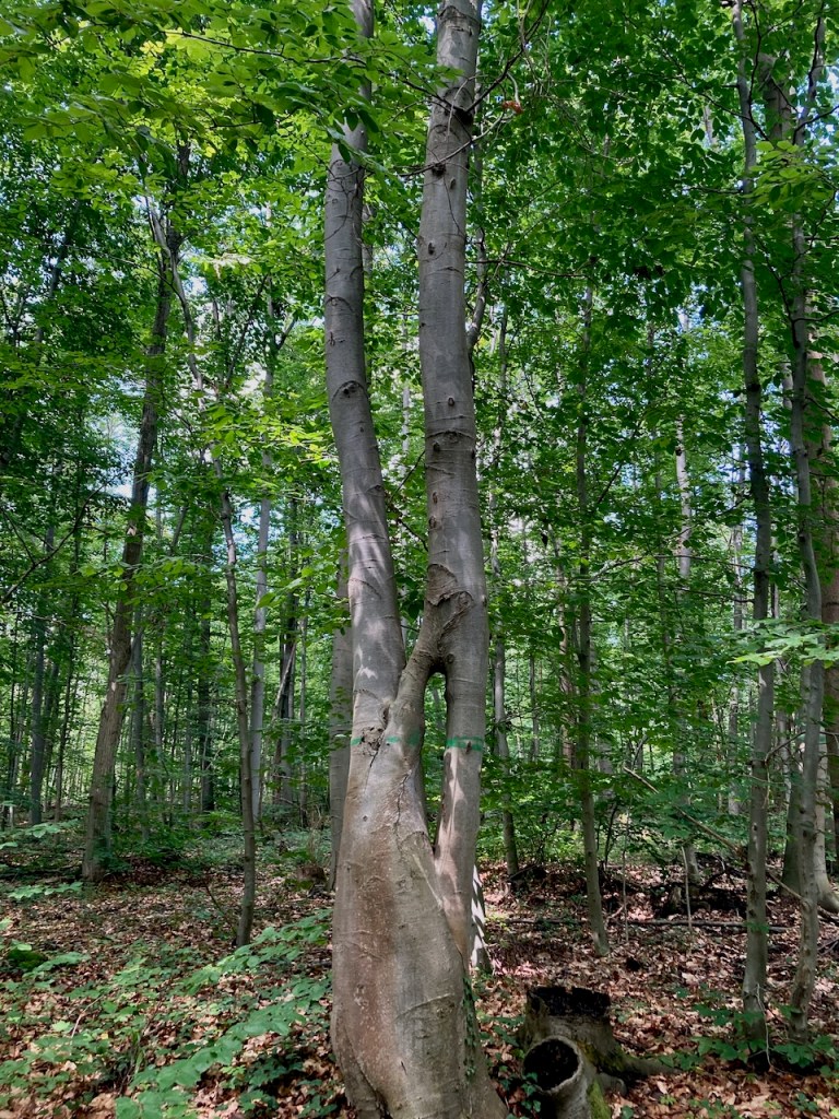
The stage took us through several woods, each with slightly different trees in slightly different stages of changing colour. The air felt fresh in each, the soil smelled different, and the atmosphere of each forest was clearly its own.
We walked on the edges of the hills and looked down at Jena.
Enticed by the sun, we lay back on conveniently located sun loungers to soak up as much vitamin D as we could. November is a dark, dreary month here.
We passed a sign that had clearly been here a while . . .
. . . and paused for lunch at a bench overlooking a tiny village, a little oasis just a stone’s throw from the city.
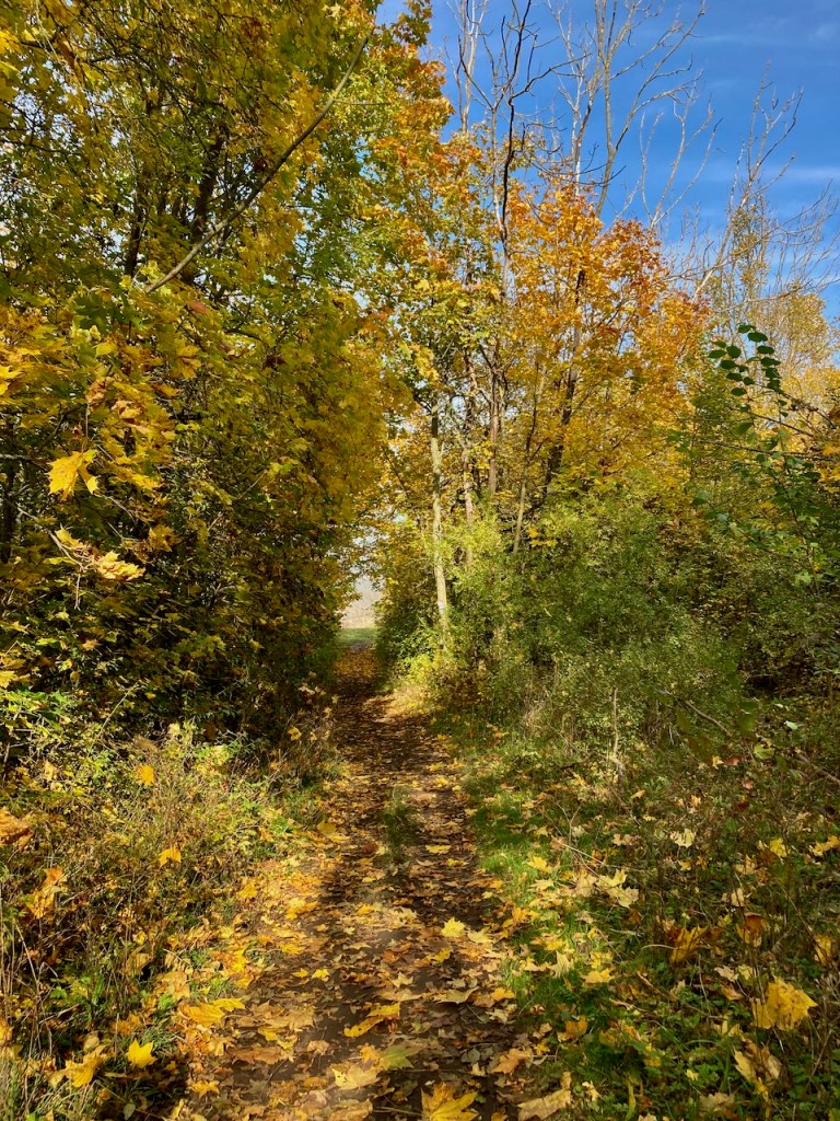
We crossed a field . . .
. . . leading us along a path back to an old ruin we’d been to before. The landscape in October was slightly different than that of July.
Finally, we passed the vineyards that I’d seen several times now, all at different growing stages.
We walked down the hill, followed the dotted line on our map to the end of the trail, and I grinned. Last stage done with a person I love on a sunny October afternoon.
And with that, I completed the entirety of the SaaleHorizontale. The moment of finishing was one of gratitude for the time spent walking in nature and for the people who had joined me. The world is a beautiful place, and even more so when it can be shared with others.
Walking allows us to be in our bodies and in the world without being made busy by them. It leaves us free to think without being wholly lost in our thoughts. – Rebecca Solnit, Wanderlust
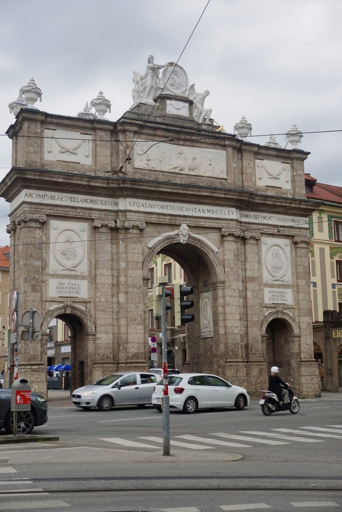
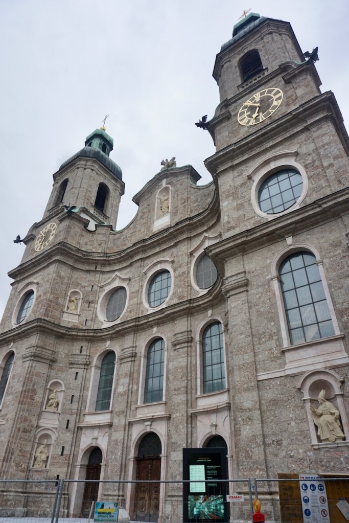
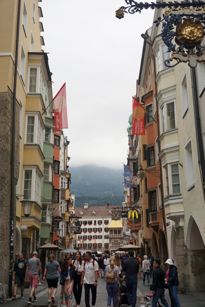
Memories of our first alpine tour still fresh in our minds, my partner and I left Slovenia just as cooler air was moving in. We arrived in Innsbruck glad that we had jeans and raincoats, and spent a couple hours browsing the plethora of sporting goods stores and walking through the beautiful old town. With mountains visible from everywhere, painted buildings, and a vibe of loving adventure, Innsbruck is the type of place I could easily imagine living . . . or at least visiting again.
We spent the night a little ways outside of town to facilitate our drive the following morning. Past Garmisch-Partenkirchen, not far from the German border, we were surprised to hear a radio show host speaking English and realized we were not far from a US military base.
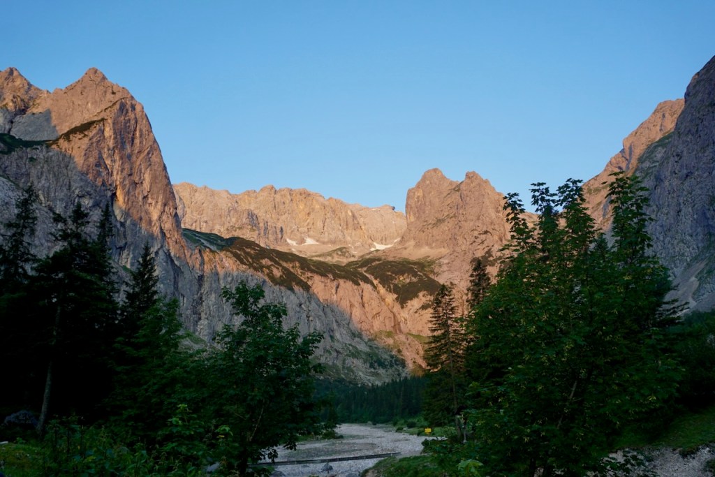
We parked and looked up at our destination: Zugspitze, Germany’s tallest mountain. From where we were standing, it was only slightly visible, hidden behind mountains that seemed much more imposing, much more daunting. Knowing that they weren’t, knowing what awaited us on the route ahead, filled me with a sense of wonder. We were actually here. And we were ready. Our backpacks included easily-accessible energy bars, our essentials for a night in the hut (toiletries, sleeping bag liner, towel, change of clothes, extra layers that turned out to be unnecessary), and the necessary gear: climbing harness, carabiners, slings, helmet, via ferrata set (Klettersteig in German, details to follow), rope, ice axe, crampons, trekking poles. Showtime.
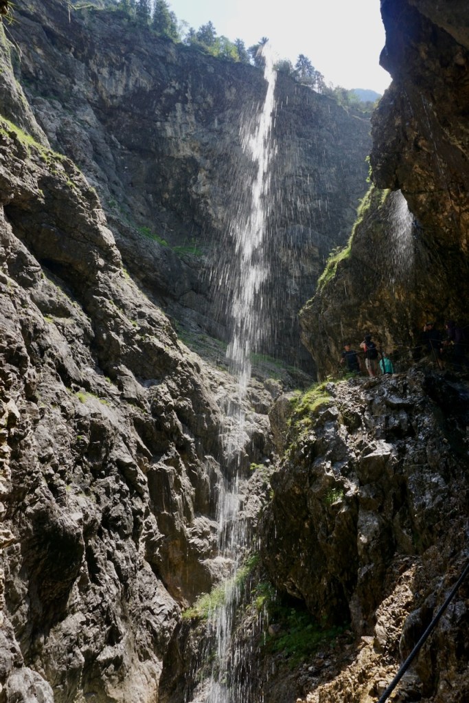
But first we had an easy day to warm up. We followed the trail markers along the river to the Höllentalklamm, the gorge that we’d pass through on our way to Höllentalangerhütte, the alpine hut where we’d spend the night.
The gorge itself was dark and cool, the spraying water a much-needed relief from the heat. We walked carefully along narrow, slippery bridges and stones through the canyon, carved deep into the earth. The ancients were right to honour water as one of the four elements.
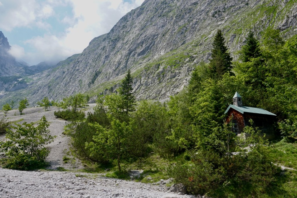
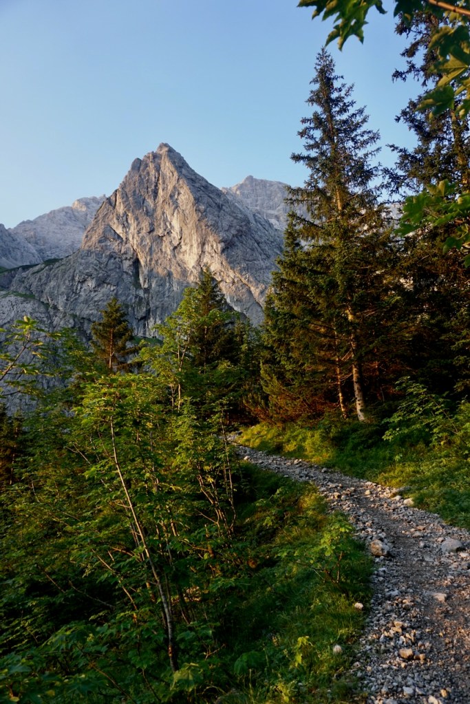
Subsequently, the path grew steeper, rockier. The mountains grew larger as we approached, and the trees began to recede. We had ascended 700 meters and could see the end of the tree line past the point where we would end our walk for the day. The air around us glimmered and my senses tingled.
We reached Höllentalangerhütte in high spirits with the sort of jitteriness that comes at the end of a long wait. It brought to mind the last day of school, or one’s birthday, or a favourite holiday. One more sleep.
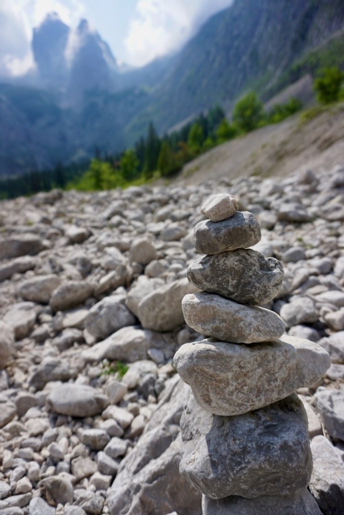
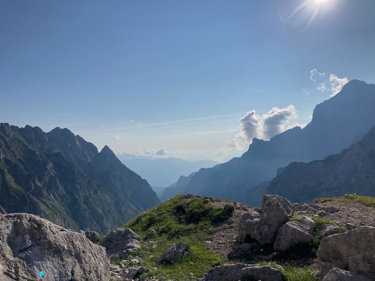
After a shower and a snack, we meandered across fields of stone away from the hut and took a good look at what we could see of our path for the next day.
The way markers designated six hours. In the end, the climb took us exactly six hours.
We began promptly at 6am, joining most of those who had shared our 35-bed dorm room for breakfast at 5:30. The mountains glowed that morning in welcome. To be in such a place, and to be able to take on the task we were taking on, is an incredible privilege. We couldn’t stop smiling.
The Zugspitze is steep, just over five kilometers with an elevation gain of 1,390 meters. This was easily the most demanding mental and physical experience I’ve had in the mountains. The physical challenge, the ceaseless gaining in elevation along difficult terrain, tired the body and that tired the mind. A tired mind is then an unfocused mind, and that can be dangerous. The mental challenge then, is remaining alert and aware, moving simultaneously with confidence and caution.
In addition to the steepness of the terrain, the Zugspitze is also a technical climb with multiple sections of via ferrata, or Klettersteig. This is a sort of aided climbing using fixed cables that allows access to sides of mountains that would be too risky to attempt otherwise. That being said, you don’t want to fall because a via ferrata set is basically one-time use. The set is comprised of two large carabiners attached to lanyards, which are attached to a longer lanyard snugly packed inside a little bag that will only extend if you fall (and then you can’t stuff the lanyard back into its bag in alignment with safety ratings, so that’s that). The entire set is attached to your climbing harness. A helmet is required and I find durable, fingerless gloves designed for the thick cables to be essential. We also use an additional safety sling because again, you don’t want to fall. There were two sections of Klettersteig on the Zugspitze, both relatively easy grades but hard enough once we got into altitude. The first one made for a nice warm-up for what was to come.
The sections of the route that were not part of the Klettersteig were rock scrambles, generally easyclimbing that requires all four limbs. Mountaineering is serious work, but there was so much play alongside the intensity.
As we climbed higher however, I was breathing too quickly. My pulse was racing and head spinning from the altitude. We continued moving as my partner demonstrated breathing slowly and deeply to bring everything down. And then I carefully counted breaths, letting my body acclimate. In just a few moments, my head cleared and my pulse returned to normal. It is easier to keep going, slowly, under such circumstances than stopping for a rest; the body needs to adjust, not to stop, and the breath controls the body. To reset mentally, it was enough to look around. The strength that comes from being wrapped in nature, the edges of the mountain growing more jagged as we crossed them, left me with feet planted firmly on the ground and a strengthened resolve.
What I found unique about this climb is that it never let up and, therefore, neither did we. It was continuously hard, continuously driving me to the edge of what I thought I could do. I kept moving long after I would have liked to have stopped and long after it hurt. I knew I had blisters forming on the backs of my heels, but I also had carabiners in both hands to clip onto cables, rocks to scramble over, and a sheer drop visible to my left that kept my feet moving with precision. The nearly instantaneous benefits of energy bars have never been more apparent.
We had made very good time when we reached the glacier, a very special aspect of climbing the Zugspitze. Excited to get into snow, we unpacked our crampons and rope, which we had prepared in advance with figure-eight knots for us to clip into and butterfly knots as stopper knots for the unlikely event that one of us fell into a crevasse. As we had practiced, we wrapped the ends of the rope around our bodies, securing them with one more knot. My partner readied his ice axe and I adjusted one trekking pole. Our free hands would be used to guide the rope as we walked.
Photo by TM
Due to the potential consequences of falling, a glacier crossing should not be done alone, but rather in pairs or groups, everyone attached to a rope. It is the leader’s job to make the way, to form the tracks. It is the leader’s job, when necessary, to use the ice axe to arrest a fall. The follower’s job is to manoeuvre the rope and to keep the right amount of slack between the leader and follower. Knowing the terrain where we were, an ice axe for the follower was unnecessary, but there are bigger, more dangerous glaciers where this would not have been the case. A trekking pole with a snow plate was sufficient for stability and support. Crossing the glacier as a team with my partner, our safety quite literally tied together, sent jitters up my spine as we got ready. And then, with the first steps, the romantic moment vanished into one of sheer focus.
A combination of steepness and rope management made the glacier tiring work. We followed tracks that had been made throughout the season, lamenting that the snow was rather mushy, a sign that it was much warmer for this time of year than it should have been. As grateful as we were to have the way tamped down, the steepness remained a challenge. Our toes did most of the work, the spikes cutting sharply into the snow and holding fast.
Arriving at the end of the glacier and getting ready to clip back into the Klettersteig, we shed our jackets immediately. It is absolutely no joke that glaciers are the way to see climate change in action. We looked down at the edge of the glacier and stepped quickly and carefully, not wanting to linger. And then we looked up at the way ahead, following the cables with our eyes until we could no longer see them, the summit hidden but closer than it had been.
Photo by TM
The second Klettersteig took us the remaining two and a half hours of the climb. When we looked down, we could see the zig-zag tracks that we had followed across the glacier, essential in steep terrain. Although it hadn’t felt that way, the glacier looked vast. Focused on whatever needed my attention in any given moment, we had climbed a lot farther than I had realized.
It was easy to lose track of time not just because of how hard we were working, but also because of how much fun the climb was. And it really was, which struck me over and over. I knew that I was pushing all of my body’s limits and that I was absolutely in the range of what I could do even if I hadn’t done it before. I knew I had a range of aches and pains and bruises, but I had ceased to feel them. I knew I was tired and thirsty and hungry, that I hadn’t eaten enough at our second snack break, that everything should have been uncomfortable, but somehow it wasn’t. There was laughter ready to bubble up at any moment, a smile every time my partner and I called to each other, an electricity throughout my body that propelled me along. For six hours, there was nothing but us and the Zugspitze.
Photo by TM
More than once, we thought we were just around the corner from the summit. More than once, we thought we were right there only to lose sight of it again. The clouds began to roll in behind us and my partner, whose photos are below, paused above me to watch. Suddenly, the world we had come from disappeared and there was only the world of the rock under our hands and the mountain who allowed us to hold on. My heart hammered in my chest in both exertion and a profound swelling of gratitude and respect for what we were doing.
About 40 minutes later, the Klettersteig cables disappeared. We climbed the last few meters unassisted, the exhaustion of the previous hours vanishing in the waves of excitement that began to build, and we were there.
At 2,962 meters, we had summited Germany’s tallest mountain in exactly six hours, mind and body fully engaged the whole time, laughing throughout in exuberance as reality hit us. The Zugspitze is not only Germany’s tallest mountain but also one of its hardest mountaineering tours, and we had done it. Together.
We ate and drank, gratefully took the train back to where we’d parked the car, ate and drank again, and then drove the five hours home, stopping for yet more food. Words failing us and hearts full of the day, we talked mostly about other things or not at all. Periodically, one of us would utter something like “Wow” prompting a response akin to “Yeah” from the other one. Slowly, we were able to talk about the experience, our different thoughts and feelings along the way, the areas where we’d each encountered challenges, or how much fun a certain section had been. Gradually, as we told others about the Hochtour and shared our photos, it became real that we’d stood at Germany’s highest point and that we’d made the way there together.
There were, however, serious conversations before planning this trip about whether we wanted to attempt it, whether my fledgling mountaineering skills were up to the task. There were moments before committing where we were uncertain about whether this was the right thing to do together. Mountaineering is a risky sport and the consequences are unthinkable, which is precisely the reason they must be thought about. And discussed. Openly and honestly, which can be stressful.
Once we decided to do it, the preparation took weeks. My partner took responsibility for learning the route and briefing me on it while I practiced different techniques of walking in new boots and read up on crossing glaciers and how to respond in a sudden thunderstorm. We watched videos and practiced knots together, made packing lists, prepared backpacks, went for a local hike completely kitted out, made adjustments. We talked about weather and feeling comfortable and knowing what it meant to decide to turn back. We did not take this climb lightly and I do not want to make light of what it took to get there.
As a result, there was no point on the Zugspitze where we were in any doubt about what we were doing, but also no point at which we took the mountain and our being there for granted. Nature allows you to be where you are, or it doesn’t. Nature welcomes your presence, or it doesn’t. Nature speaks and we have to listen, to respect. We are guests in nature.
And it was an honour to be there.
Photos, travels, musings, and ideas on education by someone trying to make the world a better and more peaceful place