Category Archives: Travel Guide

Travel Guide: Marrakech

Both my partner and I have long dreamed of going to Marrakech, and this seemed to be a good point in our lives to make that happen. After consulting with friends who had lived in Tangier, we had a sense that this would not be our only visit to Morocco, and this feeling only intensified after our three nights in Marrakech. We’ve both had the fortune and opportunity to see a bit of the world and neither of us have ever been anywhere quite like Marrakech.

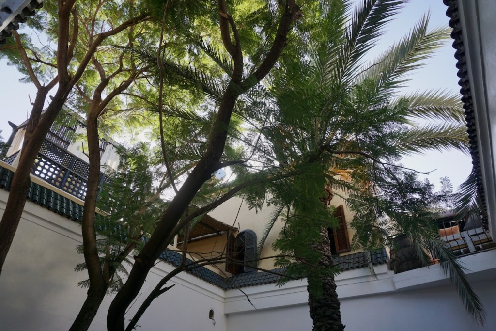
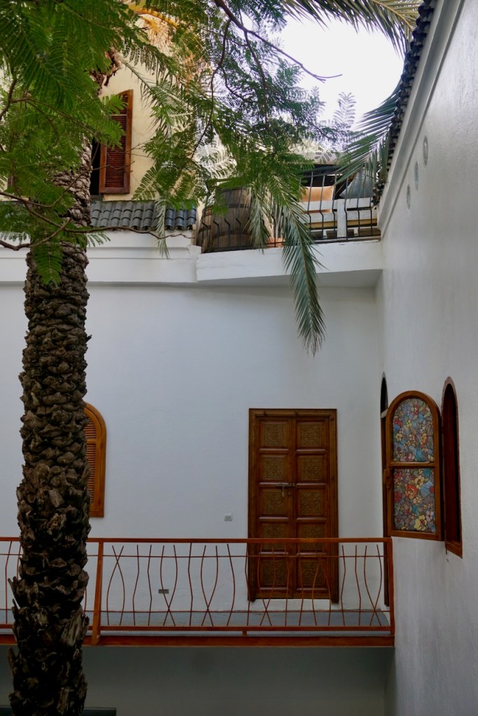
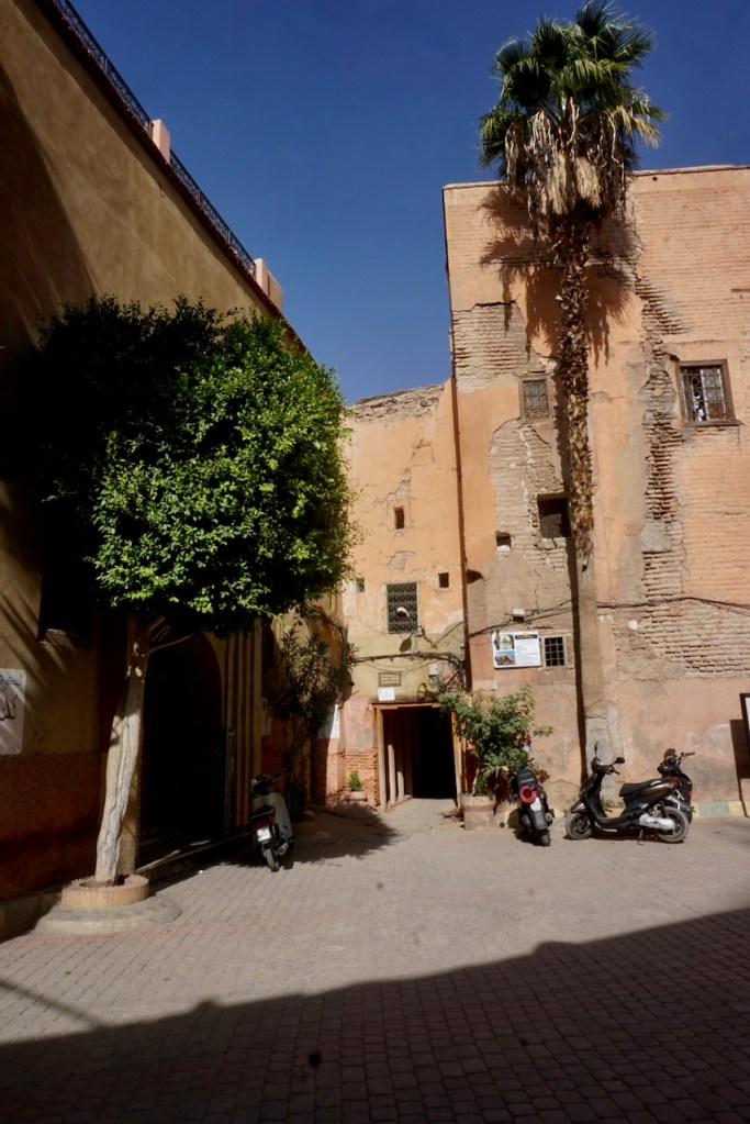
Upon landing in the late afternoon, we took a bus from the airport to Jemaa El Fna, the main marketplace in the old city, or medina, of Marrakech. From there, we navigated twists, turns, bikes, mopeds, and donkeys before arriving at the alley that we would have missed had we not been looking for it. A few twists and turns later, we entered our riad, the guesthouse build around a courtyard that would be our oasis during our visit. Riads are quiet havens that have existed for centuries as family homes; the windows face the courtyard, so there is practically no noise that comes in from outside. Ours contained, as is traditional, a fountain of running water and a good deal of flora, including a date palm that was home to a family of birds. No alarm clock needed, assuming you’ve slept through the call to prayer that comes in the middle of the night and then earlier than the birds. (Spoiler alert: You haven’t slept through anything, but it’s all rather charming.)

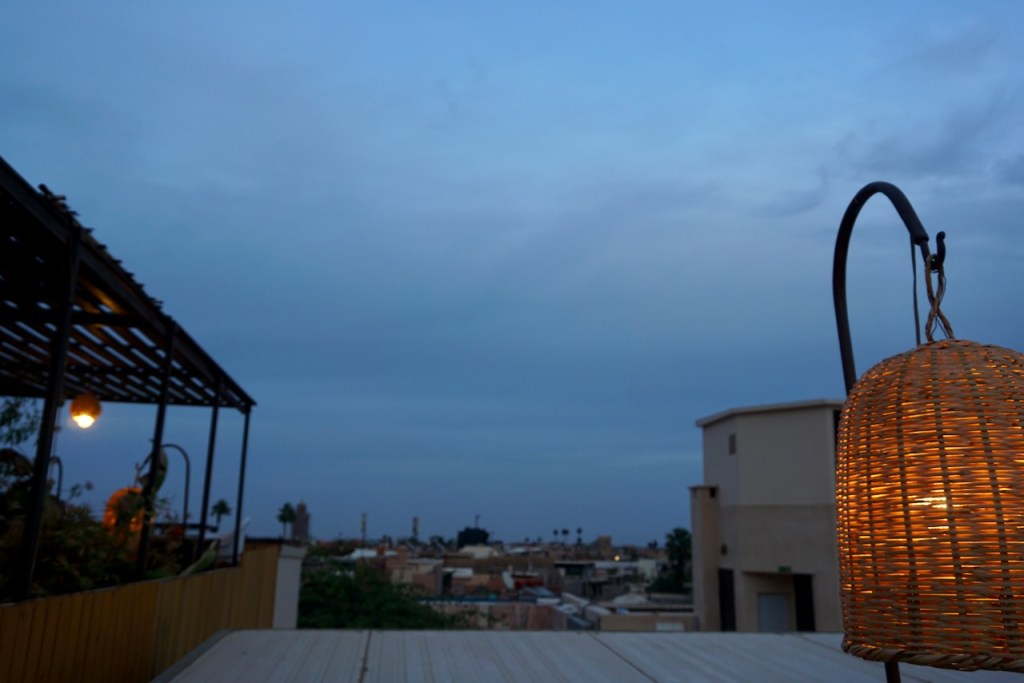
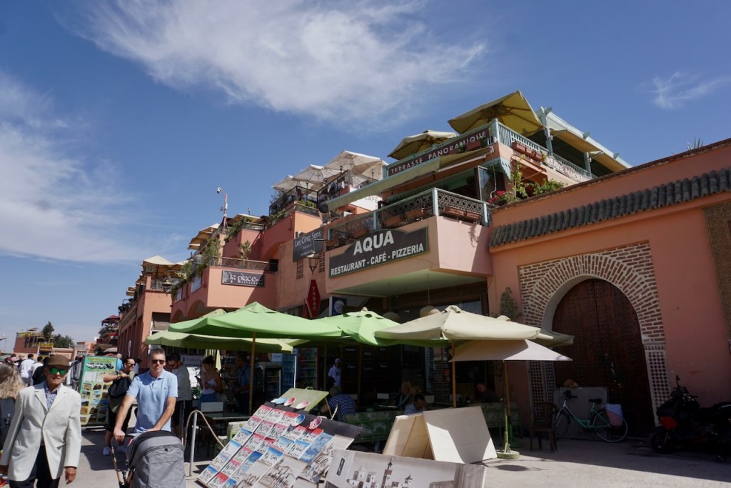
Breakfast was served on the rooftop terrace and the suite that we booked (yes, we went all out for this one) included a living room and a sitting area in the airy corridor. We were served sweets and mint tea on arrival, and we knew we were in a different world.

As we would learn, rooftop eateries are common and we intentionally sought them out.

We could usually see cats, a common feature of Marrakech, jumping around the rooftops, and while they are very pretty, they do come along and beg. Understandably, the restaurant cats are definitely better off than the cats eking out a living under park benches.

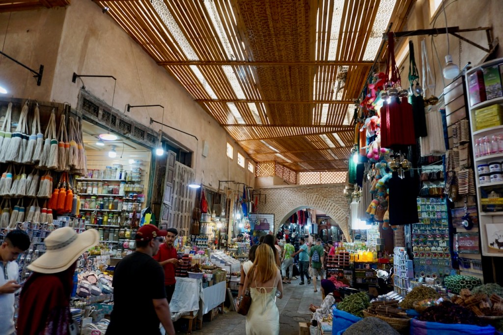
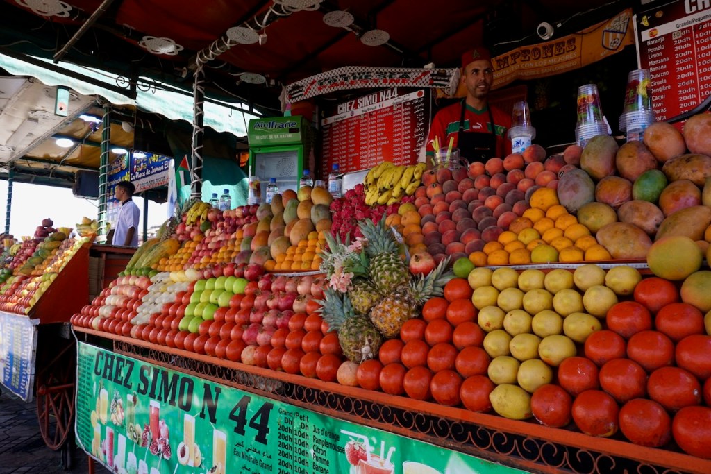
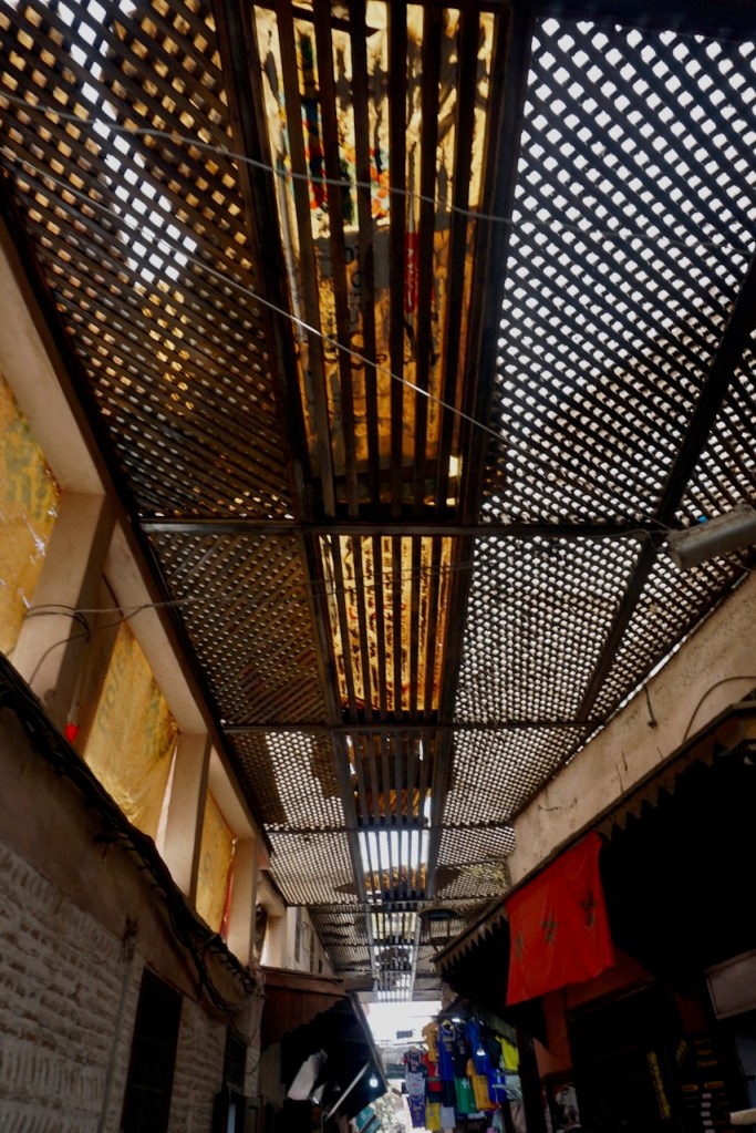
From that first walk through Jemaa El Fna, however, we were enchanted. The market, and particularly the main square, contained everything we’d always imagined about Marrakech, and we spent our time there grinning at being caught on a film set, surreal snake charmer music (and snake charmers!) included. In addition to the snake charmers, monkeys on leashes, and horse-drawn carriages, there were vendors selling all manner of items to buy, in all colours, in all scents. We never tired of looking, and the indoor market sections were surprising cool due to the slatted wooden ceilings that kept out the sun.

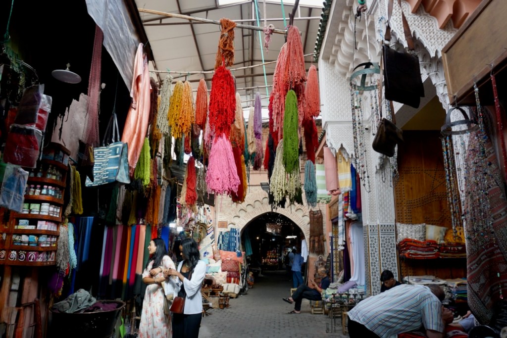
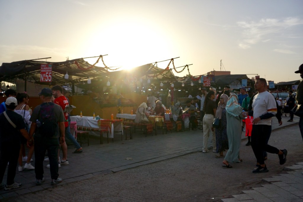
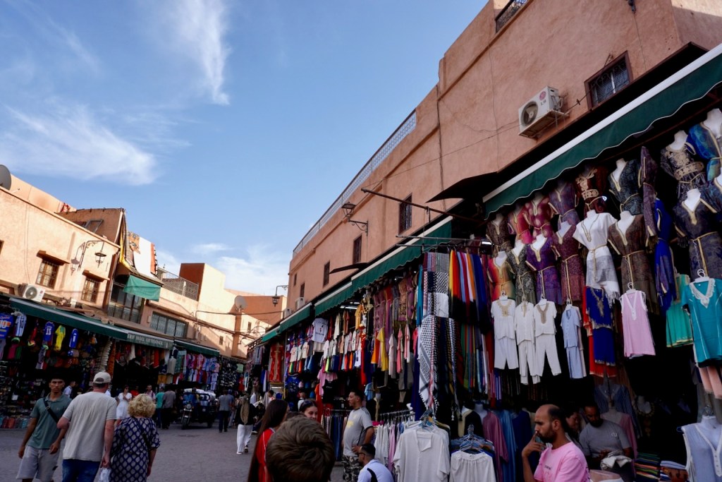
Taking the advice of our riad host, we did our best to bargain prices down at least 60% of the original asking price. We weren’t entirely successful, and we definitely bought a few things priced for tourists, regardless of haggling, but we never paid full price and we did walk away a couple of times. Overall, we found the vendors and shopkeepers respectful and less pushy than we’d been told to expect. They were also extremely flexible, switching immediately into a different language if we didn’t respond in whichever one they tried first. Just for fun, I used as much French as I could, but it’s amazing to see how little French I can still speak.

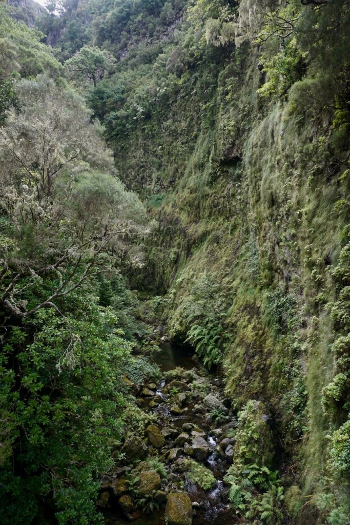
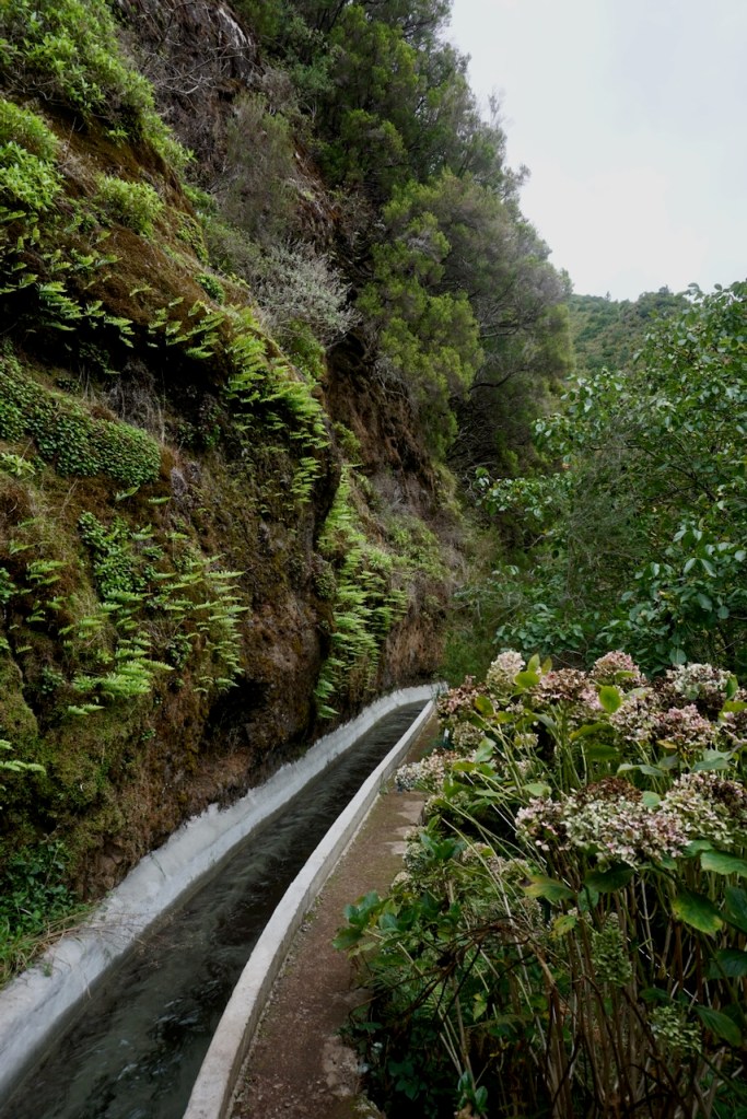
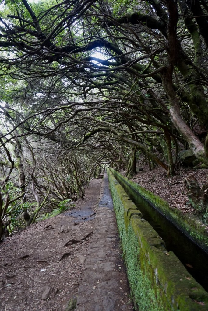
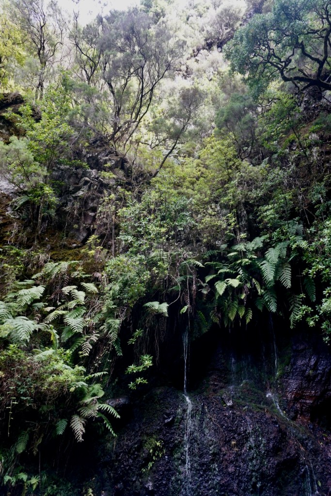
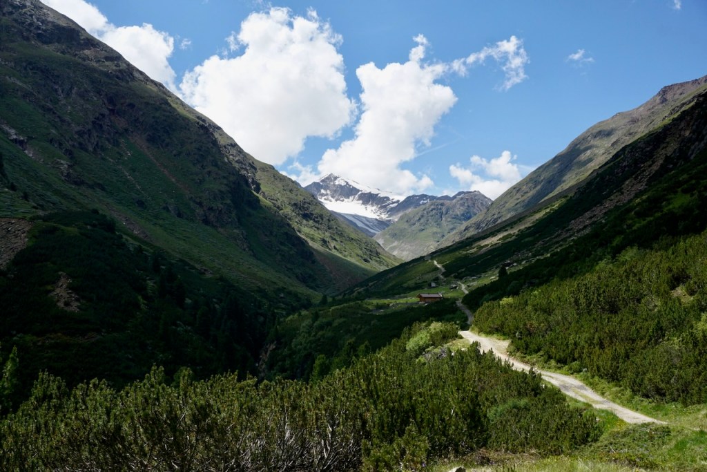
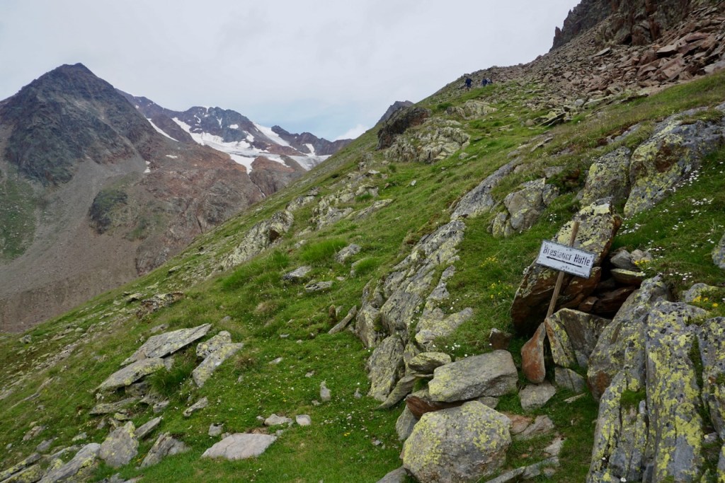
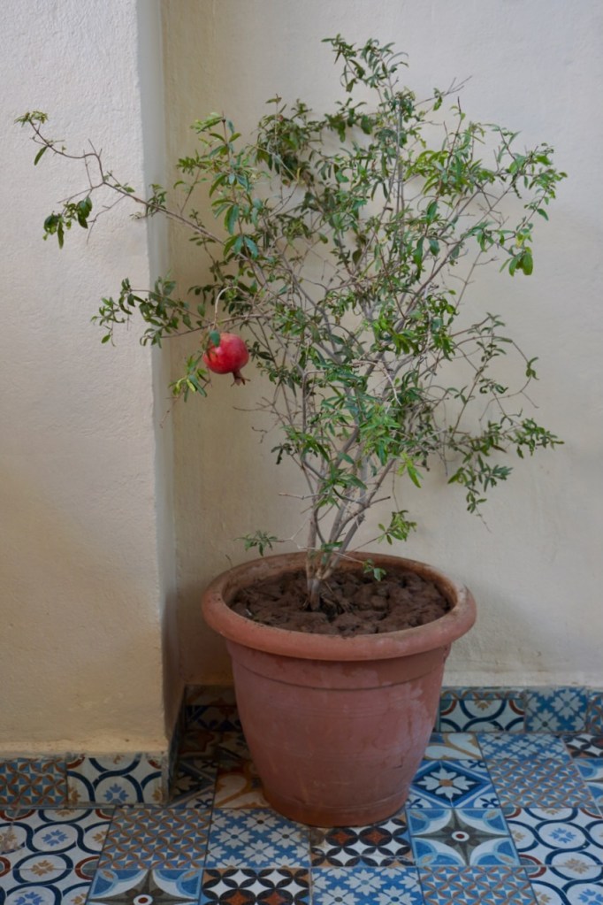
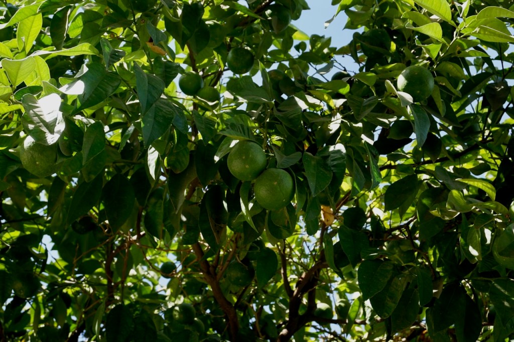
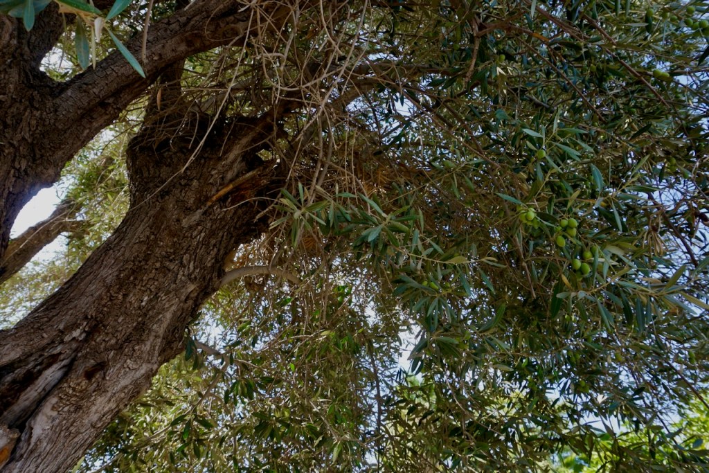
We were also pleasantly surprised by the amount of green in the desert of Marrakech. Our tour guide on our first morning told us that the water comes from the north, from the Atlas Mountains where mint grows, and that the centuries-old irrigation systems were hidden underground as protection against invasions. We saw pomegranates, olives, dates, and oranges growing from trees, and the tour guide explained that fruit from trees in the parks are free for the taking.

Standing in the shadow of Koutoubia Mosque, we learned about the history of Marrakech . . .

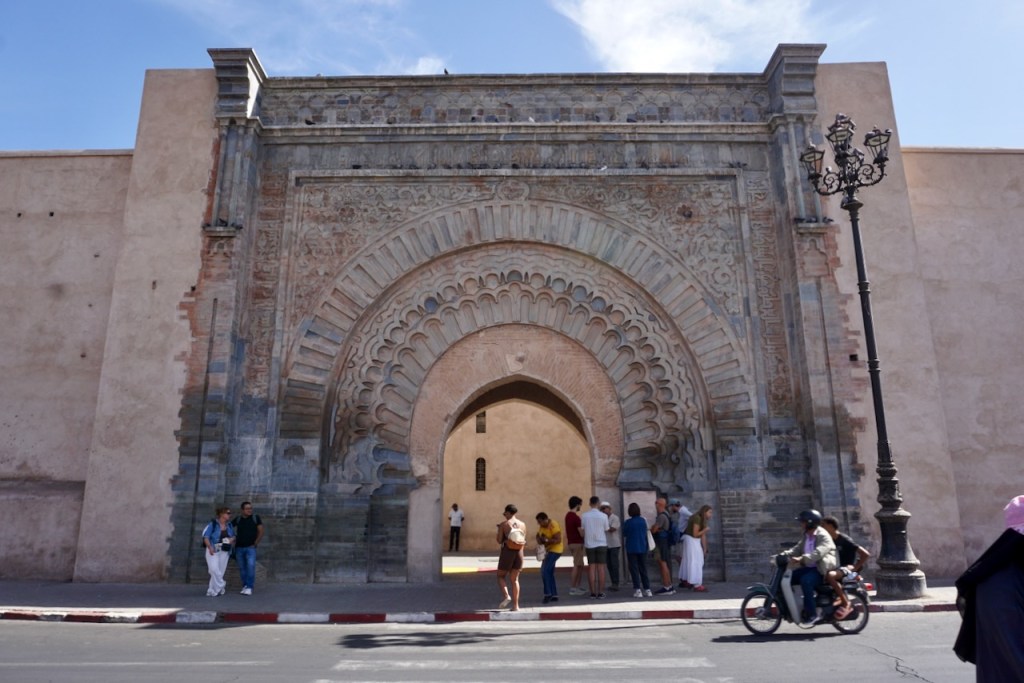
. . . and later walked through a couple of the ancient gates to the city.

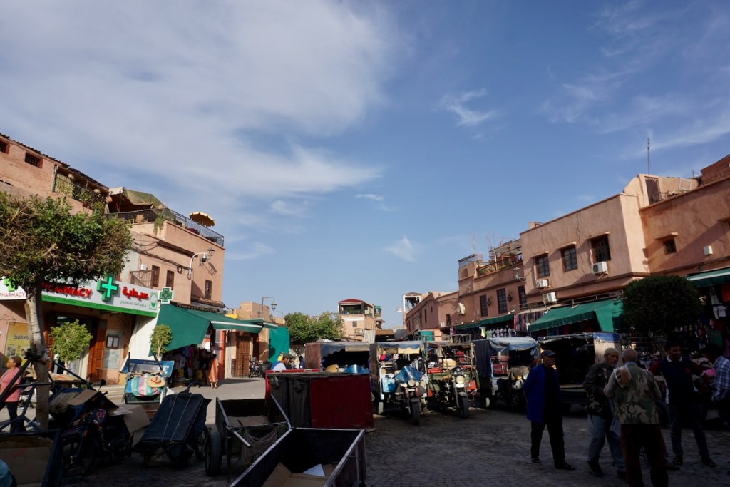
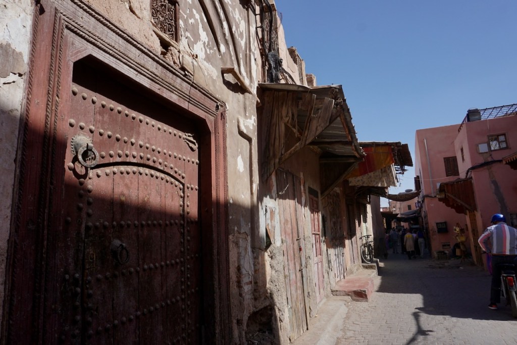
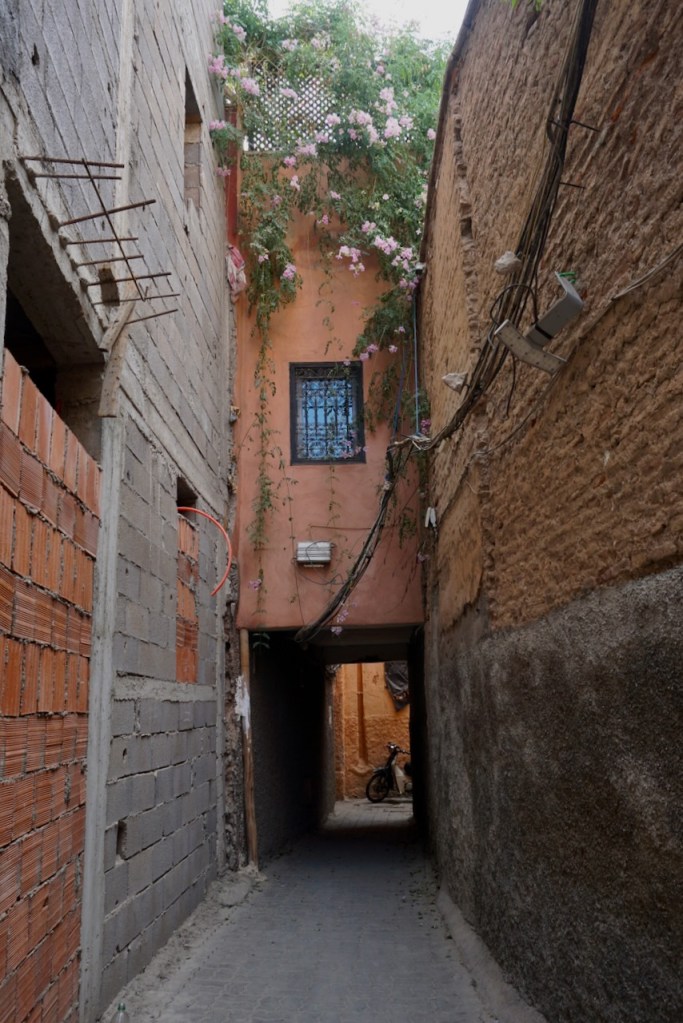
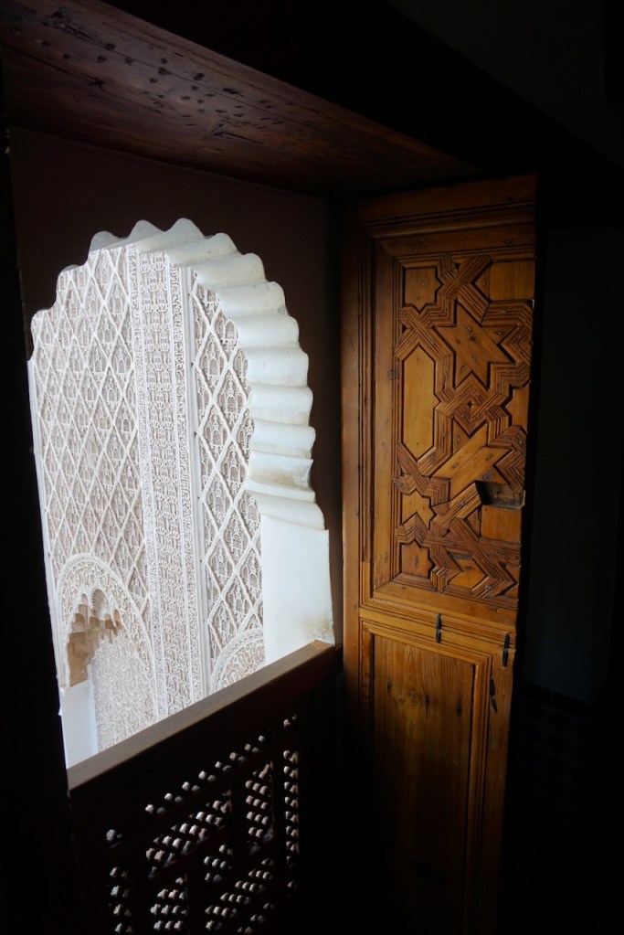
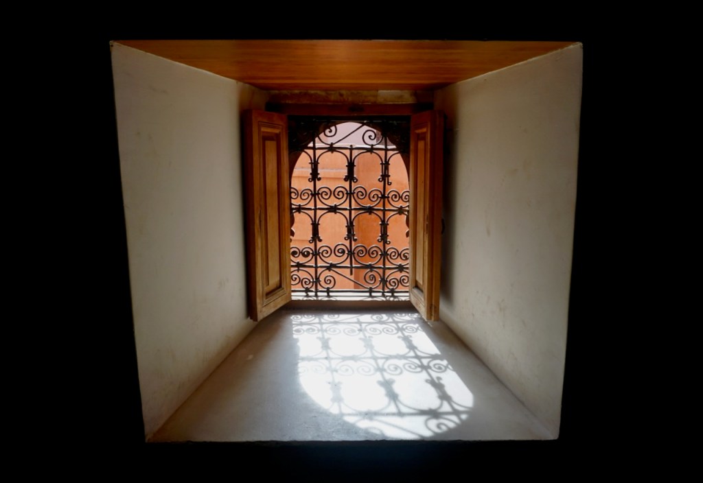
We so taken with the winding, narrow alleyways, designed for protection from invaders and sunlight. Additionally, the windows and doors were in shapes that we are not used to seeing, adding to the sense of being in a different world.

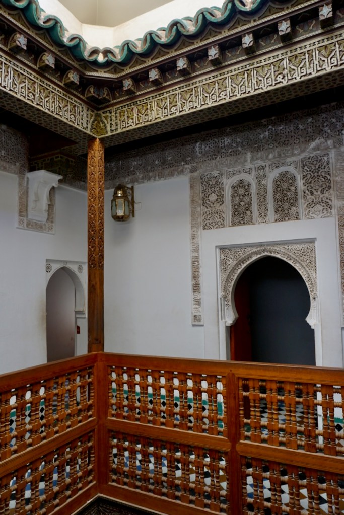
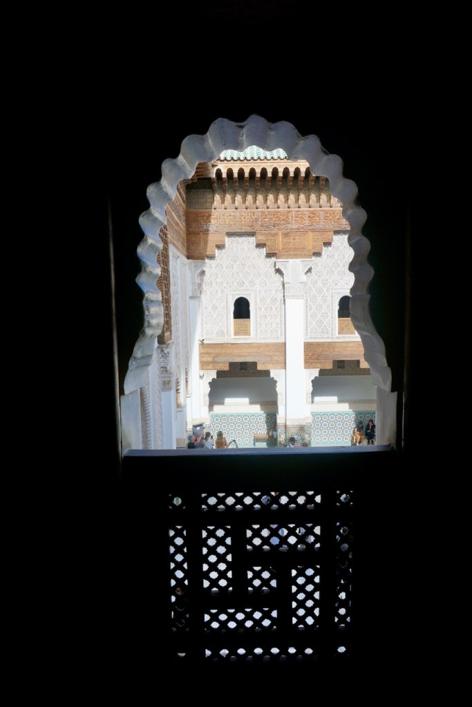
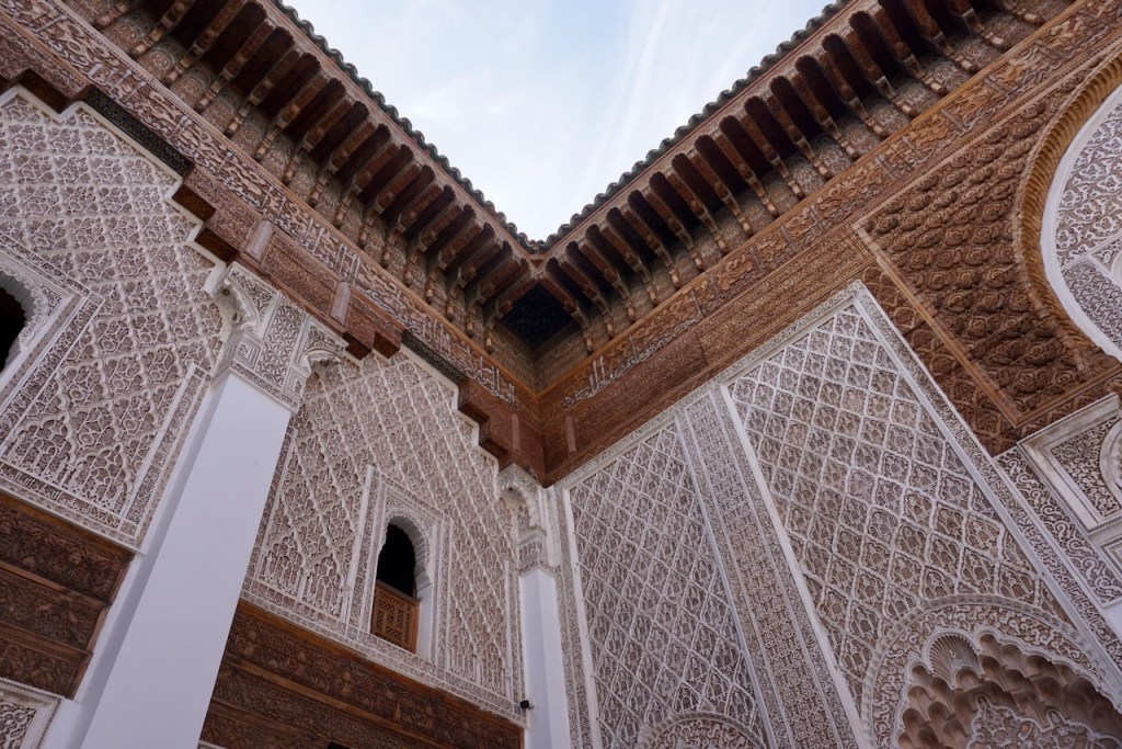
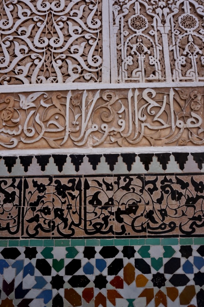
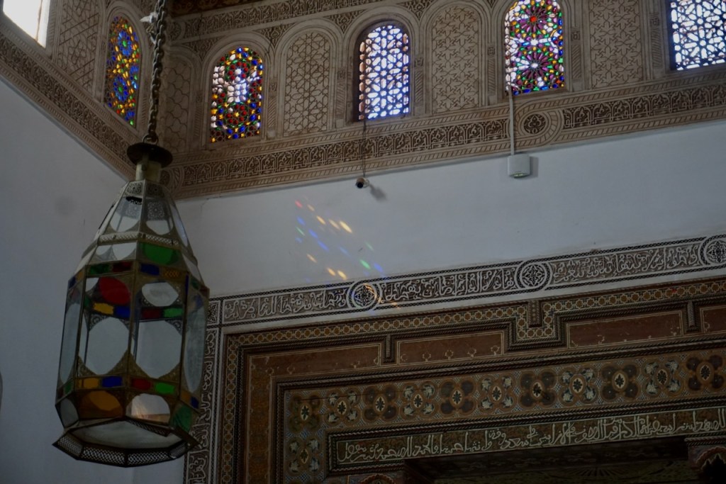
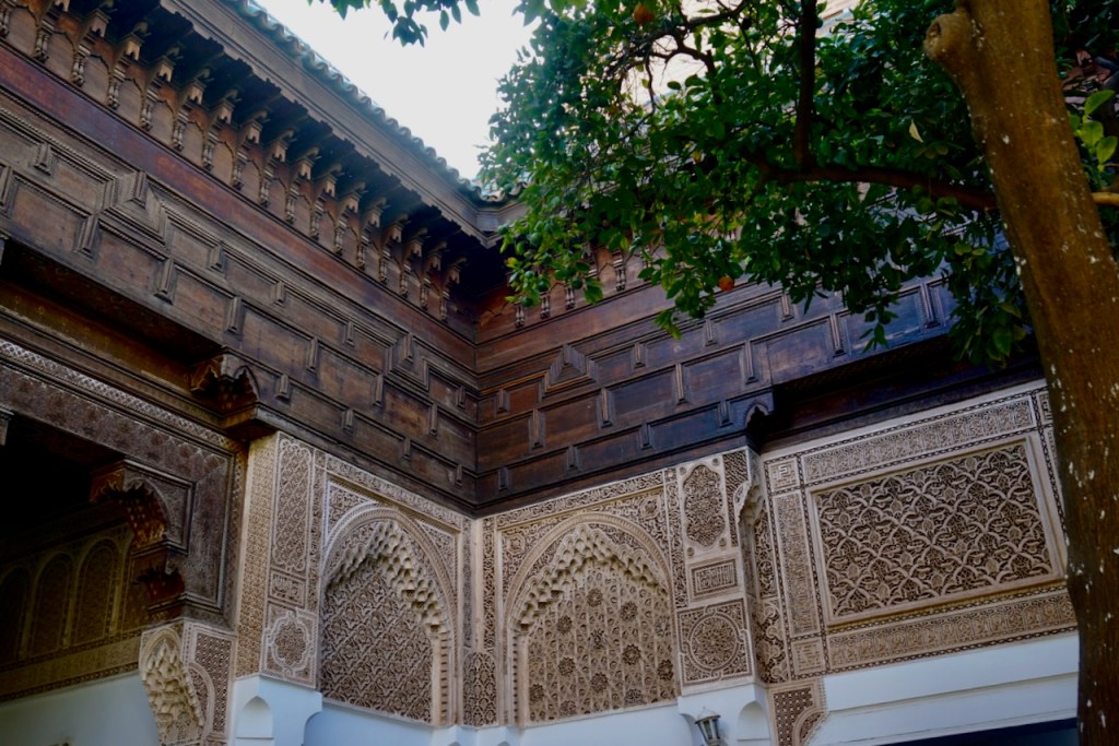
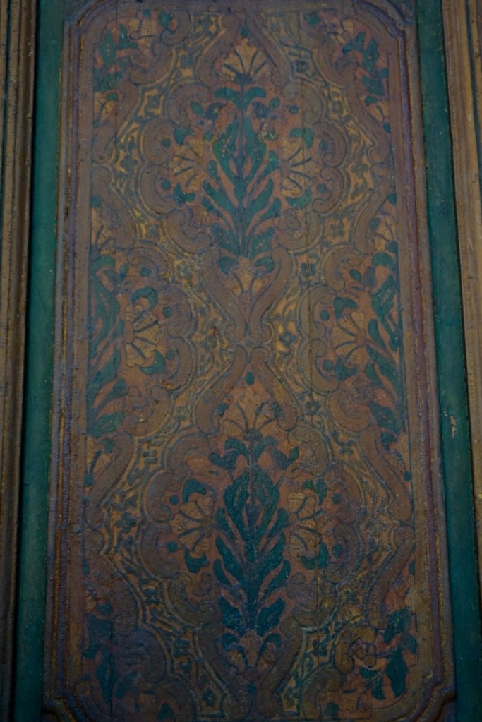
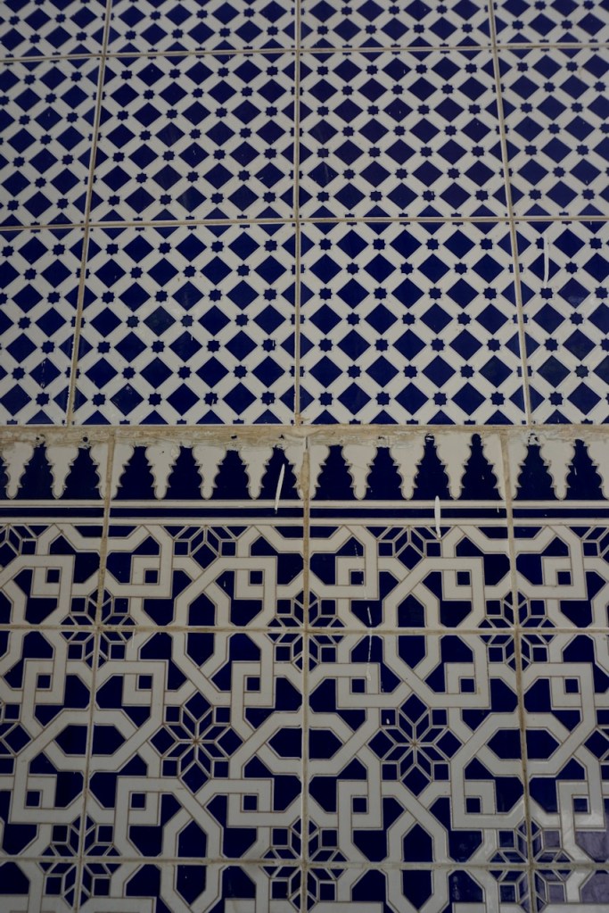
One of the best opportunities to see the architecture, tiles, carved and painted ceilings, and ornate calligraphy that characterize Marrakech is to visit the Ibn Yusuf Madrasa, which dates to the sixteenth century. This former Qur’an school has been preserved as a museum, and it is stunning.

The same can be said for the Bahia Palace, built in the nineteenth century, which also contains beautiful gardens in the riad courtyards. Much of the palace, like much of the city, was undergoing renovations from the earthquake in 2023, however, so there was a lot we were unable to see.

The former Jewish Quarter is located nearby, and it was heartwarming to have heard from the tour guide about the very positive and protective relationship between Muslims and Jews in Morocco. He explained that while Jews were not persecuted there, considering Judaism is an Abrahamic religion and the Abrahamic religions are traditionally recognized and protected under Islam, there were fears of invaders, and the Jewish Quarter was deliberately surrounded by other sections of the medina as a means of security.

It took us several alleyways to make our way to the Slat al-Azama (or Lazama) Synagogue, founded in 1492 following the expulsion of Jews from Spain. A small museum located on the other side of the riad courtyard contained images of Jewish communities, life, and culture across Morocco and other parts of Africa.

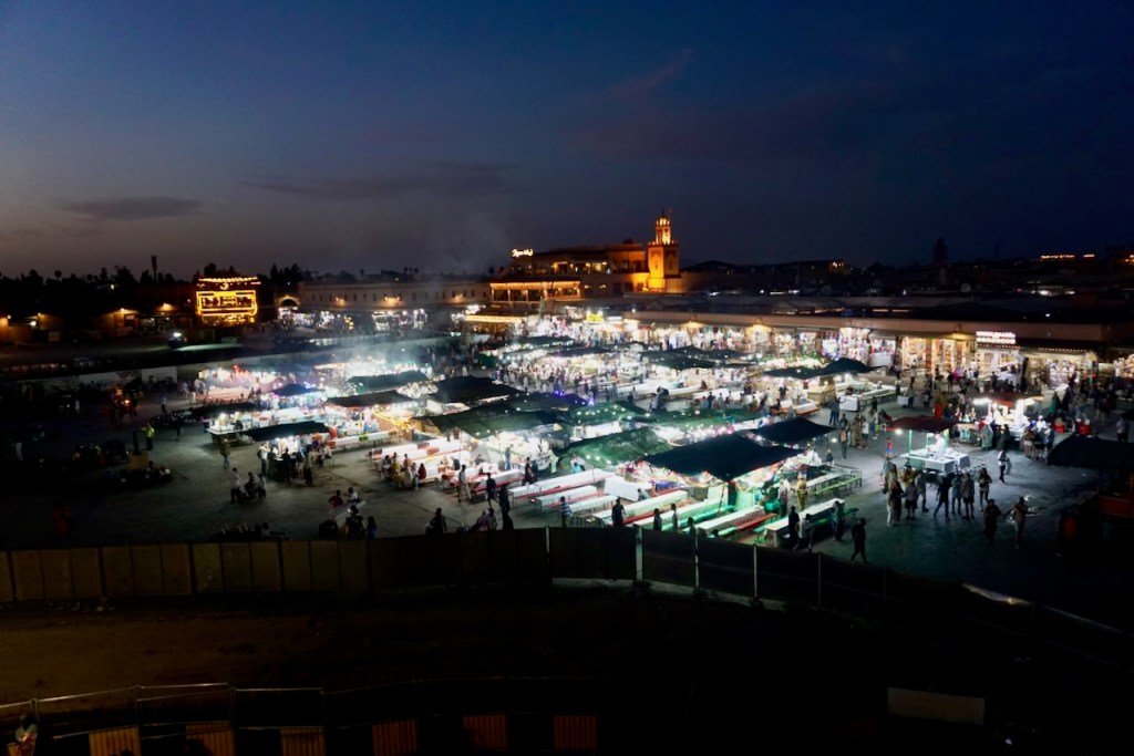
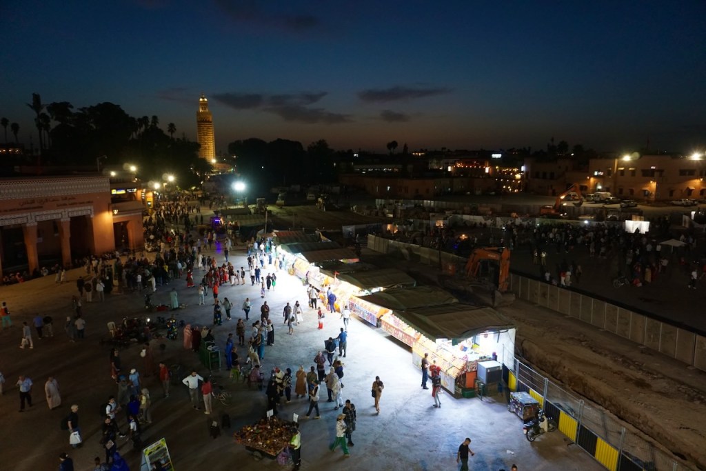
A visit to Marrakech, we were told, is not complete without a view of Jemaa El-Fna at night. We climbed the stairs to a rooftop café that exists for the purpose of said view, purchased the required beverage per person, and took in from above the hustle and bustle that we had experienced from below.

Marrakech is an overwhelming sensory experience and we retreated to the quiet of our riad each afternoon to gather and recentre ourselves. By the time our third and final morning came around, we had seen what we wanted to see and were ready for a change of pace. We basked in the calm of our riad before heading to the airport and I fell asleep immediately on the plane, exhausted from everything we’d taken in. The snake charmer music, which I was delighted to find out is real, had acted like a portal into a different world and, grateful for our time there, we could leave it behind. I never need to go back to Marrakech, but I’m so glad to have been there.

Travel Guide: Madeira

Funchal

Madeira is a Portuguese island off the coast of Morocco, and I knew little else about it when my partner and I decided to spend a week there. For reasons that immediately became apparent upon our arrival in the capital, Funchal, the island is known as the “Flower Island”.

The temperature on Madeira remains constant year-round and the island is full of microclimates, which was the most amazing part of our trip. The vegetation and foliage are more diverse there than anything we’d ever seen in a similarly-sized area, and the landscape was made up of different worlds.

In Funchal, we delighted in old buildings lining winding streets . . .

. . . the botanical gardens in the centre of town, which contained tropical species I haven’t seen since living in Singapore . . .

. . . and proximity to the harbour. . . .

Funchal also has an excellent street art scene in the Zona Velha, the old part of town that used to be comprised of fishermen’s cottages and is now made up of buzzing restaurants and shops.

Unbeknownst to us before our arrival, dolphin and whale watching tours were on offer, and we were happy to participate. Once a pod is spotted, the boat is only allowed to spend 10 minutes there so as not to overwhelm the animals, which we appreciated. We saw several groups of pilot whales, which are common in the area.

That afternoon, we visited the Mercado dos Lavradores, which seemed more touristy than we would have liked. A salesperson gave us tastes of the seven different species of passion fruits that grow on Madeira and we bought one each. A few items that we hadn’t selected ended up in our bag, as well, and we certainly paid for them. However, everything really did taste as good as it looked.

Interested in the views from lookout points, we walked through Forte de São Tiago later that day, the yellow paint striking against the blue sky.

The steepness of the island is hard to understate, and this is something we didn’t fully understand or appreciate until we rented a car later on, but we were beginning to get an idea.

The following day, we took a cable car up to the Monte Palace Tropical Garden, giving us an excellent perspective on the elevation of Funchal. The air was noticeably cooler than at sea level, and we were fascinated by the hundreds of plants from all over the world that looked completely at home. In the centre of the gardens was a lake with a small stage and live music. It was relaxing, idyllic, and a wonderful oasis away from the bustle of city life, even on an island.

The Monte Church, located just around the corner, stands at 598 meters, and the view down to sea level was impressive.

Traditionally, one descends from the palace into the city by way of the Carreiros do Monte, essentially a wicker basket sled guided from the rear by two porters. Nowadays, the ride is only two kilometers (we walked the rest of the way) and we enjoyed every minute of it.

Machico

The following morning, we took the bus to the airport to pick up our rental car, and then headed down the road to the beach town of Machico, which we had chosen due to its proximity to the hiking trails for which Madeira is famous. We arrived to weather significantly cooler than what we had experienced in Funchal, though the two locations are only 25 kilometers apart along the coast. In recognition of the slower pace and change of atmosphere, we made ourselves comfortable on the rocky beach and just watched the waves.

That afternoon, we drove out to a lookout point on the eastern end of the island, gradually gaining elevation on narrow, twisting roads. The landscape changed from tropical trees and flowers, to cacti and beach grasses, to red earth with scrubby brush.

We walked along the edges of cliffs looking out into the sea, clearly in the shape of the caldera left behind from the volcano that created Madeira Island.

The next morning, we took what was probably the wildest drive of the trip, climbing serpentines for about 1300 meters from where we began at sea level. We wanted to hike up to Pico Ruivo, the highest point of Madeira Island at 1862 meters.

At just under three kilometers, the trail is straightforward though steep, and it winds through an incredibly diverse landscape. We started in terrain that was almost sub-alpine, mist in the cold air . . .

. . . climbed through and above the clouds . . .

. . . and ended on the south side of the peak in a dry, scrubby landscape with signs of fire damage. . . .

By the time we got to the summit, I was very aware of my pregnant and rapidly changing body. I had needed to go more slowly than usual to regulate my breathing, and I tried to skirt the stairs that caused my stomach muscles to engage, resulting in cramps that are best avoided. But there’s also a feeling of confidence that comes from being pregnant in such terrain (I wasn’t the only one, either!) and I enjoyed that very much.

Upon returning to the car, having thoroughly enjoyed the hike and wanting to explore more of the island, we drove about five minutes back down the road and again into the clouds. Pulling over when we could, we walked the easy, flat trail from Queimadas to Pico das Pedras. In sharp contrast to the morning, this trail took us through a rainforest. It had been cold and sunny on the summit, but we needed a jacket for the rainforest.

And what a forest. Moss hanging in clumps from old, gnarled trees; water running below us and along the sides of the path; ferns everywhere. We walked mostly in silence, smelling the muddy earth and the effortlessly lush vegetation, marvelling at finding ourselves in yet another climate zone.

From there, another winding, twisting drive took us yet higher into the cliffs to the short walk named for its outlook point, Vereda dos Balcões. We were in a cloud forest at that point, walking along the side of a cliff that looked down into one of the many villages dotting the landscape.

After our explorations of the east side of the island, we drove out the next day towards the centre to hike the Levada das 25 Fontes, a trail named for its 25 waterfalls. The easy walk led downhill from where we parked, and its status as one of Madeira’s most famous walks was immediately apparent from the number of people following the trail. We had to look for stillness here, which we managed to find.

And then, ready for stillness to find us, we followed a trail turnoff that would take us back to the car in a slightly different direction than the out-and-back that we knew most people would follow. Alongside Spanish moss, trees with low-hanging branches, and irrigation canals, we found ourselves exactly where we wanted to be – entirely alone.

From there, we continued our drive to Porto Moniz, the northwestern most point of the island. We walked along the water and gazed down into the natural pools created by the ocean.

The drive back to Machico completed our circuit of the island, which had left us in awe of the diversity we had experienced. We have both had the fortune to see a few places in the world, and neither of us had been anywhere quite like this.

The next morning, our last full day on Madeira, I settled myself on the rocky beach while my partner took a surf lesson . . .

. . . and we spent the afternoon hiking the Vereda da Ponta de São Lourenço, the trail on the eastern end of the island that reaches the highest peak in that area. This time, we walked through desert and along sea cliffs, and were almost always in sight of the ocean. Every so often, a particularly spectacular rock formation came into view, and we just had to stop and take in the colours.

The sun made this walk strenuous because there was absolutely zero shade, but the rocky paths themselves were gentle enough with a relaxed variety of ascents and descents. And like we had seen literally everywhere in Madeira, there were snacks and drinks on offer (upon return, of course!) from multiple food trucks in the parking lot.

Returning to our favourite restaurant for yet another delicious meal of fish (locally caught) and vegetables (locally grown), we toasted a local beer and a local juice to the week we had experienced. We had seen plenty of families underway on Madeira and smiled at the thought of being there with our little one. It is hopefully not our last time on this beautiful island, and we departed early the next morning with beach air in our noses and the sunrise in our eyes. One cannot ask for more than that.

In the Alps: Ötztal

The German word “Hochtour” literally translates to “high tour” and the term is used to describe a mountaineering trek through the Alps that passes through snow or over a glacier. Last summer was my introduction to the Hochtour along the Berliner Höhenweg and climbing the Zugspitze, Germany’s tallest mountain. This summer’s adventure took me, my partner, and a friend into the Ötztal, home of Austria’s tallest mountains. This year, rather than the glacier being part of the adventure, the glacier was the adventure.

Day 1: Vent to Martin-Busch-Hütte

We began in the tiny town of Vent, following a trail that was steep immediately.

We walked toward glaciers in the distance, following the river that cut through the rock, witness to millions of years of time.

We passed an old shepherd’s hut, and we didn’t know it at the time, but we’d meet the shepherd and his dogs another day. The much more modern house we had passed earlier was his.

After a few hours, eight kilometers, and 600 meters of elevation, we reached the end of civilization and the beginning of our adventure. We would spend two nights at the Martin-Busch-Hütte, allowing us the luxury of leaving many of our belongings behind for our summit tour the following day. As the sign said, we were in the last spot for cell service.

The hut is located at 2,501 meters and after a snack and a shower, we went for a little walk to look around at the world we had entered.

Day 2: Similaun

Summer mountaineering requires an early start because summer in the Alps is thunderstorm season. You cannot be on a peak when lightening strikes, and this means being down low enough to avoid being the highest point anywhere. We check weather forecasts, watch the clouds, and rely on the hut personnel, locals with experience, to give us the best tips on how to time the path ahead. The rule of thumb is to start early.

The way ahead was rocky and climbed steadily. We passed a sign showing the way to the archeological site where 5,300-year-old Ötzi the Iceman was found in 1991, which I’d love to go back to visit someday. On this day, there was a mountain to climb.

To reach the summit of the Similaun at 3,606m, we would gain almost 1,100 meters of elevation. The effect this has on the body is not be underestimated, and we were all grateful for having included jogging in our training. Although I can’t say I felt it, it must have helped! We paused when we reached the Similaun Hütte just over the border in Italy and gazed at what awaited us.

At the edge of the glacier, we prepared: Harness and helmet on; pre-organized carabiners, slings, rescue gear, ice screw attached to harness; crampons on; ice axe in hand; butterfly knots in the rope and figure-eights clipped to us. As the most experienced, my partner went last to perform any needed rescue manoeuvres should one of us fall into a crevasse. Based on negotiation, I went first to follow tracks and find the way.

Breathing was difficult. The thighs burned. I couldn’t always find the way leading us away from crevasses and up the glacier, and we took a slight deviation from the proper way when fear of the unknown got to me. Our friend in the middle of our rope said that she was using a mantra to put one foot in front of the other, but my mind had gone in the opposite direction. As we climbed, I was already in a mindset of not wanting to be there, which is the primary reason that I don’t know if I will do this type of mountaineering again.

As the clouds rolled in, we reached the end of the glacier and the rock scramble along the mountain ridge began. This is the part I enjoyed because this is where I could feel my body again – I am a climber, after all. We reached summit and looked down into Austria on one side and Italy on the other.

We heard a clap of thunder after we had already begun our descent. The sky darkened as we returned to our gear on the glacier and we ran. This is is the part where, like my friends, I should have thought, “Wow, now we’re really mountaineers!” But the negative mindset from before set in. As the hail began, which turned to rain as we descended, that’s not where my mind was.

The weather changes quickly in the Alps and the rain had let up by the time we reached the Similaun Hütte and stepped inside to take stock of ourselves. Not having had time to put raincovers over our backpacks, everything was soaked. As the sun began to shine, we heard another clap of thunder from above, but this time we knew – it was one weather front meeting another rather than the sign of a coming thunderstorm.

Later on, I reflected that had the weather held during our descent, I probably wouldn’t have fallen apart. The negative film running through my head would have faded and been replaced by the accomplishment of reaching 3,606 meters. But I know how the brain works, and we remember the peak and the end of experiences. I’ve dreamt every night since of being on that mountain, and my dream self has reacted differently, more bravely, more calmly. The sun shines in my dream. My actual self was mentally crushed.

It was a relief to reach the Martin-Busch-Hütte and lay our things out to dry. We talked over weather, the day, and conditions with the men sharing our room and marvelled at the weather cells in the Alps. Just on the other side of the valley, they hadn’t had rain at all.

Day 3: Martin-Busch-Hütte to Breslauer Hütte

The purpose of the next day was to reach our second and final hut of this trip, the Breslauer Hütte located at the foot of Austria’s second-tallest mountain, the Wildspitze. From the beginning, the Wildspitze at 3,768 meters had been the goal. However, because of my experience the day before and the not-so-promising weather forecast, we decided a change of plans was in order.

We left the Martin-Busch-Hütte in the rain, which is no problem when you’re prepared for it. The landscape was dreamy as we descended, kissed by clouds.

The sun had come out by the time our ascent began with over 900 meters in elevation gain comprising the last few kilometers. We passed gazing cattle . . .

. . . stopped to rest on a plateau surrounded by peaks . . .

. . . and made our way along steep ridges, past more peaceful cattle, through rocky terrain that told of mountains from long ago, and across a river. Some of this had been glacier once.

It was a long way up to the Breslauer Hütte, and hard going. We covered 12 kilometers that day, and, upon reaching 2,844 meters, we certainly felt it.

That evening, we watched the sunset.

Day 4: Breslauer Hütte to Vent

The following morning began with a strange feeling. The clientele of the Breslauer Hütte could be easily divided into two groups – mountaineers and hikers. As we decided not to attempt the Wildspitze this time (my friends have now bookmarked it for the future), we were clearly in the hiking group, despite having the gear and experience of the mountaineers. We had come to this place with a purpose and were leaving it behind.

It wasn’t only because of me but it also wasn’t not because of me that we changed the plan. I’m grateful that my friends made the decision that they did, and I will be cheering for them when they head back there next time. But that didn’t prevent me from feeling, as they were, a sense of loss.

Nevertheless, we enjoyed the easy scramble up to Wildes Mannle, a 3,023 meter peak nearby.

We crossed the river we’d seen the following day . . .

. . . and climbed the ridge to the summit, looking over into the distance where we knew the Wildspitze was.

From there, we began our descent, again past the cows . . .

. . . and into a green oasis, welcome after the rocky terrain a thousand meters above.

With the challenges of ascending behind us, I took the opportunity to photograph the alpine flowers that guided us along the way.

Upon reaching civilization, we crossed a bridge over the river . . .

. . . walked past one last herd of grazing horses . . .

. . . and looked in the direction of the Wildspitze again, invisible now.

This was not my mountain to climb, but I have no doubt that my friends will climb it one day. If I’ve learned any lesson, it is this: If one cannot go calmly and steadily, one need not go at all. The purpose is to be there, not to get there.

And if I can focus on the being rather than the doing , then I have learned something indeed.